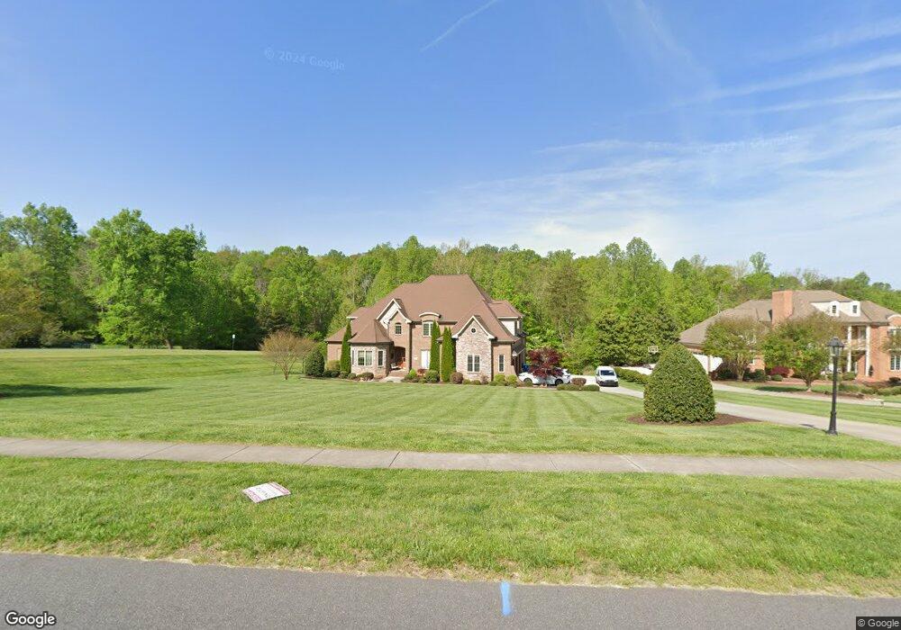
6339 Poplar Forest Dr Summerfield, NC 27358
Estimated Value: $1,076,692 - $1,278,000
4
Beds
5
Baths
4,960
Sq Ft
$230/Sq Ft
Est. Value
About This Home
This home is located at 6339 Poplar Forest Dr, Summerfield, NC 27358 and is currently estimated at $1,140,173, approximately $229 per square foot. 6339 Poplar Forest Dr is a home with nearby schools including Summerfield Elementary School, Northern Guilford Middle School, and Northern Guilford High School.
Ownership History
Date
Name
Owned For
Owner Type
Purchase Details
Closed on
Dec 15, 2011
Sold by
Dinh Triet and Dinh Phuoc
Bought by
Patel Yogesh P and Patel Sapana Y
Current Estimated Value
Home Financials for this Owner
Home Financials are based on the most recent Mortgage that was taken out on this home.
Original Mortgage
$400,000
Outstanding Balance
$274,283
Interest Rate
4.06%
Mortgage Type
New Conventional
Estimated Equity
$865,890
Purchase Details
Closed on
Nov 20, 2009
Sold by
Henson Forest Development Corporation
Bought by
Dinh Triet and Dinh Phuoc
Create a Home Valuation Report for This Property
The Home Valuation Report is an in-depth analysis detailing your home's value as well as a comparison with similar homes in the area
Home Values in the Area
Average Home Value in this Area
Purchase History
| Date | Buyer | Sale Price | Title Company |
|---|---|---|---|
| Patel Yogesh P | $546,000 | None Available | |
| Dinh Triet | $90,000 | None Available |
Source: Public Records
Mortgage History
| Date | Status | Borrower | Loan Amount |
|---|---|---|---|
| Open | Patel Yogesh P | $400,000 |
Source: Public Records
Tax History Compared to Growth
Tax History
| Year | Tax Paid | Tax Assessment Tax Assessment Total Assessment is a certain percentage of the fair market value that is determined by local assessors to be the total taxable value of land and additions on the property. | Land | Improvement |
|---|---|---|---|---|
| 2025 | $7,328 | $824,300 | $110,000 | $714,300 |
| 2024 | $7,328 | $824,300 | $110,000 | $714,300 |
| 2023 | $7,328 | $824,300 | $110,000 | $714,300 |
| 2022 | $7,328 | $824,300 | $110,000 | $714,300 |
| 2021 | $5,034 | $566,200 | $89,000 | $477,200 |
| 2020 | $5,034 | $566,200 | $89,000 | $477,200 |
| 2019 | $5,034 | $566,200 | $0 | $0 |
| 2018 | $0 | $566,200 | $0 | $0 |
| 2017 | $5,008 | $566,200 | $0 | $0 |
| 2016 | $5,110 | $559,400 | $0 | $0 |
| 2015 | $5,138 | $559,400 | $0 | $0 |
| 2014 | $5,194 | $559,400 | $0 | $0 |
Source: Public Records
Map
Nearby Homes
- 6981 Brandi Wood Cir
- 7825 Spencer Brook Dr
- 7003 Pearson Run Ct
- 7819 Wilson Farm Rd
- 7004 Westfield Village Cir
- 7107 Lanier Rd
- 7524 Whitaker Dr
- 7619 Whitaker Dr
- 7399 Henson Forest Dr
- 7400 & 7400 ZZ Haw Ridge Rd
- 7418 Moores Mill Rd
- 7376 Henson Forest Dr
- 7107 Lake Henson Dr
- 5603 Monk Ct
- 6998 Colleen Ct
- 2327 Scalesville Rd
- 7020 Marseilles Ct
- 7106 Lambert Lake Rd
- 7111 Lambert Lake Rd
- 5408 Briardenn Ct
- 6341 Poplar Forest Dr
- 6335 Poplar Forest Dr
- 6343 Poplar Forest Dr
- 6344 Poplar Forest Dr
- 6333 Poplar Forest Dr
- 6338 Poplar Forest Dr
- 6336 Poplar Forest Dr
- 6345 Poplar Forest Dr
- 6334 Poplar Forest Dr
- 6346 Poplar Forest Dr
- 6331 Poplar Forest Dr
- 6348 Poplar Forest Dr
- 6347 Poplar Forest Dr
- 6329 Poplar Forest Dr
- 6330 Poplar Forest Dr
- 6979 Bethesda Ct
- 6981 Bethesda Ct
- 6349 Poplar Forest Dr
- 6350 Poplar Forest Dr
- 6329 Blue Aster Trace