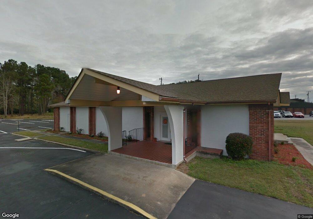
634 Airport Rd New Bern, NC 28560
Estimated Value: $498,256
--
Bed
--
Bath
108,900
Sq Ft
$5/Sq Ft
Est. Value
About This Home
This home is located at 634 Airport Rd, New Bern, NC 28560 and is currently estimated at $498,256, approximately $4 per square foot. 634 Airport Rd is a home located in Craven County with nearby schools including Brinson Memorial Elementary School, Grover C. Fields Middle School, and New Bern High School.
Ownership History
Date
Name
Owned For
Owner Type
Purchase Details
Closed on
Feb 3, 2022
Sold by
Johnny Baker
Bought by
Craven County
Current Estimated Value
Purchase Details
Closed on
Apr 7, 2021
Sold by
Curtis Benjamin and Grant Orlando
Bought by
Craven County
Purchase Details
Closed on
Aug 17, 2017
Sold by
Curtis Benjamin and Grant Orlando
Bought by
Curtis Benjamin and Grant Orlando
Purchase Details
Closed on
Jun 9, 2003
Sold by
Church-New Bern N C Congregation Of
Bought by
Church-Independent Fundamental
Create a Home Valuation Report for This Property
The Home Valuation Report is an in-depth analysis detailing your home's value as well as a comparison with similar homes in the area
Home Values in the Area
Average Home Value in this Area
Purchase History
| Date | Buyer | Sale Price | Title Company |
|---|---|---|---|
| Craven County | -- | Dunn Pittman Skinner & Cushman | |
| Craven County | $385,000 | Dunn Pittman Skinner & Cushman | |
| Craven County | $167,000 | None Available | |
| Curtis Benjamin | -- | None Available | |
| Church-Independent Fundamental | $280,000 | -- |
Source: Public Records
Tax History Compared to Growth
Tax History
| Year | Tax Paid | Tax Assessment Tax Assessment Total Assessment is a certain percentage of the fair market value that is determined by local assessors to be the total taxable value of land and additions on the property. | Land | Improvement |
|---|---|---|---|---|
| 2025 | -- | $566,200 | $102,000 | $464,200 |
| 2024 | -- | $566,200 | $102,000 | $464,200 |
| 2023 | $0 | $477,700 | $102,000 | $375,700 |
| 2022 | $0 | $292,100 | $102,000 | $190,100 |
| 2021 | $0 | $440,100 | $250,000 | $190,100 |
| 2020 | $0 | $440,100 | $250,000 | $190,100 |
| 2019 | $0 | $440,100 | $250,000 | $190,100 |
| 2018 | $0 | $380,100 | $190,000 | $190,100 |
| 2017 | $0 | $380,100 | $190,000 | $190,100 |
| 2016 | $0 | $512,000 | $250,000 | $262,000 |
| 2015 | -- | $512,000 | $250,000 | $262,000 |
| 2014 | -- | $512,000 | $250,000 | $262,000 |
Source: Public Records
Map
Nearby Homes
- 709 Airport
- 115 Grantham Place
- 209 Green Springs Rd
- 212 Selover Ave
- 1009 Michael Dr
- 322 Hoke St
- 125 Neeley Ln
- 307 Neuse Cliffs Rd
- 716 Old Cherry Point Rd
- 404 Pine St
- 802 Neuse Dr
- 1306 Green Springs Rd
- 2108 Neuse Cliffs
- 2131 Neuse Cliffs Cir
- 413 Brooks Dr
- 410 Brown Dr
- 105 Scotts Creek Dr
- 921 Madam Moores Ln
- 108 Jordan Dr
- 100 Delanie Way
- -------- Airport Rd
- 0 Airport Rd
- 824 Airport Rd
- 1307 Us 70 Hwy E
- 822 Airport Rd
- 1211 U S 70
- 1601 Us 70 Hwy E
- 820 Airport Rd
- 707 Clermont Rd
- 1207 Us Highway 70 E
- 1207 U S 70 Hwy E
- 818 Airport Rd
- 1203 Us Highway 70 E Unit A
- 1203 Us Highway 70 E
- 817 Airport Rd
- 1205 Us Highway 70 E
- 1205 U S 70 Hwy E
- 1307 Old Cherry Point Rd
- 1201 Us 70 Hwy E
- 1123 Us Highway 70 E