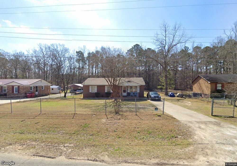
634 Alfred C Carson Dr Sandersville, GA 31082
Estimated Value: $98,000 - $123,000
--
Bed
--
Bath
1,232
Sq Ft
$90/Sq Ft
Est. Value
About This Home
This home is located at 634 Alfred C Carson Dr, Sandersville, GA 31082 and is currently estimated at $110,466, approximately $89 per square foot. 634 Alfred C Carson Dr is a home located in Washington County with nearby schools including Ridge Road Primary School, Ridge Road Elementary School, and T.J. Elder Middle School.
Ownership History
Date
Name
Owned For
Owner Type
Purchase Details
Closed on
May 1, 2012
Sold by
Usda Rural Development
Bought by
Dorn Patsy J
Current Estimated Value
Purchase Details
Closed on
May 25, 1989
Sold by
United States Through Fha
Bought by
Bell Claudia M
Purchase Details
Closed on
May 12, 1988
Sold by
Duggan Wynonia and Duggan Helen E
Bought by
United States Through Fha
Purchase Details
Closed on
Apr 8, 1979
Purchase Details
Closed on
Jan 30, 1979
Create a Home Valuation Report for This Property
The Home Valuation Report is an in-depth analysis detailing your home's value as well as a comparison with similar homes in the area
Home Values in the Area
Average Home Value in this Area
Purchase History
| Date | Buyer | Sale Price | Title Company |
|---|---|---|---|
| Dorn Patsy J | -- | -- | |
| Bell Claudia M | $32,000 | -- | |
| United States Through Fha | -- | -- | |
| -- | $30,500 | -- | |
| -- | $2,100 | -- |
Source: Public Records
Tax History Compared to Growth
Tax History
| Year | Tax Paid | Tax Assessment Tax Assessment Total Assessment is a certain percentage of the fair market value that is determined by local assessors to be the total taxable value of land and additions on the property. | Land | Improvement |
|---|---|---|---|---|
| 2024 | $1,220 | $34,160 | $3,200 | $30,960 |
| 2023 | $520 | $17,840 | $3,200 | $14,640 |
| 2022 | $520 | $17,840 | $3,200 | $14,640 |
| 2021 | $535 | $17,840 | $3,200 | $14,640 |
| 2020 | $539 | $17,840 | $3,200 | $14,640 |
| 2019 | $538 | $17,840 | $3,200 | $14,640 |
| 2018 | $539 | $17,840 | $3,200 | $14,640 |
| 2017 | $646 | $21,023 | $2,903 | $18,120 |
| 2016 | $638 | $21,023 | $2,903 | $18,120 |
| 2015 | $610 | $806 | $2,903 | $18,120 |
| 2014 | $610 | $21,023 | $2,903 | $18,120 |
| 2013 | $610 | $21,023 | $2,903 | $18,120 |
Source: Public Records
Map
Nearby Homes
- 766 McElrath St
- 516 Sunhill Rd
- 525 E Church St
- 520 E Church St
- 530 E Church St
- 518 Cooley Dr
- 407 Riddleville Rd
- 408 Moye Dr
- 415 Riddleville Rd
- 0 Franklin Haynes Dr
- 219 Cypress St
- 406 S Smith St
- 210 E Church St
- 821 E Mccarty St
- 908 E Mccarty St
- 849 E Mccarty St
- 704 Martin Luther King Junior Ave
- 1282 E Mccarty St
- 324 Railroad Ave
- 319 E Mccarty St
- 632 Alfred C Carson Dr
- 636 Alfred C Carson Dr
- 636 Alfred C Carson St
- 630 Alfred C Carson Dr
- 638 Alfred C Carson Dr
- 635 Alfred C Carson Dr
- 641 Alfred C Carson Dr
- 626 Alfred C Carson Dr
- 633 Alfred C Carson Dr
- 640 Alfred C Carson Dr
- 629 Alfred C Carson Dr
- 426 Clemmon St
- 622 Alfred C Carson Dr
- 625 Alfred C Carson Dr
- 422 Clemmon St
- 621 Alfred C Carson Dr
- 618 Alfred C Carson Dr
- 433 Clemmon St
- 418 Clemmon St
- 624 McElrath St