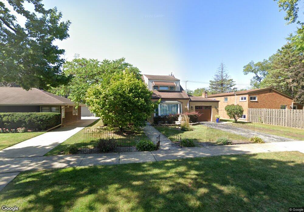
634 Barnsdale Rd La Grange Park, IL 60526
Estimated Value: $379,910 - $442,000
3
Beds
1
Bath
1,260
Sq Ft
$329/Sq Ft
Est. Value
About This Home
This home is located at 634 Barnsdale Rd, La Grange Park, IL 60526 and is currently estimated at $414,478, approximately $328 per square foot. 634 Barnsdale Rd is a home located in Cook County with nearby schools including Forest Road Elementary School, Park Junior High School, and Lyons Township High School.
Ownership History
Date
Name
Owned For
Owner Type
Purchase Details
Closed on
Apr 19, 2004
Sold by
Mahmoud Issam A and Mahmoud Jamie A
Bought by
State Bank Of Countryside and Trust #04-2628
Current Estimated Value
Purchase Details
Closed on
May 2, 2000
Sold by
Chicago Title Land Trust Company
Bought by
Mahmoud Issam A and Mahmoud Jamie A
Home Financials for this Owner
Home Financials are based on the most recent Mortgage that was taken out on this home.
Original Mortgage
$112,000
Interest Rate
8.26%
Create a Home Valuation Report for This Property
The Home Valuation Report is an in-depth analysis detailing your home's value as well as a comparison with similar homes in the area
Home Values in the Area
Average Home Value in this Area
Purchase History
| Date | Buyer | Sale Price | Title Company |
|---|---|---|---|
| State Bank Of Countryside | -- | -- | |
| Mahmoud Issam A | $140,000 | -- |
Source: Public Records
Mortgage History
| Date | Status | Borrower | Loan Amount |
|---|---|---|---|
| Previous Owner | Mahmoud Issam A | $112,000 |
Source: Public Records
Tax History Compared to Growth
Tax History
| Year | Tax Paid | Tax Assessment Tax Assessment Total Assessment is a certain percentage of the fair market value that is determined by local assessors to be the total taxable value of land and additions on the property. | Land | Improvement |
|---|---|---|---|---|
| 2024 | $7,070 | $29,732 | $5,250 | $24,482 |
| 2023 | $6,102 | $31,000 | $5,250 | $25,750 |
| 2022 | $6,102 | $23,477 | $4,500 | $18,977 |
| 2021 | $5,892 | $23,476 | $4,500 | $18,976 |
| 2020 | $6,099 | $24,458 | $4,500 | $19,958 |
| 2019 | $4,687 | $19,888 | $4,125 | $15,763 |
| 2018 | $4,606 | $19,888 | $4,125 | $15,763 |
| 2017 | $4,502 | $19,888 | $4,125 | $15,763 |
| 2016 | $4,489 | $17,356 | $3,750 | $13,606 |
| 2015 | $4,002 | $17,356 | $3,750 | $13,606 |
| 2014 | $3,955 | $17,356 | $3,750 | $13,606 |
| 2013 | $4,208 | $18,709 | $3,750 | $14,959 |
Source: Public Records
Map
Nearby Homes
- 525 Homestead Rd
- 725 N Catherine Ave
- 818 N La Grange Rd
- 9532 Jackson Ave
- 415 N Ashland Ave
- 314 Beach Ave
- 31 Richmond Ave
- 9532 Lexington Ave
- 425 N Catherine Ave
- 326 Kemman Ave
- 141 N La Grange Rd Unit 601
- 141 N La Grange Rd Unit 504
- 141 N La Grange Rd Unit 905
- 314 E 31st St
- 3251 Grand Blvd
- 3336 Grand Blvd
- 3800 Harrison Ave
- 636 N Stone Ave
- 54 N Ashland Ave
- 606 N Brainard Ave
- 638 Barnsdale Rd
- 630 Barnsdale Rd
- 706 E Harding Ave
- 704 E Harding Ave
- 626 Barnsdale Rd
- 702 E Harding Ave
- 633 Homestead Rd
- 700 E Harding Ave
- 633 Barnsdale Rd Unit A
- 633 Barnsdale Rd Unit B
- 633 Barnsdale Rd
- 633 Barnsdale Rd
- 622 Barnsdale Rd
- 702 Barnsdale Rd
- 637 Barnsdale Rd Unit A
- 637 Barnsdale Rd
- 629 Homestead Rd
- 629 Barnsdale Rd
- 627 Barnsdale Rd
- 625 Homestead Rd