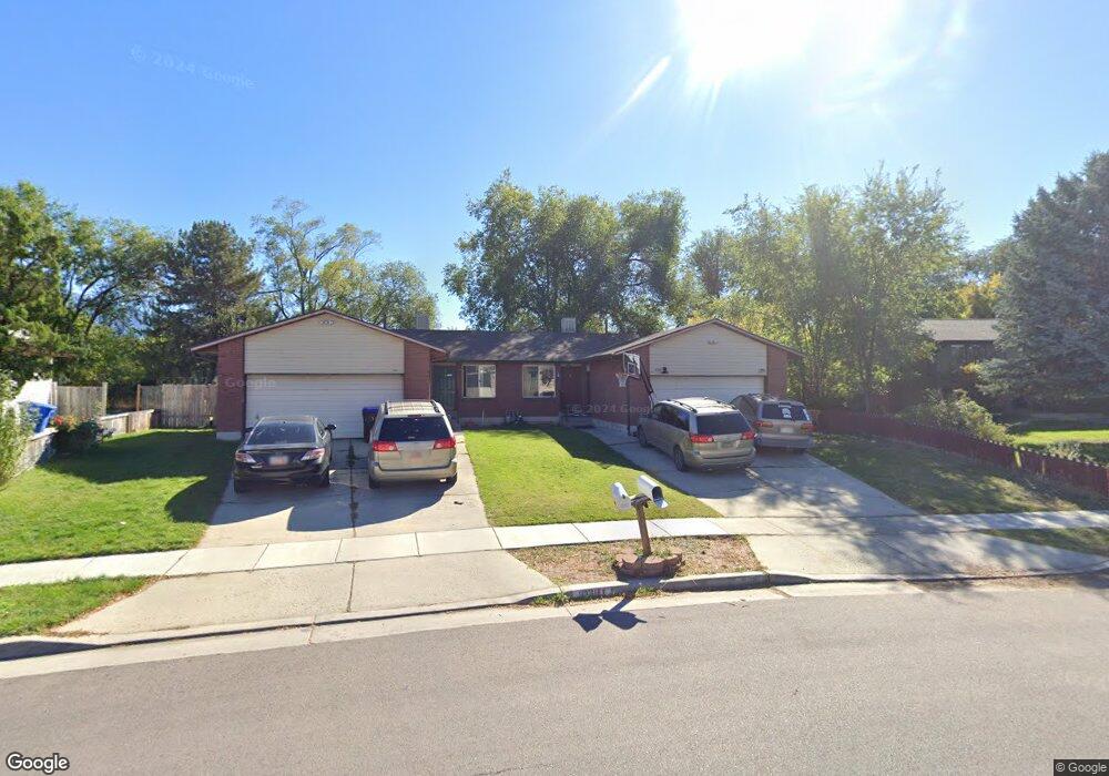
634 E 6770 S Midvale, UT 84047
Estimated Value: $687,000 - $781,000
6
Beds
4
Baths
3,328
Sq Ft
$222/Sq Ft
Est. Value
About This Home
This home is located at 634 E 6770 S, Midvale, UT 84047 and is currently estimated at $737,264, approximately $221 per square foot. 634 E 6770 S is a home located in Salt Lake County with nearby schools including East Midvale Elementary School, Hillcrest High School, and Midvale Middle School.
Ownership History
Date
Name
Owned For
Owner Type
Purchase Details
Closed on
Oct 19, 2006
Sold by
Harrison Tonya Sue and Morris Tawna H
Bought by
Liu Bosco and Liu Arthur
Current Estimated Value
Home Financials for this Owner
Home Financials are based on the most recent Mortgage that was taken out on this home.
Original Mortgage
$248,000
Outstanding Balance
$147,987
Interest Rate
6.46%
Mortgage Type
Unknown
Estimated Equity
$589,278
Purchase Details
Closed on
Sep 21, 1995
Sold by
Kelsch Joseph M
Bought by
Taylor David R and Taylor Valorie M
Home Financials for this Owner
Home Financials are based on the most recent Mortgage that was taken out on this home.
Original Mortgage
$160,000
Interest Rate
7.88%
Purchase Details
Closed on
Sep 19, 1995
Sold by
Kelsch Patsy Dawn
Bought by
Kelsch Joseph M
Home Financials for this Owner
Home Financials are based on the most recent Mortgage that was taken out on this home.
Original Mortgage
$160,000
Interest Rate
7.88%
Create a Home Valuation Report for This Property
The Home Valuation Report is an in-depth analysis detailing your home's value as well as a comparison with similar homes in the area
Home Values in the Area
Average Home Value in this Area
Purchase History
| Date | Buyer | Sale Price | Title Company |
|---|---|---|---|
| Liu Bosco | -- | First American Title | |
| Taylor David R | -- | -- | |
| Kelsch Joseph M | -- | -- |
Source: Public Records
Mortgage History
| Date | Status | Borrower | Loan Amount |
|---|---|---|---|
| Open | Liu Bosco | $248,000 | |
| Previous Owner | Taylor David R | $160,000 |
Source: Public Records
Tax History
| Year | Tax Paid | Tax Assessment Tax Assessment Total Assessment is a certain percentage of the fair market value that is determined by local assessors to be the total taxable value of land and additions on the property. | Land | Improvement |
|---|---|---|---|---|
| 2025 | -- | $627,300 | $177,200 | $450,100 |
| 2024 | -- | $598,500 | $167,200 | $431,300 |
| 2023 | $3,129 | $509,100 | $159,000 | $350,100 |
| 2022 | $3,315 | $526,800 | $132,500 | $394,300 |
| 2021 | $3,019 | $410,200 | $122,300 | $287,900 |
| 2020 | $2,951 | $379,500 | $100,500 | $279,000 |
| 2019 | $2,865 | $358,900 | $94,800 | $264,100 |
| 2016 | $2,802 | $330,900 | $94,800 | $236,100 |
Source: Public Records
Map
Nearby Homes
- 6874 S 595 E Unit 66
- 512 E Larchwood Dr
- 6969 S Free Land Ave
- 6965 S 700 E
- 6907 S 800 E
- 6948 S 855 E
- 7083 Village Place
- 761 E Gables Ln
- 775 E Gables Ln
- 6969 S 855 E
- 6310 S 530 E
- 283 E Vaughn Ln Unit 12
- 776 E Gables St
- 6960 S 900 E
- 6717 S Vaughn Ln Unit 9
- 6715 S Vaughn Ln Unit 8
- 6718 S Vaughn Ln Unit 21
- 6720 S Vaughn Ln Unit 20
- 347 E Winchester St
- 6716 S Vaughn Ln Unit 22
- 634 Larchwood Dr Unit 636
- 636 E Larchwood Dr
- 620 E Larchwood Dr
- 620 Larchwood Dr
- 644 Larchwood Dr
- 644 E Larchwood Dr
- 609 Angie Cir Unit 611
- 608 Larchwood Dr
- 619 Angie Cir Unit 623
- 654 Larchwood Dr Unit 656
- 6753 S 615 E Unit 6755
- 645 Larchwood Dr Unit 647
- 645 E Larchwood Dr
- 655 E Floret Ln Unit 10
- 605 Angie Cir
- 655 E Benbrook Ln
- 651 E Benbrook Ln
- 659 E Floret Ln Unit 9
- 592 Larchwood Dr
- 6804 S Sun Rock Cove
Your Personal Tour Guide
Ask me questions while you tour the home.