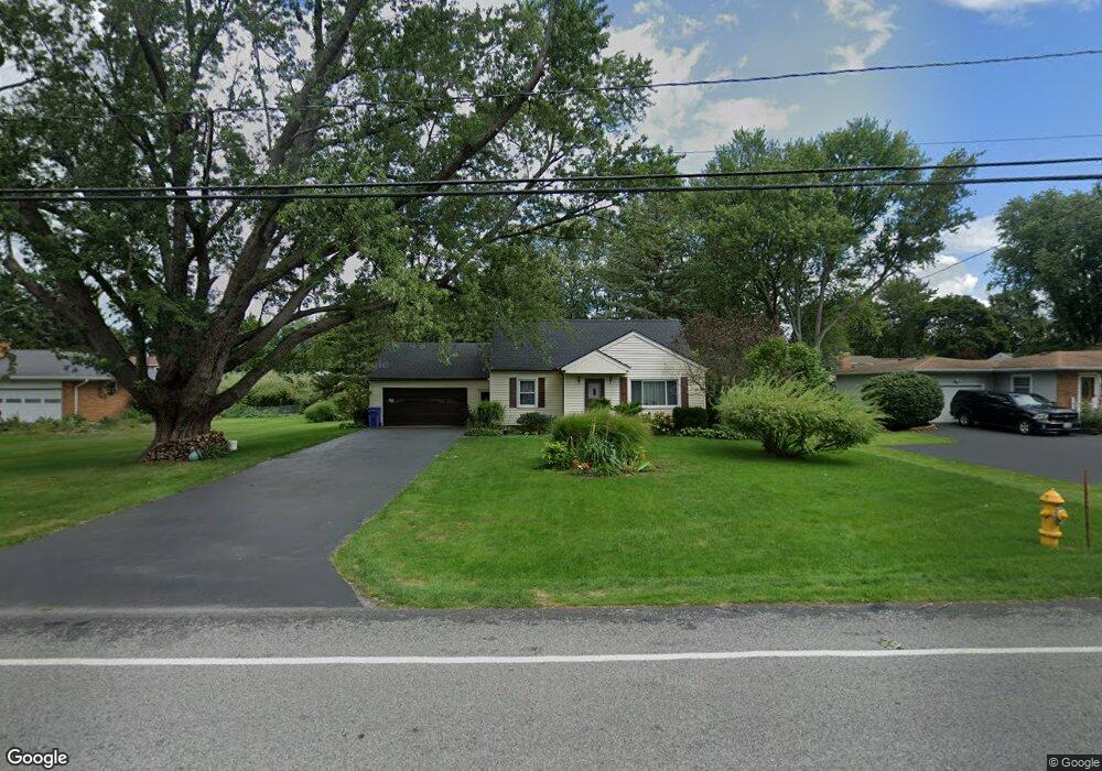
634 Hard Rd Webster, NY 14580
Estimated Value: $299,925 - $339,000
3
Beds
2
Baths
1,630
Sq Ft
$196/Sq Ft
Est. Value
About This Home
This home is located at 634 Hard Rd, Webster, NY 14580 and is currently estimated at $320,231, approximately $196 per square foot. 634 Hard Rd is a home located in Monroe County with nearby schools including Klem Road North Elementary School, Willink Middle School, and Thomas High School.
Ownership History
Date
Name
Owned For
Owner Type
Purchase Details
Closed on
Oct 22, 2007
Sold by
Marciszew Margaret
Bought by
Mockevicius Rolandas
Current Estimated Value
Home Financials for this Owner
Home Financials are based on the most recent Mortgage that was taken out on this home.
Original Mortgage
$112,400
Outstanding Balance
$70,977
Interest Rate
6.43%
Mortgage Type
New Conventional
Estimated Equity
$249,254
Purchase Details
Closed on
Jun 17, 2003
Sold by
Gibson David J
Bought by
Marciszewski Margaret
Create a Home Valuation Report for This Property
The Home Valuation Report is an in-depth analysis detailing your home's value as well as a comparison with similar homes in the area
Home Values in the Area
Average Home Value in this Area
Purchase History
| Date | Buyer | Sale Price | Title Company |
|---|---|---|---|
| Mockevicius Rolandas | $140,500 | John D. Marchioni | |
| Marciszewski Margaret | $132,500 | Michael J Labue |
Source: Public Records
Mortgage History
| Date | Status | Borrower | Loan Amount |
|---|---|---|---|
| Open | Mockevicius Rolandas | $112,400 |
Source: Public Records
Tax History
| Year | Tax Paid | Tax Assessment Tax Assessment Total Assessment is a certain percentage of the fair market value that is determined by local assessors to be the total taxable value of land and additions on the property. | Land | Improvement |
|---|---|---|---|---|
| 2024 | $5,951 | $132,500 | $29,300 | $103,200 |
| 2023 | $5,783 | $132,500 | $29,300 | $103,200 |
| 2022 | $6,147 | $132,500 | $29,300 | $103,200 |
| 2021 | $6,090 | $132,500 | $29,300 | $103,200 |
| 2020 | $5,382 | $132,500 | $29,300 | $103,200 |
| 2019 | $4,832 | $132,500 | $29,300 | $103,200 |
| 2018 | $5,078 | $132,500 | $29,300 | $103,200 |
| 2017 | $4,792 | $132,500 | $29,300 | $103,200 |
| 2016 | $4,832 | $132,500 | $29,300 | $103,200 |
| 2015 | -- | $132,500 | $29,300 | $103,200 |
| 2014 | -- | $132,500 | $29,300 | $103,200 |
Source: Public Records
Map
Nearby Homes
- 643 Kayloc Cir
- 1055 Klem Rd
- 1 Hard Rd
- 572 Holt Rd
- 1164 Woodbridge Ln
- 497 Pellett Rd
- 1222 Scenic Cir
- 902-904 -900 Lake Rd
- 904 Lake Rd Unit 900-902
- 675 Maple Dr
- 611 Maris Run
- 621 Brookstone Bend
- 37 Southfield Dr
- 75 Southfield Dr
- 362 Webster Rd
- 93 Kircher Park
- 763 Maple Dr
- 595 Lake Rd
- 524 Old Mill Ln
- 453 Pheasant Run
- 636 Hard Rd
- 630 Hard Rd
- 633 Bending Bough Dr
- 640 Hard Rd
- 637 Bending Bough Dr
- 629 Hard Rd
- 626 Hard Rd
- 625 Bending Bough Dr
- 623 Hard Rd
- 641 Bending Bough Dr
- 949 Cannon Cir
- 950 Cannon Cir
- 622 Hard Rd
- 621 Bending Bough Dr
- 634 Bending Bough Dr
- 638 Bending Bough Dr
- 646 Hard Rd
- 619 Hard Rd
- 630 Bending Bough Dr
- 641 Hard Rd
Your Personal Tour Guide
Ask me questions while you tour the home.