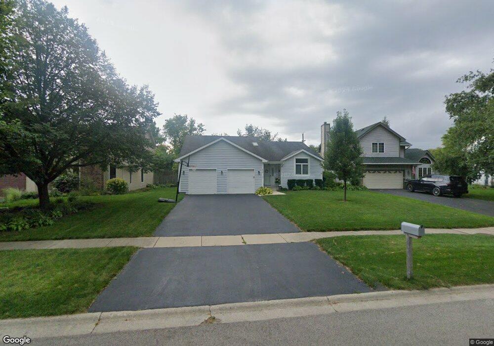
634 Lincoln Ave Grayslake, IL 60030
Estimated Value: $360,797 - $438,000
4
Beds
3
Baths
1,612
Sq Ft
$247/Sq Ft
Est. Value
About This Home
This home is located at 634 Lincoln Ave, Grayslake, IL 60030 and is currently estimated at $397,449, approximately $246 per square foot. 634 Lincoln Ave is a home located in Lake County with nearby schools including Frederick School, Prairieview School, and Grayslake Middle School.
Ownership History
Date
Name
Owned For
Owner Type
Purchase Details
Closed on
Nov 9, 2007
Sold by
Shields Philip R and Shields Patricia A
Bought by
Shields Philip R and Shields Patricia A
Current Estimated Value
Purchase Details
Closed on
Sep 30, 1996
Sold by
Parker William R and Henson Parker Melinda
Bought by
Shields Philip R and Shields Patricia A
Home Financials for this Owner
Home Financials are based on the most recent Mortgage that was taken out on this home.
Original Mortgage
$152,700
Outstanding Balance
$14,082
Interest Rate
8.14%
Estimated Equity
$383,367
Create a Home Valuation Report for This Property
The Home Valuation Report is an in-depth analysis detailing your home's value as well as a comparison with similar homes in the area
Home Values in the Area
Average Home Value in this Area
Purchase History
| Date | Buyer | Sale Price | Title Company |
|---|---|---|---|
| Shields Philip R | -- | None Available | |
| Shields Philip R | $191,000 | -- |
Source: Public Records
Mortgage History
| Date | Status | Borrower | Loan Amount |
|---|---|---|---|
| Open | Shields Philip R | $152,700 |
Source: Public Records
Tax History Compared to Growth
Tax History
| Year | Tax Paid | Tax Assessment Tax Assessment Total Assessment is a certain percentage of the fair market value that is determined by local assessors to be the total taxable value of land and additions on the property. | Land | Improvement |
|---|---|---|---|---|
| 2024 | $9,421 | $100,797 | $15,757 | $85,040 |
| 2023 | $8,412 | $88,102 | $13,772 | $74,330 |
| 2022 | $8,412 | $76,137 | $10,845 | $65,292 |
| 2021 | $9,879 | $85,890 | $10,425 | $75,465 |
| 2020 | $9,874 | $81,722 | $9,919 | $71,803 |
| 2019 | $9,532 | $78,405 | $9,516 | $68,889 |
| 2018 | $9,886 | $81,635 | $12,974 | $68,661 |
| 2017 | $9,905 | $76,790 | $12,204 | $64,586 |
| 2016 | $9,431 | $70,886 | $11,266 | $59,620 |
| 2015 | $9,185 | $64,759 | $10,292 | $54,467 |
| 2014 | $7,874 | $56,097 | $8,457 | $47,640 |
| 2012 | $7,762 | $58,587 | $8,832 | $49,755 |
Source: Public Records
Map
Nearby Homes
- 390 N Garfield Blvd
- 42 Village Station Ln
- 102 Soo Line Dr
- 10 Glen St
- 533 Cannon Ball Dr
- 349 Brittain Ave
- 231 Lionel Dr
- 228 Station Park Cir
- 270 Lionel Dr
- 146 Westerfield Place
- 121 Park Ave
- 11 S Lake St
- Lot 48 Lake Ave
- 32100 Alleghany Rd
- 220 Bluff Ct
- 1617 Albany St
- 101 Burton St
- 34110 S Circle Dr
- 1191 Hummingbird Ln
- 977 Harris Rd Unit 34
- 640 Lincoln Ave
- 626 Lincoln Ave
- 646 Lincoln Ave
- 620 Lincoln Ave
- 652 Lincoln Ave
- 623 Lincoln Ave
- 635 Lincoln Ave
- 614 Lincoln Ave
- 643 Lincoln Ave
- 658 Lincoln Ave Unit 3
- 655 Lincoln Ave
- 667 Lincoln Ave
- 664 Lincoln Ave
- 590 N Garfield Blvd
- 565 Lincoln Ave
- 573 Trestle Ct
- 585 Trestle Ct
- 598 N Garfield Blvd
- 586 N Garfield Blvd
- 557 Lincoln Ave