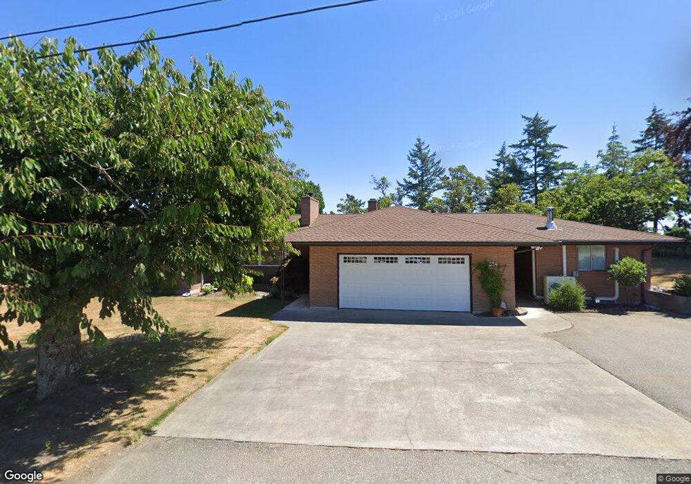
634 Moe Rd Camano Island, WA 98282
Estimated Value: $736,000 - $1,038,966
3
Beds
3
Baths
1,849
Sq Ft
$492/Sq Ft
Est. Value
About This Home
This home is located at 634 Moe Rd, Camano Island, WA 98282 and is currently estimated at $909,242, approximately $491 per square foot. 634 Moe Rd is a home located in Island County with nearby schools including Utsalady Elementary School, Port Susan Middle School, and Stanwood High School.
Ownership History
Date
Name
Owned For
Owner Type
Purchase Details
Closed on
Oct 13, 2022
Sold by
Yengoyan Vander Meer 2011 Living Trust
Bought by
Moore Erin L and Meehan Bernard J
Current Estimated Value
Home Financials for this Owner
Home Financials are based on the most recent Mortgage that was taken out on this home.
Original Mortgage
$420,000
Outstanding Balance
$403,738
Interest Rate
5.89%
Mortgage Type
New Conventional
Estimated Equity
$505,504
Purchase Details
Closed on
Dec 7, 2016
Sold by
Richardson Carolyn Meyer and Richardson Patrick
Bought by
Vander Yengoyan Aram A and Vander Meer Kathleen
Home Financials for this Owner
Home Financials are based on the most recent Mortgage that was taken out on this home.
Original Mortgage
$325,000
Interest Rate
3.47%
Mortgage Type
New Conventional
Purchase Details
Closed on
Oct 1, 2005
Sold by
Meyer Robert
Bought by
Richardson Carolyn Meyer and Meyer Katherine
Create a Home Valuation Report for This Property
The Home Valuation Report is an in-depth analysis detailing your home's value as well as a comparison with similar homes in the area
Home Values in the Area
Average Home Value in this Area
Purchase History
| Date | Buyer | Sale Price | Title Company |
|---|---|---|---|
| Moore Erin L | -- | -- | |
| Vander Yengoyan Aram A | $446,900 | Land Title & Escrow Island C | |
| Richardson Carolyn Meyer | $104,833 | -- |
Source: Public Records
Mortgage History
| Date | Status | Borrower | Loan Amount |
|---|---|---|---|
| Open | Moore Erin L | $420,000 | |
| Previous Owner | Vander Yengoyan Aram A | $325,000 |
Source: Public Records
Tax History Compared to Growth
Tax History
| Year | Tax Paid | Tax Assessment Tax Assessment Total Assessment is a certain percentage of the fair market value that is determined by local assessors to be the total taxable value of land and additions on the property. | Land | Improvement |
|---|---|---|---|---|
| 2024 | $6,919 | $900,708 | $430,000 | $470,708 |
| 2023 | $6,919 | $896,430 | $420,000 | $476,430 |
| 2022 | $5,119 | $717,126 | $360,000 | $357,126 |
| 2021 | $4,826 | $546,573 | $240,000 | $306,573 |
| 2020 | $4,387 | $498,788 | $200,000 | $298,788 |
| 2019 | $4,379 | $446,744 | $225,000 | $221,744 |
| 2018 | $4,460 | $447,444 | $225,000 | $222,444 |
| 2017 | $4,043 | $422,630 | $200,000 | $222,630 |
| 2016 | $3,448 | $425,411 | $200,000 | $225,411 |
| 2015 | $3,552 | $347,464 | $200,000 | $147,464 |
| 2013 | -- | $364,342 | $211,589 | $152,753 |
Source: Public Records
Map
Nearby Homes
- 289 E Driftwood Shores Rd
- 244 David St
- 245 David St
- 251 Goodrich Rd
- 0 E Shumway Rd
- 230 Heather Dr
- 169 Driftwood Shores Rd
- 446 Lehman Dr
- 362 N Sunrise Blvd
- 335 Heather Dr
- 501 S Vesper Way
- 269 E Lochwood Dr
- 355 Selkirk Dr
- 105 N Sunrise Blvd
- 230 Rocky Mountain High Rd
- 302 Melrose Dr
- 474 Stirling Dr
- 578 N Sundin Dr
- 552 Sundin Dr
- 566 Sundin Dr
- 620 Moe Rd
- 224 Longbeach Dr
- 616 Moe Rd
- 220 Longbeach Dr
- 238 Iverson Rd
- 600 Iverson Rd
- 212 Longbeach Dr
- 612 Moe Rd
- 568 Iverson Beach Rd
- 240 Iverson Rd
- 236 Iverson Rd
- 225 Longbeach Dr
- 242 Iverson Rd
- 605 Moe Rd
- 616 Iverson Beach Rd
- 600 Moe Rd
- 555 Iverson Beach Rd
- 239 Iverson Rd
- 235 Iverson Rd
- 231 Iverson Rd