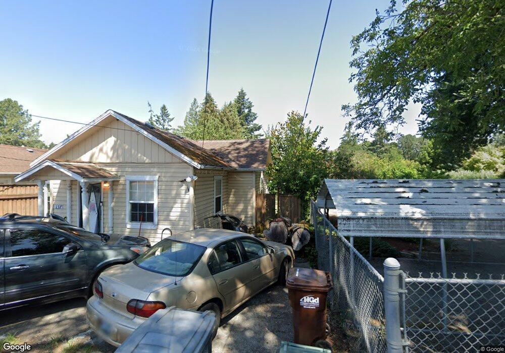
634 N 1st Ave Hillsboro, OR 97124
Northwest Hillsboro NeighborhoodEstimated Value: $513,714 - $584,000
3
Beds
2
Baths
1,902
Sq Ft
$287/Sq Ft
Est. Value
About This Home
This home is located at 634 N 1st Ave, Hillsboro, OR 97124 and is currently estimated at $546,679, approximately $287 per square foot. 634 N 1st Ave is a home located in Washington County with nearby schools including Lincoln Street Elementary School, Evergreen Jr High School, and Glencoe High School.
Ownership History
Date
Name
Owned For
Owner Type
Purchase Details
Closed on
Apr 2, 2013
Sold by
Koivunen Gary Norman
Bought by
Livi Koivunen Gary N and Gary N Koivunen Revocable Living Trust
Current Estimated Value
Home Financials for this Owner
Home Financials are based on the most recent Mortgage that was taken out on this home.
Original Mortgage
$150,000
Interest Rate
3.54%
Mortgage Type
New Conventional
Purchase Details
Closed on
Oct 6, 2008
Sold by
Koivunen Gary N
Bought by
Koivunen Gary N
Create a Home Valuation Report for This Property
The Home Valuation Report is an in-depth analysis detailing your home's value as well as a comparison with similar homes in the area
Home Values in the Area
Average Home Value in this Area
Purchase History
| Date | Buyer | Sale Price | Title Company |
|---|---|---|---|
| Livi Koivunen Gary N | -- | Fidelity Natl Title Co Of Or | |
| Koivunen Gary Norman | -- | Fidelity Natl Title Co Of Or | |
| Koivunen Gary N | -- | None Available |
Source: Public Records
Mortgage History
| Date | Status | Borrower | Loan Amount |
|---|---|---|---|
| Closed | Koivunen Gary Norman | $150,000 |
Source: Public Records
Tax History Compared to Growth
Tax History
| Year | Tax Paid | Tax Assessment Tax Assessment Total Assessment is a certain percentage of the fair market value that is determined by local assessors to be the total taxable value of land and additions on the property. | Land | Improvement |
|---|---|---|---|---|
| 2025 | $4,354 | $266,380 | -- | -- |
| 2024 | $4,230 | $258,630 | -- | -- |
| 2023 | $4,230 | $251,100 | $0 | $0 |
| 2022 | $4,116 | $251,100 | $0 | $0 |
| 2021 | $4,033 | $236,690 | $0 | $0 |
| 2020 | $3,946 | $229,800 | $0 | $0 |
| 2019 | $3,833 | $223,110 | $0 | $0 |
| 2018 | $3,669 | $216,620 | $0 | $0 |
| 2017 | $3,536 | $210,320 | $0 | $0 |
| 2016 | $3,439 | $204,200 | $0 | $0 |
| 2015 | $3,300 | $198,260 | $0 | $0 |
| 2014 | $3,282 | $192,490 | $0 | $0 |
Source: Public Records
Map
Nearby Homes
- 856 NW Val Ct
- 665 NE 3rd Ave
- 154 NW Garibaldi St
- 457 NW Forest St
- 711 NW Connell Ave
- 341 NE 3rd Ave
- 456 NW Dennis Ave
- 1 NE 3rd Ave
- 354 NE Jackson St
- 635 NW Queens Ct
- 874 NE 6th Dr
- 245 NE 4th Ave
- 420 NE Jackson St
- 1242 NE Parkside Dr
- 437 NW Freeman Ave
- 1425 NE Glen Ellen Dr
- 660 NW Ledum Ln
- 511 NE Lincoln St
- 624 NE Edison St
- 528 NW Celtis Ln
- 628 N 1st Ave
- 149 NE Grant St
- 680 N 1st Ave
- 704 N 1st Ave
- 149A NE Grant St
- 139 NE Grant (See New Ml#)
- 139 NE Grant St
- 143 NE Grant St
- 145 NE Grant St
- 612 N 1st Ave
- 625 NE 2nd Ave
- 0 N 1st Ave
- 726 N 1st Ave
- 175 NE Grant St
- 206 NE Donelson St
- 641 N 1st Ave
- 209 NE Florist Ln Unit A
- 671 N 1st Ave
- 693 N 1st Ave Unit 1
- 693 N 1st Ave