Estimated Value: $492,000 - $551,000
5
Beds
3
Baths
2,464
Sq Ft
$208/Sq Ft
Est. Value
About This Home
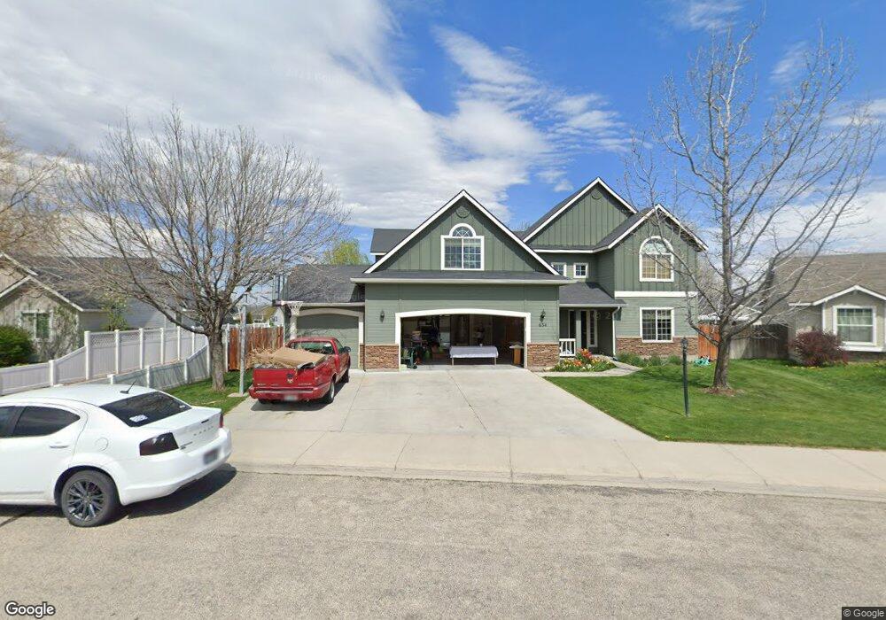
This home is located at 634 N Mudstone Way, Kuna, ID 83634 and is currently estimated at $513,622, approximately $208 per square foot. 634 N Mudstone Way is a home located in Ada County with nearby schools including Hubbard Elementary School, Ross Elementary School, and Fremont H. Teed Elementary School.
Ownership History
Date
Name
Owned For
Owner Type
Purchase Details
Closed on
May 10, 2021
Sold by
Long Charles Leroy and Long Kay Lynn
Bought by
Long Charles Leroy and Long Kay Lynn
Current Estimated Value
Home Financials for this Owner
Home Financials are based on the most recent Mortgage that was taken out on this home.
Original Mortgage
$118,761
Interest Rate
3.1%
Mortgage Type
New Conventional
Purchase Details
Closed on
Oct 23, 2020
Sold by
Long Charles Leroy and Long Kay
Bought by
Long Charles Leroy and Long Kay Lynn
Create a Home Valuation Report for This Property
The Home Valuation Report is an in-depth analysis detailing your home's value as well as a comparison with similar homes in the area
Home Values in the Area
Average Home Value in this Area
Purchase History
| Date | Buyer | Sale Price | Title Company |
|---|---|---|---|
| Long Charles Leroy | -- | Accommodation | |
| Long Charles Leroy | -- | Titleone Boise | |
| Long Charles Leroy | -- | None Available |
Source: Public Records
Mortgage History
| Date | Status | Borrower | Loan Amount |
|---|---|---|---|
| Closed | Long Charles Leroy | $118,761 |
Source: Public Records
Tax History Compared to Growth
Tax History
| Year | Tax Paid | Tax Assessment Tax Assessment Total Assessment is a certain percentage of the fair market value that is determined by local assessors to be the total taxable value of land and additions on the property. | Land | Improvement |
|---|---|---|---|---|
| 2025 | $1,583 | $484,800 | -- | -- |
| 2024 | $1,978 | $450,700 | -- | -- |
| 2023 | $1,978 | $442,900 | $0 | $0 |
| 2022 | $2,751 | $571,100 | $0 | $0 |
| 2021 | $2,671 | $440,600 | $0 | $0 |
| 2020 | $2,680 | $346,500 | $0 | $0 |
| 2019 | $2,777 | $323,300 | $0 | $0 |
| 2018 | $2,318 | $271,700 | $0 | $0 |
| 2017 | $1,883 | $234,200 | $0 | $0 |
| 2016 | $1,664 | $210,600 | $0 | $0 |
| 2015 | $1,768 | $198,800 | $0 | $0 |
| 2012 | -- | $131,000 | $0 | $0 |
Source: Public Records
Map
Nearby Homes
- 381 E Daniel Ct
- 190 S Johns Bay Ave
- 974 E Odyssey St
- 980 E Odyssey St
- 390 N Cleveland Ave
- 820 E Exploration Dr
- 846 E Exploration Dr
- 862 E Exploration Dr
- Plan 2602 at Journeys End
- Plan 2018 at Journeys End
- Plan 1882 at Journeys End
- Plan 2221 at Journeys End
- Plan 2391 at Journeys End
- Plan 1478 at Journeys End
- Plan 1646 at Journeys End
- 1099 E Deer Flat Rd
- 873 E Deer Flat Rd
- 1276 N Cambrick Dr
- 1122 E Exploration Dr
- 430 S Rumney Ave
- 626 N
- 626 N Mudstone Way
- 656 N Mudstone Way
- 657 N Siltstone Ave
- 702 N Olivine Place
- 622 N Mudstone Way
- 703 N Olivine Place
- 627 N Mudstone Way
- 645 N Mudstone Way
- 678 N Mudstone Way
- 651 N Siltstone Ave
- 665 N Siltstone Ave
- 657 N Mudstone Way
- 706 N Olivine Place
- 613 N Mudstone Way
- 604 N Mudstone Way
- 719 N Olivine Place
- 683 N Mudstone Way
- 694 N Mudstone Way
- 599 N Mudstone Way