NOT LISTED FOR SALE

634 NE Fogarty St Newport, OR 97365

Estimated Value: $415,000 - $464,000

0.11 Acre
$4,019,473 Price per Acre
4,792 Sq Ft Lot

Last Sold November 12, 2014

Last sale price $60,000

Est. 637% increase in value since last sale

Current estimated payment $2,791/month

1 Day on Market

About This Lot

As of November 2014

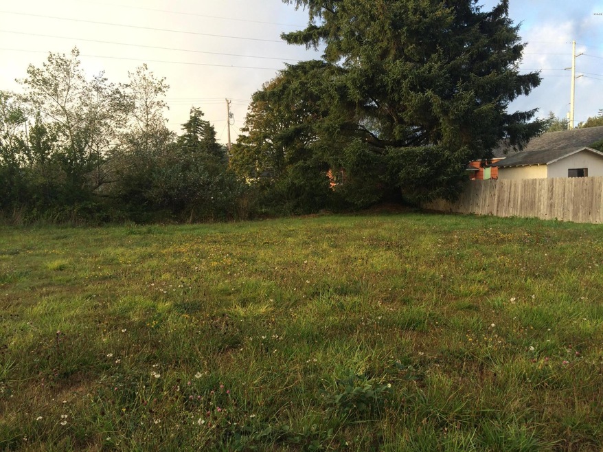
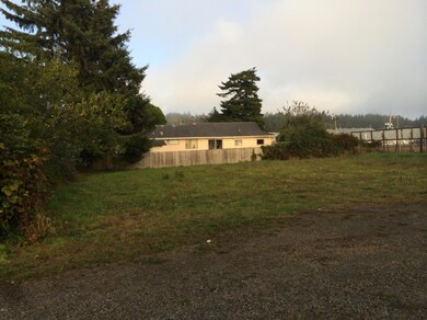
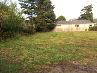
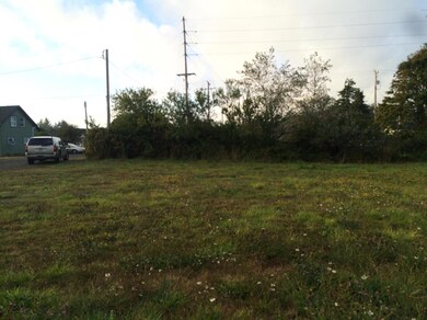
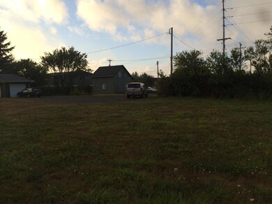
1 of 2 lots available. Rare find. Very flat 50' x 100' lot with all City Services in NE Newport. Zoned R-3. Lots of uses. Right in the middle between Sam Case, NIS &, Newport High School. Ready for a new house to be built. Can Build to suit. Front row view of High School football games. All buyers to check with City for approved uses. Seller is a licensed Real Estate Broker in the State of Oregon.

Last Agent to Sell the Property

Brodie Becksted

Taylor & Taylor Realty Company Listed on: 10/16/2014

Last Buyer's Agent

Steve Lovas

Windermere West Coast Properties

Property Details

Property Type

  • Land

Est. Annual Taxes

  • $3,937

Lot Details

  • 4,792 Sq Ft Lot
  • Lot Dimensions are 50' x 100'
  • Level Lot
  • Property is zoned R-3 Residential

Additional Features

  • Mobile Home Allowed
  • Gas Available at Street

Listing and Financial Details

  • Tax Lot 4
  • Assessor Parcel Number 111105DD-3600-00

Community Details

Overview

  • No Home Owners Association
  • Bakers 1St To Newport Subdivision

Recreation

  • Electricity Available at Street

Property Details

Property Type

Land

Est. Annual Taxes

$3,937

Lot Details

0

Listing Details

  • Property Sub Type: Land - Residential
  • Prop. Type: Land-Residential
  • Road Frontage Type: None
  • Lot Size Acres: 0.11
  • Lot Size: 50' x 100'
  • Lot Size Sq Ft: 4791.6
  • Road Surface Type: Gravel
  • Subdivision Name: Bakers 1st to Newport
  • Directions: Hwy 20 to NE Eads Street, turn East on NE 7th Street, turn south on NE Fogarty Street. lots on left hand side.
  • Contract Information:BankLender Owned: No
  • Contract Information:Short Sale: No
  • Contract Information:_three_rd Party Approval: No
  • General Property Description:Land Sub-Type: Land
  • General Property Description:Frontage: None
  • General Property Description:Primary View: None
  • General Property Description:Secondary View: None
  • General Property Description:_pound_ of Acres: 0.11
  • Location Tax and Other Information:Tax Lot: 3600
  • Miscellaneous Survey: Recorded
  • Topography:Level: Yes
  • Water:At Street: Yes
  • Electric:At Street2: Yes
  • Gas:At Street3: Yes
  • Sewer:City Street2: Yes
  • General Property Description:Lot Dimensions: 50' x 100'
  • Location Tax and Other Information:Subdv ParcelLot: 4
  • Miscellaneous Cable T V: Avail
  • Special Features: None

Exterior Features

  • View: None

Utilities

  • Utilities: Natural Gas Available
  • Water Source: At Street

Condo/Co-op/Association

  • Association: No

Lot Info

  • Parcel #: 111105DD-3600-00
  • Zoning: R-3 Residential
  • ResoLotSizeUnits: Acres

Tax Info

  • Tax Year: 2013

Range of Values:

Collateral Analytics

Collateral Analytics Collateral Analytics AVMs (Automated Valuation Model) employ a number of statistical approaches combined with neighborhood-specific comparable selection guarantees the most up-to-date and precise valuations.

Not Available

Collateral Analytics does not have data for the current month. Please view the chart for historical values.

ICE

ICE Mortgage Technology ICE Mortgage Technology’s AVM (Automated Valuation Model) is a state-of-the-art online residential property valuation tool that provides a quick and accurate estimate of the value of almost any home in the U.S.

Not Available

ICE Mortgage Technology does not have data for the current month. Please view the chart for historical values.

First American

First American First American Data & Analytics’ next-generation AVM combines unrivaled data assets with a blended ensemble of valuation models to produce highly accurate, reliable valuations you can trust.

Not Available

First American does not have data for the current month. Please view the chart for historical values.

Quantarium

Quantarium Quantarium’s valuation service, repeatedly proven the industry’s most accurate and comprehensive, is supercharged with a self-learning and auto-tuning AI engine that continually becomes smarter and more accurate as it processes daily inputs from the industry’s leading RE data lake.

Not Available

Quantarium does not have data for the current month. Please view the chart for historical values.

Average Value
Not Available
List Price
Sold Price
Create a Home Valuation Report for This Property
The Home Valuation Report is an in-depth analysis detailing your home's value as well as a comparison with similar homes in the area

Home Values in the Area

Source: Public Records

Average Home Value in this Area


Source: Public Records

Mortgage History

Date Status Borrower Loan Amount
Closed Kukkola Michael J $150,000
Source: Public Records

Property History

Date Event Price Change Sq Ft Price
11/12/2014 11/12/14 Sold $60,000 -24.1% --
10/17/2014 10/17/14 Pending -- -- --
10/16/2014 10/16/14 For Sale $79,000 -- --
Source: Lincoln County Board of REALTORS® MLS (OR)

Tax History Compared to Growth

Source: Public Records

Tax History

Year Tax Paid Tax Assessment Tax Assessment Total Assessment is a certain percentage of the fair market value that is determined by local assessors to be the total taxable value of land and additions on the property. Land Improvement
2024 $3,937 $218,190 -- --
2023 $3,844 $211,840 $0 $0
2022 $3,726 $205,670 $0 $0
2021 $3,662 $199,680 $0 $0
2020 $3,575 $193,870 $0 $0
2019 $3,422 $188,230 $0 $0
2018 $3,316 $182,750 $0 $0
2017 $3,287 $177,430 $0 $0
2016 $3,217 $172,270 $0 $0
2015 $1,081 $60,630 $0 $0
Source: Public Records

Agents Affiliated with this Home

See All Agents

Map

Source: Lincoln County Board of REALTORS® MLS (OR)

MLS Number: 14-2385

APN: R529894