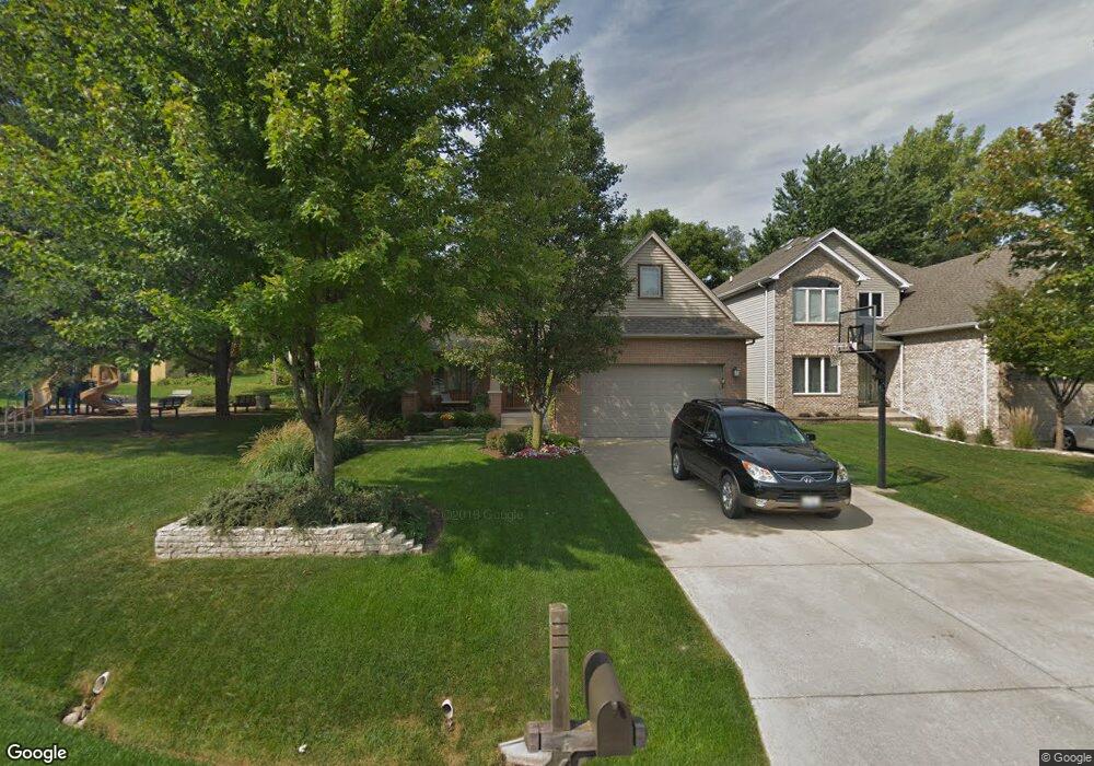
634 Robbins St Winfield, IL 60190
Estimated Value: $641,000 - $674,000
--
Bed
--
Bath
2,999
Sq Ft
$220/Sq Ft
Est. Value
About This Home
This home is located at 634 Robbins St, Winfield, IL 60190 and is currently estimated at $659,720, approximately $219 per square foot. 634 Robbins St is a home with nearby schools including Winfield Central School, Winfield Primary School, and West Chicago Community High School.
Ownership History
Date
Name
Owned For
Owner Type
Purchase Details
Closed on
Jan 25, 2022
Sold by
Sartore Michael D and Sartore Kristin S
Bought by
Michael D & Kristin S Sartore Living Trust and Sartore Kristin
Current Estimated Value
Purchase Details
Closed on
Aug 30, 2002
Sold by
G Carey Construction Company
Bought by
Century Grove Ltd
Home Financials for this Owner
Home Financials are based on the most recent Mortgage that was taken out on this home.
Original Mortgage
$56,000
Interest Rate
4.75%
Mortgage Type
Purchase Money Mortgage
Purchase Details
Closed on
Aug 14, 2002
Sold by
G Carey Construction Company
Bought by
Sartore Michael D and Sartore Kristin S
Home Financials for this Owner
Home Financials are based on the most recent Mortgage that was taken out on this home.
Original Mortgage
$56,000
Interest Rate
4.75%
Mortgage Type
Purchase Money Mortgage
Purchase Details
Closed on
Oct 3, 1994
Sold by
Palos Bank & Trust Company
Bought by
First National Bank Of Evergreen Park
Create a Home Valuation Report for This Property
The Home Valuation Report is an in-depth analysis detailing your home's value as well as a comparison with similar homes in the area
Home Values in the Area
Average Home Value in this Area
Purchase History
| Date | Buyer | Sale Price | Title Company |
|---|---|---|---|
| Michael D & Kristin S Sartore Living Trust | -- | Kabbe Law Group Llc | |
| Century Grove Ltd | -- | -- | |
| Sartore Michael D | $70,000 | -- | |
| First National Bank Of Evergreen Park | -- | -- |
Source: Public Records
Mortgage History
| Date | Status | Borrower | Loan Amount |
|---|---|---|---|
| Previous Owner | Sartore Michael D | $56,000 |
Source: Public Records
Tax History Compared to Growth
Tax History
| Year | Tax Paid | Tax Assessment Tax Assessment Total Assessment is a certain percentage of the fair market value that is determined by local assessors to be the total taxable value of land and additions on the property. | Land | Improvement |
|---|---|---|---|---|
| 2024 | $13,843 | $192,429 | $22,435 | $169,994 |
| 2023 | $13,256 | $175,750 | $20,490 | $155,260 |
| 2022 | $12,472 | $164,260 | $19,150 | $145,110 |
| 2021 | $11,742 | $157,460 | $18,360 | $139,100 |
| 2020 | $11,544 | $152,680 | $17,800 | $134,880 |
| 2019 | $11,468 | $145,390 | $16,950 | $128,440 |
| 2018 | $10,983 | $137,160 | $16,000 | $121,160 |
| 2017 | $10,713 | $130,330 | $15,200 | $115,130 |
| 2016 | $10,435 | $121,520 | $14,170 | $107,350 |
| 2015 | $10,261 | $112,490 | $13,120 | $99,370 |
| 2014 | $10,000 | $107,140 | $12,490 | $94,650 |
| 2013 | $9,839 | $111,060 | $12,950 | $98,110 |
Source: Public Records
Map
Nearby Homes
- 27W120 Williams St
- 0S732 Myrtle St
- 27W327 Williams St
- 0S650 Forest St
- 1s050 Shaffner Rd
- 27W0S Roosevelt Rd
- Lot 17,18,19 Roosevelt Rd
- 0S760 Cleveland St
- 27W423 Sunnyside Ave
- 3 Sunnyside Ave
- 27W180 Cooley Ave
- 2059 W Roosevelt Rd
- 0S044 Lee Ct
- 2152 Belleau Woods Dr
- 1310 Yorkshire Woods Ct
- 27W020 Walz Way
- 0S619 Forest Ave
- 0S064 Calvin Ct
- 1S710 Shaffner Rd
- 1S728 Shaffner Rd
- 0S626 Robbins St
- 0S610 Robbins St
- 0S623 Jefferson St
- 0S625 Jefferson St
- 0S617 Jefferson St
- 0S602 Robbins St
- 0S635 Robbins St
- 0S643 Robbins St
- 0S627 Robbins St
- 0S611 Jefferson St
- 0S619 Robbins St
- 0S647 Robbins St
- 0S651 Jefferson St
- 0S586 Robbins St
- S605 Jefferson St
- 0S611 Robbins St
- 0S651 Robbins St
- 27W180 Williams St
- 0S587 Jefferson St
- 0S582 Robbins St