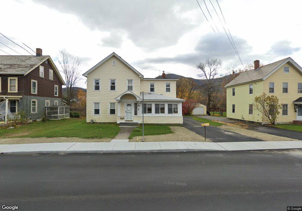
634 State Rd North Adams, MA 01247
Estimated Value: $249,000 - $340,000
4
Beds
3
Baths
2,131
Sq Ft
$133/Sq Ft
Est. Value
About This Home
This home is located at 634 State Rd, North Adams, MA 01247 and is currently estimated at $284,469, approximately $133 per square foot. 634 State Rd is a home located in Berkshire County with nearby schools including Greylock Elementary School, Drury High School, and Pine Cobble School.
Ownership History
Date
Name
Owned For
Owner Type
Purchase Details
Closed on
Jul 16, 2021
Sold by
Demers Charles H
Bought by
C & S Demers Ft
Current Estimated Value
Purchase Details
Closed on
Nov 14, 2011
Sold by
Demers Patricia A and Gomeau Barbara J
Bought by
Demers Charles H
Purchase Details
Closed on
May 21, 1998
Sold by
Sedala Neil A and Segala Susan M
Bought by
Demers Madeline
Purchase Details
Closed on
Jan 30, 1997
Sold by
Fhc Inc
Bought by
Segala Neil A and Segala Susan M
Create a Home Valuation Report for This Property
The Home Valuation Report is an in-depth analysis detailing your home's value as well as a comparison with similar homes in the area
Home Values in the Area
Average Home Value in this Area
Purchase History
| Date | Buyer | Sale Price | Title Company |
|---|---|---|---|
| C & S Demers Ft | -- | None Available | |
| Demers Charles H | -- | -- | |
| Demers Madeline | $89,000 | -- | |
| Segala Neil A | $24,000 | -- |
Source: Public Records
Mortgage History
| Date | Status | Borrower | Loan Amount |
|---|---|---|---|
| Previous Owner | Segala Neil A | $50,000 | |
| Previous Owner | Segala Neil A | $25,000 |
Source: Public Records
Tax History Compared to Growth
Tax History
| Year | Tax Paid | Tax Assessment Tax Assessment Total Assessment is a certain percentage of the fair market value that is determined by local assessors to be the total taxable value of land and additions on the property. | Land | Improvement |
|---|---|---|---|---|
| 2025 | $3,875 | $231,900 | $34,700 | $197,200 |
| 2024 | $3,634 | $212,000 | $31,700 | $180,300 |
| 2023 | $3,456 | $195,600 | $31,700 | $163,900 |
| 2022 | $3,119 | $168,300 | $31,700 | $136,600 |
| 2021 | $2,901 | $155,900 | $29,400 | $126,500 |
| 2020 | $2,767 | $148,600 | $29,200 | $119,400 |
| 2019 | $2,645 | $138,400 | $29,200 | $109,200 |
| 2018 | $2,535 | $137,900 | $30,700 | $107,200 |
| 2017 | $2,412 | $136,500 | $30,400 | $106,100 |
| 2016 | $2,337 | $134,400 | $30,400 | $104,000 |
| 2015 | $2,111 | $126,500 | $31,500 | $95,000 |
Source: Public Records
Map
Nearby Homes
- 17 Phelps Ave
- 1 State Rd
- 520 State Rd Unit 207
- 520 State Rd Unit 402
- 520 State Rd Unit 208
- 11 Foucher Ave
- 505 Barbour St
- 25 Taft St
- 227 Protection Ave
- 25 College Ave
- 20 Kateley Ln
- 42 Harding Ave
- 447 Notch Rd
- 100 N Hoosac Rd
- 55 First St
- 34 Goodrich St
- 20 Barlow Ave
- 26 Charles St
- 46 Cobble View Rd
- 0 Reservoir Rd
- 628 State Rd
- 640 State Rd
- 648 State Rd
- 625 State Rd
- 612 State Rd
- 9 Phelps Ave Unit 13
- 656 State Rd
- 651 Mohawk Trail Unit 3B
- 651 Mohawk Trail Unit 2D
- 651 Mohawk Trail Unit 2C
- 27 Phelps Ave
- 664 State Rd
- 35 Phelps Ave Unit 37
- 596 State Rd
- 26 Phelps Ave Unit 28
- 592 State Rd Unit 594
- 34 Phelps Ave
- 670 State Rd
- 978 State Rd
- 586 State Rd