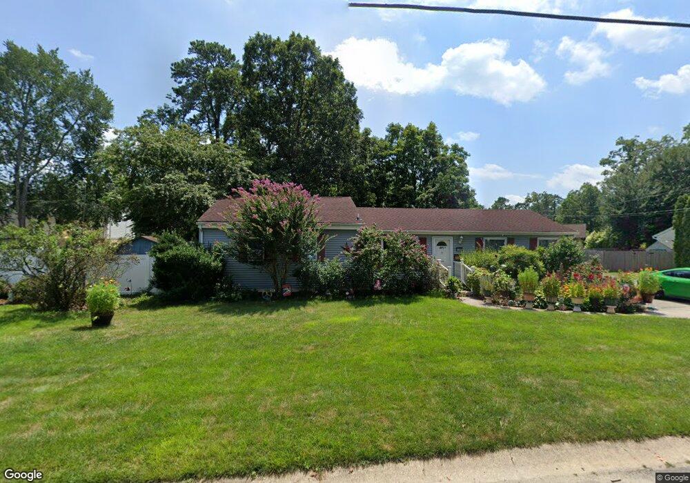
6340 Bensen Ave Mays Landing, NJ 08330
Estimated Value: $295,000 - $343,442
--
Bed
--
Bath
1,584
Sq Ft
$205/Sq Ft
Est. Value
About This Home
This home is located at 6340 Bensen Ave, Mays Landing, NJ 08330 and is currently estimated at $324,361, approximately $204 per square foot. 6340 Bensen Ave is a home located in Atlantic County with nearby schools including Joseph Shaner School, George L. Hess Educational Complex, and William Davies Middle School.
Ownership History
Date
Name
Owned For
Owner Type
Purchase Details
Closed on
Jun 18, 2001
Sold by
Hood David M and Hood Holly
Bought by
Grazias Racheal
Current Estimated Value
Purchase Details
Closed on
Mar 24, 1999
Sold by
Barnes Christopher J and Talley Ellen M
Bought by
Hood David M
Purchase Details
Closed on
Sep 16, 1994
Sold by
Palumbo Dominick
Bought by
Barnes Christopher and Talley Ellen
Home Financials for this Owner
Home Financials are based on the most recent Mortgage that was taken out on this home.
Original Mortgage
$98,000
Interest Rate
8.56%
Mortgage Type
FHA
Purchase Details
Closed on
Nov 25, 1992
Sold by
Carr Vincent P
Bought by
Palubo Dominick and Palubo Coleen
Create a Home Valuation Report for This Property
The Home Valuation Report is an in-depth analysis detailing your home's value as well as a comparison with similar homes in the area
Home Values in the Area
Average Home Value in this Area
Purchase History
| Date | Buyer | Sale Price | Title Company |
|---|---|---|---|
| Grazias Racheal | $123,900 | -- | |
| Hood David M | $102,000 | Fidelity National Title | |
| Barnes Christopher | $98,000 | -- | |
| Palubo Dominick | $105,000 | -- |
Source: Public Records
Mortgage History
| Date | Status | Borrower | Loan Amount |
|---|---|---|---|
| Previous Owner | Barnes Christopher | $98,000 |
Source: Public Records
Tax History Compared to Growth
Tax History
| Year | Tax Paid | Tax Assessment Tax Assessment Total Assessment is a certain percentage of the fair market value that is determined by local assessors to be the total taxable value of land and additions on the property. | Land | Improvement |
|---|---|---|---|---|
| 2025 | $4,759 | $146,000 | $39,800 | $106,200 |
| 2024 | $4,759 | $146,000 | $39,800 | $106,200 |
| 2023 | $4,460 | $146,000 | $39,800 | $106,200 |
| 2022 | $4,460 | $146,000 | $39,800 | $106,200 |
| 2021 | $4,450 | $146,000 | $39,800 | $106,200 |
| 2020 | $4,450 | $146,000 | $39,800 | $106,200 |
| 2019 | $4,461 | $146,000 | $39,800 | $106,200 |
| 2018 | $4,296 | $146,000 | $39,800 | $106,200 |
| 2017 | $4,225 | $146,000 | $39,800 | $106,200 |
| 2016 | $4,099 | $146,000 | $39,800 | $106,200 |
| 2015 | $3,952 | $146,000 | $39,800 | $106,200 |
| 2014 | $4,274 | $172,200 | $47,800 | $124,400 |
Source: Public Records
Map
Nearby Homes
- 37 Delancy Ct
- 150 Rainbow Dr
- 6314 Lance Ave
- 6310 Phillips Ave
- 0 Harding Hwy Unit NJAC2019438
- 0 Harding Hwy Unit 597638
- 6301 Knight Ave
- 6301 Roberts Ave
- 6206 Roberts Ave
- 6140 Robin Dr
- 16 Holly Ct
- 24 Holly Ct
- 13 Hickory Ln
- 14 Hickory Ln
- 10 Locust Ct
- 39 Dogwood Ln Unit OAKS OF WEYMOUTH
- 39 Dogwood Ln
- 5 Camac Ave
- 32 Hickory Ln Unit 215
- 1 Walnut Ct
- 6338 Bensen Ave
- 6346 Bensen Ave
- 6342 Bensen Ave
- 6344 Benson Ave
- 6344 Bensen Ave
- 6339 Harding Hwy
- 6341 Bensen Ave
- 6339 Bensen Ave
- 6343 Bensen Ave
- 6336 Bensen Ave
- 6350 Bensen Ave
- 6337 Harding Hwy
- 6348 Bensen Ave
- 6337 Bensen Ave
- 6345 Bensen Ave
- 6334 Bensen Ave
- 6354 Bensen Ave
- 6340 Beech Ln
- 6344 Beech Ln
- 6354 Bensen Ave