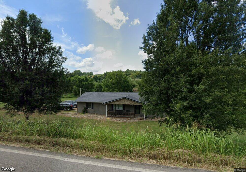
6344 State Route 775 Patriot, OH 45658
Estimated Value: $183,626 - $235,000
3
Beds
2
Baths
1,176
Sq Ft
$181/Sq Ft
Est. Value
About This Home
This home is located at 6344 State Route 775, Patriot, OH 45658 and is currently estimated at $212,875, approximately $181 per square foot. 6344 State Route 775 is a home located in Gallia County with nearby schools including Southwestern Elementary School and South Gallia Middle School.
Ownership History
Date
Name
Owned For
Owner Type
Purchase Details
Closed on
Sep 7, 2011
Sold by
Fannie Mae
Bought by
Rose Angela
Current Estimated Value
Purchase Details
Closed on
May 25, 2011
Sold by
Alderigi Georgio
Bought by
Federal National Mortgage Association
Purchase Details
Closed on
Aug 31, 2007
Sold by
Hunt Cindy L and Hunt Stephen
Bought by
Alderigi Georgio
Purchase Details
Closed on
Mar 1, 2000
Sold by
Hunt Cindy L
Bought by
Hunt Cindy L
Purchase Details
Closed on
Oct 22, 1996
Sold by
Martin Edward
Bought by
Hunt Cindy L
Create a Home Valuation Report for This Property
The Home Valuation Report is an in-depth analysis detailing your home's value as well as a comparison with similar homes in the area
Home Values in the Area
Average Home Value in this Area
Purchase History
| Date | Buyer | Sale Price | Title Company |
|---|---|---|---|
| Rose Angela | $81,900 | None Available | |
| Federal National Mortgage Association | $56,666 | None Available | |
| Alderigi Georgio | $134,000 | None Available | |
| Hunt Cindy L | -- | -- | |
| Hunt Cindy L | $51,700 | -- |
Source: Public Records
Tax History Compared to Growth
Tax History
| Year | Tax Paid | Tax Assessment Tax Assessment Total Assessment is a certain percentage of the fair market value that is determined by local assessors to be the total taxable value of land and additions on the property. | Land | Improvement |
|---|---|---|---|---|
| 2024 | $1,385 | $42,000 | $8,130 | $33,870 |
| 2023 | $1,498 | $42,000 | $8,130 | $33,870 |
| 2022 | $1,380 | $38,100 | $6,880 | $31,220 |
| 2021 | $1,376 | $38,100 | $6,880 | $31,220 |
| 2020 | $1,377 | $38,100 | $6,880 | $31,220 |
| 2019 | $1,255 | $34,940 | $6,250 | $28,690 |
| 2018 | $1,255 | $34,940 | $6,250 | $28,690 |
| 2017 | $1,271 | $34,940 | $6,250 | $28,690 |
| 2016 | $1,131 | $31,890 | $5,050 | $26,840 |
| 2015 | $1,131 | $31,890 | $5,050 | $26,840 |
| 2013 | $1,155 | $32,350 | $5,050 | $27,300 |
| 2012 | -- | $32,350 | $5,050 | $27,300 |
Source: Public Records
Map
Nearby Homes
- 5188 Ohio 775
- 1975 Boggs Rd
- 2988 Smokey Row Rd
- 742 Peters Cave Rd
- 0 Lincoln Pike
- 000 Lincoln Pike
- 2265 Patriot
- 1963 Patriot Rd
- 5188 State Route 775
- 0 Mudsoc Rd
- 10727 B Lincoln Pike
- 10727 B Lincoln Pike
- 0 Johnson Ridge Rd
- 11097 State Route 141
- 01234 Little Bullskin Rd
- 0 Little Bullskin Rd
- 0 Ohio 790
- Sr 141
- 1725 Hull Rd
- 1725 Hull Rd Unit (Tract 4 Woods Wayne