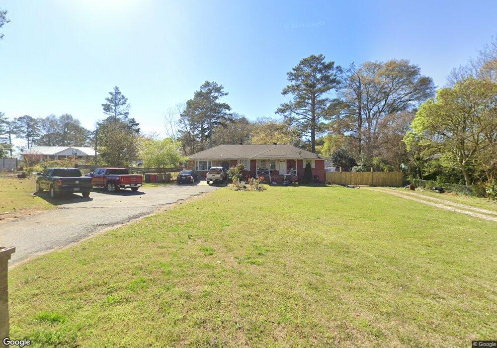
6345 Katie Ln Morrow, GA 30260
Estimated Value: $208,137 - $289,000
3
Beds
2
Baths
1,946
Sq Ft
$126/Sq Ft
Est. Value
About This Home
This home is located at 6345 Katie Ln, Morrow, GA 30260 and is currently estimated at $245,784, approximately $126 per square foot. 6345 Katie Ln is a home located in Clayton County with nearby schools including William M. Mcgarrah Elementary School, Rex Mill Middle School, and Mount Zion High School.
Ownership History
Date
Name
Owned For
Owner Type
Purchase Details
Closed on
Oct 6, 2006
Sold by
Keaton H J and Keaton Iris J
Bought by
Ambris-Cruz Valente
Current Estimated Value
Home Financials for this Owner
Home Financials are based on the most recent Mortgage that was taken out on this home.
Original Mortgage
$142,300
Outstanding Balance
$93,824
Interest Rate
8.75%
Mortgage Type
New Conventional
Estimated Equity
$151,960
Create a Home Valuation Report for This Property
The Home Valuation Report is an in-depth analysis detailing your home's value as well as a comparison with similar homes in the area
Home Values in the Area
Average Home Value in this Area
Purchase History
| Date | Buyer | Sale Price | Title Company |
|---|---|---|---|
| Ambris-Cruz Valente | $149,900 | -- |
Source: Public Records
Mortgage History
| Date | Status | Borrower | Loan Amount |
|---|---|---|---|
| Open | Ambris-Cruz Valente | $142,300 |
Source: Public Records
Tax History
| Year | Tax Paid | Tax Assessment Tax Assessment Total Assessment is a certain percentage of the fair market value that is determined by local assessors to be the total taxable value of land and additions on the property. | Land | Improvement |
|---|---|---|---|---|
| 2025 | $2,583 | $66,360 | $10,280 | $56,080 |
| 2024 | $2,630 | $66,360 | $10,280 | $56,080 |
| 2023 | $2,250 | $62,320 | $10,280 | $52,040 |
| 2022 | $2,098 | $52,400 | $10,280 | $42,120 |
| 2021 | $1,544 | $38,040 | $10,280 | $27,760 |
| 2020 | $1,343 | $32,545 | $10,338 | $22,207 |
| 2019 | $1,212 | $28,844 | $10,338 | $18,506 |
| 2018 | $1,183 | $28,118 | $10,338 | $17,780 |
| 2017 | $1,068 | $25,236 | $10,338 | $14,898 |
| 2016 | $1,142 | $27,049 | $10,338 | $16,711 |
| 2015 | $1,135 | $0 | $0 | $0 |
| 2014 | $1,138 | $27,563 | $10,338 | $17,225 |
Source: Public Records
Map
Nearby Homes
- 6366 Warbler Ct
- 6342 Warbler Ct
- 6354 Warbler Ct
- 6350 Warbler Ct
- 6362 Warbler Ct
- 6389 Warbler Ct
- 6387 Warbler Ct
- 6375 Warbler Ct
- 6354 Towhee Way
- 6348 Towhee Way
- 6371 Towhee Way
- 6343 Towhee Way
- 6357 Towhee Way
- 6266 Culver Dr
- 6355 Towhee Way
- 6359 Towhee Way
- 6486 Aquila Dr
- 6493 Menlo Way Unit 3
- 6485 Bobolink Ct
- 6397 E Meyer Dr
- 6349 Katie Ln
- 2863 Lake Harbin Rd
- 2877 Lake Harbin Rd
- 2847 Lake Harbin Rd
- 6348 Katie Ln
- 6353 Katie Ln
- 6359 Katie Ln
- 6374 Priscilla Ct
- 2891 Lake Harbin Rd
- 6386 Priscilla Ct
- 6362 Katie Ln
- 2835 Lake Harbin Rd
- 6379 Katie Ln
- 6389 Katie Ln
- 2901 Lake Harbin Rd
- 6396 Priscilla Ct
- 6403 Katie Ln
- 6453 Katie Ln
- 2842 Lake Harbin Rd
- 2911 Lake Harbin Rd
Your Personal Tour Guide
Ask me questions while you tour the home.