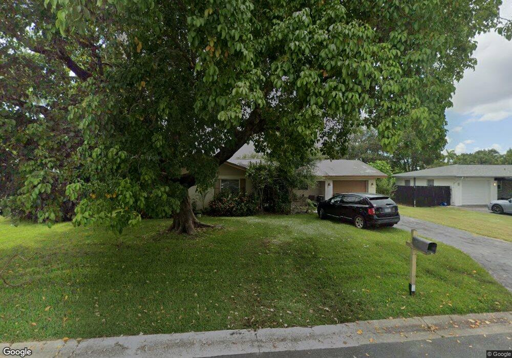
6346 Saint Andrews Cir S Fort Myers, FL 33919
Whiskey Creek NeighborhoodEstimated Value: $286,711 - $323,000
3
Beds
2
Baths
1,174
Sq Ft
$258/Sq Ft
Est. Value
About This Home
This home is located at 6346 Saint Andrews Cir S, Fort Myers, FL 33919 and is currently estimated at $303,178, approximately $258 per square foot. 6346 Saint Andrews Cir S is a home located in Lee County with nearby schools including Orangewood Elementary School, Allen Park Elementary School, and Edison Park Creative & Expressive Arts School.
Ownership History
Date
Name
Owned For
Owner Type
Purchase Details
Closed on
Dec 24, 2012
Sold by
Bank America Na
Bought by
Foxhound Way Llc
Current Estimated Value
Purchase Details
Closed on
May 9, 2011
Sold by
Schoeberle Beverly
Bought by
Bac Home Loan Servicing Lp and Countrywide Home Loans Servicing Lp
Purchase Details
Closed on
Oct 24, 2003
Sold by
Morgan Dennis E and Morgan Carol
Bought by
Schoeberle Paul and Schoeberle Beverly
Home Financials for this Owner
Home Financials are based on the most recent Mortgage that was taken out on this home.
Original Mortgage
$112,000
Interest Rate
6.04%
Create a Home Valuation Report for This Property
The Home Valuation Report is an in-depth analysis detailing your home's value as well as a comparison with similar homes in the area
Home Values in the Area
Average Home Value in this Area
Purchase History
| Date | Buyer | Sale Price | Title Company |
|---|---|---|---|
| Foxhound Way Llc | $60,767 | First American Title Ins Co | |
| Bac Home Loan Servicing Lp | -- | None Available | |
| Schoeberle Paul | $140,000 | -- |
Source: Public Records
Mortgage History
| Date | Status | Borrower | Loan Amount |
|---|---|---|---|
| Previous Owner | Schoeberle Paul | $112,000 |
Source: Public Records
Tax History Compared to Growth
Tax History
| Year | Tax Paid | Tax Assessment Tax Assessment Total Assessment is a certain percentage of the fair market value that is determined by local assessors to be the total taxable value of land and additions on the property. | Land | Improvement |
|---|---|---|---|---|
| 2025 | $3,357 | $124,111 | $108,528 | $14,589 |
| 2024 | $3,063 | $218,724 | -- | -- |
| 2023 | $3,063 | $198,840 | $0 | $0 |
| 2022 | $2,955 | $180,764 | $0 | $0 |
| 2021 | $2,568 | $166,616 | $53,095 | $113,521 |
| 2020 | $2,375 | $149,392 | $50,000 | $99,392 |
| 2019 | $2,278 | $145,344 | $50,000 | $95,344 |
| 2018 | $2,219 | $145,351 | $50,000 | $95,351 |
| 2017 | $2,178 | $147,774 | $34,500 | $113,274 |
| 2016 | $2,032 | $134,345 | $37,158 | $97,187 |
| 2015 | $1,786 | $105,898 | $33,979 | $71,919 |
| 2014 | $1,565 | $86,600 | $18,850 | $67,750 |
| 2013 | -- | $78,591 | $13,851 | $64,740 |
Source: Public Records
Map
Nearby Homes
- 5034 Westminster Dr
- 19 Winewood Ct
- 1515 Manchester Blvd
- 1348 Woodmere Ln
- 1250 Kasamada Dr
- 1423 Charles Rd
- 1421 Loma Linda Dr
- 1420 Mandel Rd
- 6011 Fountain Way
- 1563 Covington Cir E
- 1358 Hopedale Dr
- 5251 Westminster Dr
- 1221 La Faunce Way
- 8531 Yorkshire Ln
- 1557 Woodwind Ct
- 5216 Cedarbend Dr Unit 3
- 5224 Cedarbend Dr Unit 4
- 8327 Riviera Ave
- 1334 Longwood Dr
- 6005 W Riverside Dr
- 6344 Saint Andrews Cir S
- 6348 Saint Andrews Cir S
- 6316 Saint Andrews Cir S
- 6342 Saint Andrews Cir S
- 6314 Saint Andrews Cir S
- 6318 Saint Andrews Cir S
- 6350 Saint Andrews Cir S
- 6345 Saint Andrews Cir S
- 6347 Saint Andrews Cir S
- 6343 Saint Andrews Cir S
- 6349 Saint Andrews Cir S
- 6334 Saint Andrews Cir S
- 6352 Saint Andrews Cir S
- 6341 Saint Andrews Cir S
- 6351 Saint Andrews Cir S
- 6310 Saint Andrews Cir S
- 6322 Saint Andrews Cir S
- 29 Falconwood Ct
- 6339 Saint Andrews Cir S
- 6317 Saint Andrews Cir S