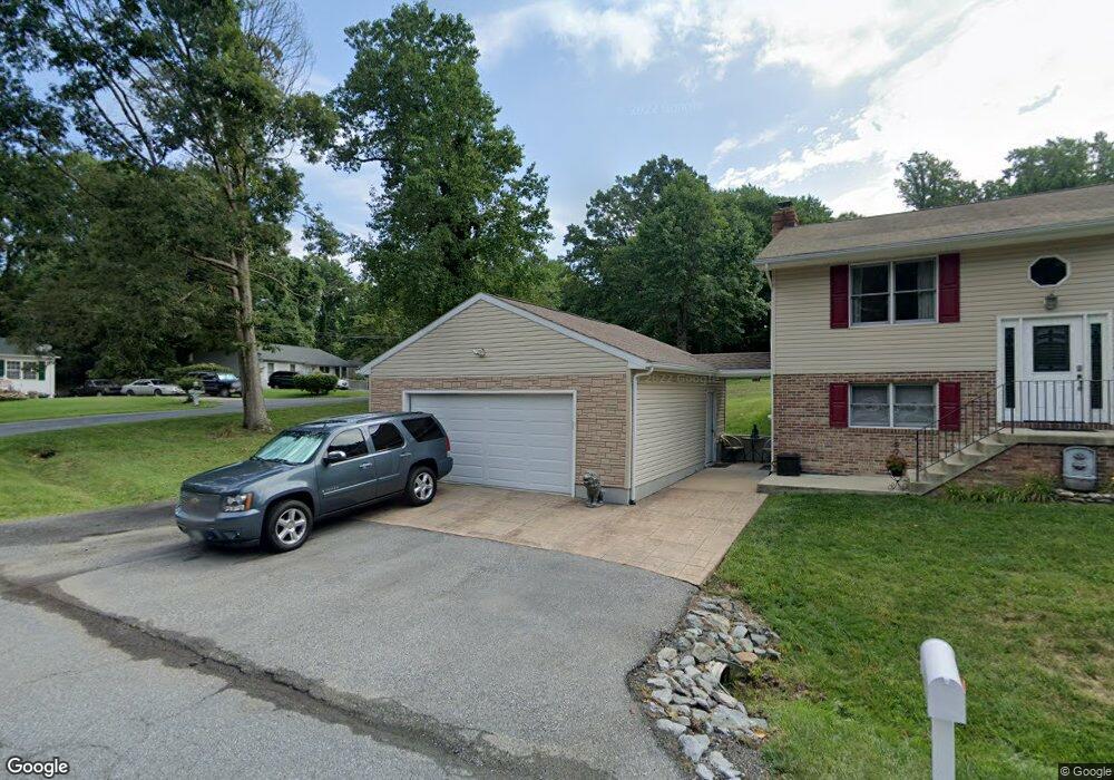
6347 Dory Ct Chesapeake Beach, MD 20732
Estimated Value: $435,535 - $532,000
Studio
2
Baths
1,936
Sq Ft
$253/Sq Ft
Est. Value
About This Home
This home is located at 6347 Dory Ct, Chesapeake Beach, MD 20732 and is currently estimated at $490,634, approximately $253 per square foot. 6347 Dory Ct is a home located in Calvert County with nearby schools including Plum Point Elementary School, Windy Hill Middle School, and Huntingtown High School.
Ownership History
Date
Name
Owned For
Owner Type
Purchase Details
Closed on
Mar 7, 2007
Sold by
Scott Leslie R
Bought by
Brooks Leslie R and Brooks Joseph
Current Estimated Value
Purchase Details
Closed on
Sep 19, 2006
Sold by
Scott Leslie R
Bought by
Brooks Leslie R and Brooks Joseph
Purchase Details
Closed on
Mar 11, 1999
Sold by
Brown Ruffer
Bought by
Scott Leslie R
Purchase Details
Closed on
Dec 27, 1997
Sold by
Bryant Wm D and Bryant Elsie J
Bought by
Brown Ruffer
Purchase Details
Closed on
May 6, 1997
Sold by
Gray C Vernon
Bought by
Bryant Wm D and Bryant Elsie J
Create a Home Valuation Report for This Property
The Home Valuation Report is an in-depth analysis detailing your home's value as well as a comparison with similar homes in the area
Home Values in the Area
Average Home Value in this Area
Purchase History
| Date | Buyer | Sale Price | Title Company |
|---|---|---|---|
| Brooks Leslie R | -- | -- | |
| Brooks Leslie R | -- | -- | |
| Scott Leslie R | $135,000 | -- | |
| Brown Ruffer | $223 | -- | |
| Bryant Wm D | $14,000 | -- |
Source: Public Records
Mortgage History
| Date | Status | Borrower | Loan Amount |
|---|---|---|---|
| Closed | Scott Leslie R | -- |
Source: Public Records
Tax History
| Year | Tax Paid | Tax Assessment Tax Assessment Total Assessment is a certain percentage of the fair market value that is determined by local assessors to be the total taxable value of land and additions on the property. | Land | Improvement |
|---|---|---|---|---|
| 2025 | $4,792 | $423,500 | $77,400 | $346,100 |
| 2024 | $4,515 | $398,333 | $0 | $0 |
| 2023 | $4,091 | $373,167 | $0 | $0 |
| 2022 | $3,827 | $348,000 | $77,400 | $270,600 |
| 2021 | $3,708 | $341,767 | $0 | $0 |
| 2020 | $3,708 | $335,533 | $0 | $0 |
| 2019 | $3,656 | $329,300 | $77,400 | $251,900 |
| 2018 | $3,550 | $320,400 | $0 | $0 |
| 2017 | $3,500 | $311,500 | $0 | $0 |
| 2016 | -- | $302,600 | $0 | $0 |
| 2015 | $2,808 | $302,600 | $0 | $0 |
| 2014 | $2,808 | $302,600 | $0 | $0 |
Source: Public Records
Map
Nearby Homes
- 3609 Dory Brooks Rd
- 6337 Dory Ct
- 6309 Brookeview Ct
- 3632 Brookeside Dr
- 6212 8th St
- 6231 8th St
- 6520 18th St
- 6119 6th St
- 6572 12th St
- 6510 18th St
- 4010 Dalrymple Rd
- 6315 5th St
- 6852 Old Bayside Rd
- 4200 Chesapeake Ave
- 7110 Chesapeake Village Blvd
- 3164 Dalrymple Rd
- 7410 Dakota Ave
- 0 10th St
- 4115 Calvert Dr
- 7694 Old Bayside Rd
- 6343 Dory Ct
- 3604 Dory Brooks Rd
- 6348 Dory Ct
- 6341 Dory Ct
- 3539 Dory Ct
- 3600 Dory Brooks Rd
- 3610 Dory Brooks Rd
- 3605 Dory Brooks Rd
- 3612 Dory Brooks Rd
- 6340 Dory Ct
- 3580 Dory Brooks Rd
- 6337 Dory Ct Unit A
- 6337 Dory Ct Unit B
- 6337 Dory Ct Unit UPPER
- 3517 Dory Brooks Rd
- 3510 Dory Brooks Rd
- 3659 Dory Brooks Rd
- 3529 Dory Brooks Rd
- 3665 Dory Brooks Rd
- 3620 Dory Brooks Rd
Your Personal Tour Guide
Ask me questions while you tour the home.