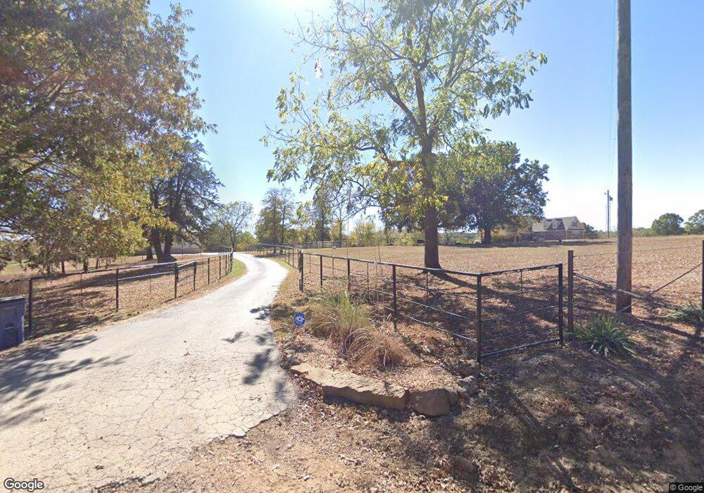
6349 Denning Rd Harrison, AR 72601
Estimated Value: $376,000 - $633,389
Studio
--
Bath
2,565
Sq Ft
$202/Sq Ft
Est. Value
About This Home
This home is located at 6349 Denning Rd, Harrison, AR 72601 and is currently estimated at $519,130, approximately $202 per square foot. 6349 Denning Rd is a home located in Boone County with nearby schools including Skyline Heights Elementary School and Harrison Jr. High School.
Ownership History
Date
Name
Owned For
Owner Type
Purchase Details
Closed on
Jun 29, 2021
Sold by
Simon Rebecca Lynn and Simon Nicholas Conrad
Bought by
Simon Nicholas Conrad and Simon Rebecca Lynn
Current Estimated Value
Home Financials for this Owner
Home Financials are based on the most recent Mortgage that was taken out on this home.
Original Mortgage
$367,000
Outstanding Balance
$332,273
Interest Rate
2.9%
Mortgage Type
New Conventional
Estimated Equity
$186,857
Purchase Details
Closed on
May 11, 2018
Sold by
Rns Llc
Bought by
Simon Rebecca L and Simon Nicholas C
Home Financials for this Owner
Home Financials are based on the most recent Mortgage that was taken out on this home.
Original Mortgage
$420,000
Interest Rate
4.44%
Mortgage Type
New Conventional
Purchase Details
Closed on
Jun 1, 1995
Bought by
Trust Deed
Create a Home Valuation Report for This Property
The Home Valuation Report is an in-depth analysis detailing your home's value as well as a comparison with similar homes in the area
Purchase History
| Date | Buyer | Sale Price | Title Company |
|---|---|---|---|
| Simon Nicholas Conrad | -- | First National Title Company | |
| Simon Rebecca L | -- | First National Title Company | |
| Trust Deed | -- | -- |
Source: Public Records
Mortgage History
| Date | Status | Borrower | Loan Amount |
|---|---|---|---|
| Open | Simon Nicholas Conrad | $367,000 | |
| Closed | Simon Rebecca L | $420,000 |
Source: Public Records
Tax History
| Year | Tax Paid | Tax Assessment Tax Assessment Total Assessment is a certain percentage of the fair market value that is determined by local assessors to be the total taxable value of land and additions on the property. | Land | Improvement |
|---|---|---|---|---|
| 2025 | $4,068 | $90,800 | $2,210 | $88,590 |
| 2024 | $4,042 | $90,800 | $2,210 | $88,590 |
| 2023 | $3,874 | $90,800 | $2,210 | $88,590 |
| 2022 | $3,376 | $90,800 | $2,210 | $88,590 |
| 2021 | $3,208 | $90,800 | $2,210 | $88,590 |
| 2020 | $3,030 | $75,220 | $1,810 | $73,410 |
| 2019 | $3,350 | $81,900 | $2,940 | $78,960 |
| 2018 | $3,725 | $81,900 | $2,940 | $78,960 |
| 2017 | $469 | $10,040 | $4,690 | $5,350 |
| 2016 | $469 | $10,040 | $4,690 | $5,350 |
| 2015 | $212 | $4,740 | $4,740 | $0 |
| 2014 | -- | $4,740 | $4,740 | $0 |
Source: Public Records
Map
Nearby Homes
- 1567 Goff (Lot 28) Rd
- 0 Old Capps Rd
- 1669 Goff (Lot 27) Rd
- 1739 Goff (Lot 26) Rd
- 1959 Henley (Lot 3) Dr
- 350 Devitos Loop
- Lot 1 Rains Rd S
- Lot 2 Rains Rd S
- 8764 U S 62
- Lot 3 Hawkins Rd
- Lot 4 Hawkins Rd
- Lot 5 Hawkins Rd
- 9513 U S 62
- 7226 Estes Rd
- 0 Hwy 392 Unit 1313787
- 5745 Estes Rd
- 172 Stella Ct
- 160 Stella Ct
- 0000 Hwy 392
- 0 Corner of Airport Rd & Hwy 65n Unit 146774
- 6349 Denning Rd
- 6099 Denning Rd W
- 6099 Denning Rd
- 1632 Old Capps Rd
- 0 Buck Ln W
- 0 Denning Rd W
- 6786 Denning Rd
- 6347 Buck Ln
- 6347 Buck Ln W
- 5931 Buck Ln
- 5929 Buck Ln
- 6474 Buck Ln
- 6951 Denning Rd
- 1800 Old Capps Rd
- 6544 Buck Ln
- 6910 Denning Rd
- 1895 Old Capps Rd
- 0 Capps Rd & Goblin Dr
- 6620 Buck Ln
- 6619 Buck Ln
Your Personal Tour Guide
Ask me questions while you tour the home.
