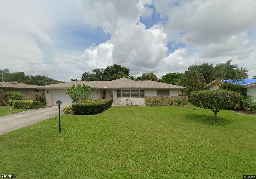
6349 Saint Andrews Cir S Fort Myers, FL 33919
Whiskey Creek NeighborhoodEstimated Value: $374,000 - $435,000
3
Beds
2
Baths
2,145
Sq Ft
$191/Sq Ft
Est. Value
About This Home
This home is located at 6349 Saint Andrews Cir S, Fort Myers, FL 33919 and is currently estimated at $409,363, approximately $190 per square foot. 6349 Saint Andrews Cir S is a home located in Lee County with nearby schools including Orangewood Elementary School, Allen Park Elementary School, and Edison Park Creative & Expressive Arts School.
Ownership History
Date
Name
Owned For
Owner Type
Purchase Details
Closed on
Jan 31, 2024
Sold by
White Maida
Bought by
White Maida
Current Estimated Value
Purchase Details
Closed on
Nov 23, 1999
Sold by
Abetz William F and Abetz Jennifer R
Bought by
White Glenn and White Maida
Purchase Details
Closed on
Jul 25, 1997
Sold by
Garner Danny E and Garner Dorothy Susan
Bought by
Abetz William F
Home Financials for this Owner
Home Financials are based on the most recent Mortgage that was taken out on this home.
Original Mortgage
$88,350
Interest Rate
7.61%
Purchase Details
Closed on
May 27, 1994
Sold by
Shirley James B and Shirley Angela R
Bought by
Garner Danny E
Home Financials for this Owner
Home Financials are based on the most recent Mortgage that was taken out on this home.
Original Mortgage
$85,600
Interest Rate
8.46%
Purchase Details
Closed on
Oct 15, 1993
Sold by
Shirley James B and Shirley Angela R
Bought by
Shirley James B and Shirley Angela R
Create a Home Valuation Report for This Property
The Home Valuation Report is an in-depth analysis detailing your home's value as well as a comparison with similar homes in the area
Home Values in the Area
Average Home Value in this Area
Purchase History
| Date | Buyer | Sale Price | Title Company |
|---|---|---|---|
| White Maida | $100 | None Listed On Document | |
| White Glenn | $104,800 | -- | |
| Abetz William F | $93,000 | -- | |
| Garner Danny E | $88,300 | -- | |
| Shirley James B | -- | -- |
Source: Public Records
Mortgage History
| Date | Status | Borrower | Loan Amount |
|---|---|---|---|
| Previous Owner | Abetz William F | $88,350 | |
| Previous Owner | Garner Danny E | $85,600 |
Source: Public Records
Tax History Compared to Growth
Tax History
| Year | Tax Paid | Tax Assessment Tax Assessment Total Assessment is a certain percentage of the fair market value that is determined by local assessors to be the total taxable value of land and additions on the property. | Land | Improvement |
|---|---|---|---|---|
| 2025 | $1,347 | $125,944 | -- | -- |
| 2024 | $1,347 | $122,395 | -- | -- |
| 2023 | $1,298 | $113,830 | $0 | $0 |
| 2022 | $1,442 | $114,869 | $0 | $0 |
| 2021 | $1,380 | $230,693 | $50,000 | $180,693 |
| 2020 | $1,365 | $110,463 | $0 | $0 |
| 2019 | $1,333 | $107,979 | $0 | $0 |
| 2018 | $1,333 | $105,966 | $0 | $0 |
| 2017 | $1,317 | $103,786 | $0 | $0 |
| 2016 | $1,299 | $192,905 | $34,500 | $158,405 |
| 2015 | $1,309 | $151,105 | $32,000 | $119,105 |
| 2014 | -- | $132,497 | $17,000 | $115,497 |
| 2013 | -- | $119,907 | $12,000 | $107,907 |
Source: Public Records
Map
Nearby Homes
- 19 Winewood Ct
- 5034 Westminster Dr
- 1515 Manchester Blvd
- 1423 Charles Rd
- 1563 Covington Cir E
- 1420 Mandel Rd
- 1348 Woodmere Ln
- 5216 Cedarbend Dr Unit 3
- 1557 Woodwind Ct
- 6011 Fountain Way
- 5224 Cedarbend Dr Unit 4
- 1358 Hopedale Dr
- 1250 Kasamada Dr
- 5251 Westminster Dr
- 5210 Cedarbend Dr Unit 4
- 1221 La Faunce Way
- 5248 Cedarbend Dr Unit 2
- 8327 Riviera Ave
- 8531 Yorkshire Ln
- 1427 Davis Dr
- 6351 Saint Andrews Cir S
- 6347 Saint Andrews Cir S
- 31 Falconwood Ct
- 6353 Saint Andrews Cir S
- 6345 Saint Andrews Cir S
- 29 Falconwood Ct
- 6350 Saint Andrews Cir S
- 6348 Saint Andrews Cir S
- 6352 Saint Andrews Cir S
- 6346 Saint Andrews Cir S
- 6355 Saint Andrews Cir S
- 6343 Saint Andrews Cir S
- 27 Falconwood Ct
- 6344 Saint Andrews Cir S
- 6354 Saint Andrews Cir S
- 34 Falconwood Ct
- 30 Falconwood Ct
- 6357 Saint Andrews Cir S
- 6341 Saint Andrews Cir S
- 1524 Argyle Dr