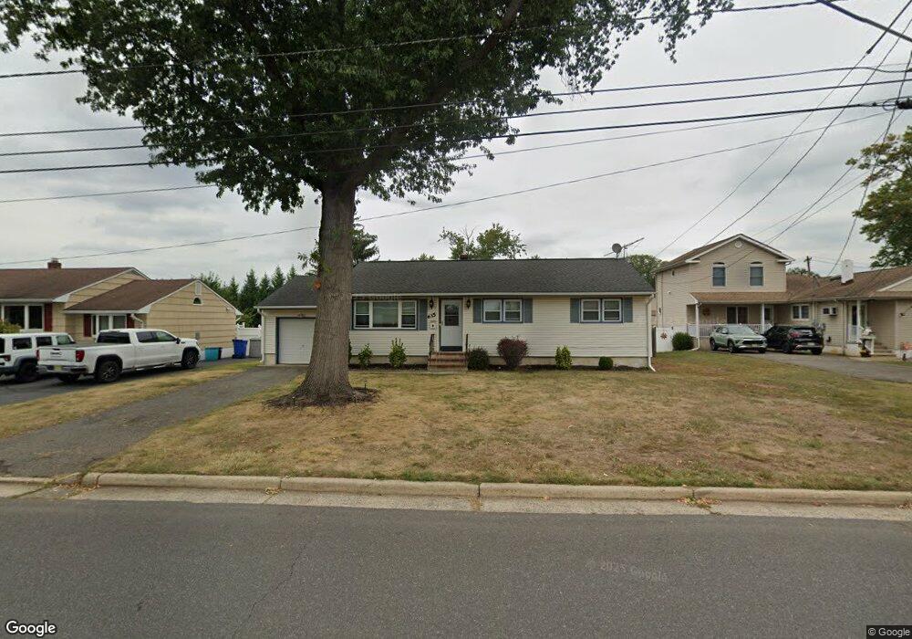
635 Ashland Rd Middlesex, NJ 08846
Estimated Value: $443,108 - $568,000
Studio
--
Bath
--
Sq Ft
0.26
Acres
About This Home
This home is located at 635 Ashland Rd, Middlesex, NJ 08846 and is currently estimated at $483,777. 635 Ashland Rd is a home located in Middlesex County with nearby schools including Middlesex High School, Thomas Edison EnergySmart Charter School, and St. Frances Cabrini School.
Ownership History
Date
Name
Owned For
Owner Type
Purchase Details
Closed on
Jan 21, 2003
Current Estimated Value
Purchase Details
Closed on
Feb 24, 1994
Sold by
Citicorp Mortgage Inc
Bought by
Mcclish Darryl
Home Financials for this Owner
Home Financials are based on the most recent Mortgage that was taken out on this home.
Original Mortgage
$134,000
Interest Rate
6.93%
Create a Home Valuation Report for This Property
The Home Valuation Report is an in-depth analysis detailing your home's value as well as a comparison with similar homes in the area
Home Values in the Area
Average Home Value in this Area
Purchase History
| Date | Buyer | Sale Price | Title Company |
|---|---|---|---|
| -- | -- | -- | |
| Mcclish Darryl | $135,000 | -- |
Source: Public Records
Mortgage History
| Date | Status | Borrower | Loan Amount |
|---|---|---|---|
| Previous Owner | Mcclish Darryl | $134,000 |
Source: Public Records
Tax History
| Year | Tax Paid | Tax Assessment Tax Assessment Total Assessment is a certain percentage of the fair market value that is determined by local assessors to be the total taxable value of land and additions on the property. | Land | Improvement |
|---|---|---|---|---|
| 2025 | $8,432 | $434,200 | $150,700 | $283,500 |
| 2024 | $8,028 | $364,400 | $150,700 | $213,700 |
Source: Public Records
Map
Nearby Homes
- 506 Melrose Ave
- 408 Fairview Ave
- 407 Clinton Ave
- 116 Greene Ave
- 303 Ashland Rd
- 238 Luca Dr
- 238 Luca Dr Unit 8
- 241 Cook Ave
- 310 Howard Ave
- 101 Lorraine Ave
- 168 Forest Dr
- 129 Forest Dr
- 531 Harris Ave
- 100 Forest Dr
- 107 Forest Dr
- 9 Swing Bridge Ln Unit 118
- 230 Vasser Dr
- 54 Forest Dr
- 112 East St
- 315 East St
- 631 Ashland Rd
- 639 Ashland Rd
- 89 George Ave
- 85 George Ave
- 120 Greenlawn Ave
- 627 Ashland Rd
- 81 George Ave
- 77 George Ave
- 623 Ashland Rd
- 80 George Ave
- 125 Greenlawn Ave
- 73 George Ave
- 76 George Ave
- 121 Greenlawn Ave
- 624 Ashland Rd
- 283 Lincoln Blvd
- 285 Lincoln Blvd
- 69 George Ave
- 619 Ashland Rd
- 108 Greenlawn Ave