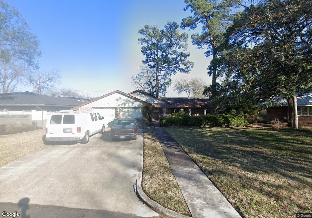
635 Azaleadell Dr Houston, TX 77018
Oak Forest-Garden Oaks NeighborhoodEstimated Value: $586,000 - $749,000
2
Beds
2
Baths
2,385
Sq Ft
$282/Sq Ft
Est. Value
About This Home
This home is located at 635 Azaleadell Dr, Houston, TX 77018 and is currently estimated at $672,467, approximately $281 per square foot. 635 Azaleadell Dr is a home located in Harris County with nearby schools including Garden Oaks Montessori, Frank Black Middle School, and Waltrip High School.
Ownership History
Date
Name
Owned For
Owner Type
Purchase Details
Closed on
Oct 4, 2015
Sold by
Johnson Bruce
Bought by
Johnson Bruce
Current Estimated Value
Purchase Details
Closed on
Nov 10, 2004
Sold by
Pate Ressie
Bought by
Johnson Bruce T and Johnson Cheryl C
Home Financials for this Owner
Home Financials are based on the most recent Mortgage that was taken out on this home.
Original Mortgage
$85,000
Outstanding Balance
$42,672
Interest Rate
5.87%
Mortgage Type
Purchase Money Mortgage
Estimated Equity
$629,795
Purchase Details
Closed on
Dec 19, 2002
Sold by
Garden Oaks Baptist Church and Geiger Riselea M
Bought by
Pate Ressie
Home Financials for this Owner
Home Financials are based on the most recent Mortgage that was taken out on this home.
Original Mortgage
$132,000
Interest Rate
6.05%
Purchase Details
Closed on
Apr 8, 1999
Sold by
Forston Thelma C
Bought by
The Thelma C Forston Revocable Living Tr
Create a Home Valuation Report for This Property
The Home Valuation Report is an in-depth analysis detailing your home's value as well as a comparison with similar homes in the area
Home Values in the Area
Average Home Value in this Area
Purchase History
| Date | Buyer | Sale Price | Title Company |
|---|---|---|---|
| Johnson Bruce | -- | None Available | |
| Johnson Bruce T | -- | North American Title Co | |
| Pate Ressie | -- | North American Title Co | |
| The Thelma C Forston Revocable Living Tr | -- | -- |
Source: Public Records
Mortgage History
| Date | Status | Borrower | Loan Amount |
|---|---|---|---|
| Open | Johnson Bruce T | $85,000 | |
| Previous Owner | Pate Ressie | $132,000 | |
| Closed | Pate Ressie | $16,500 |
Source: Public Records
Tax History Compared to Growth
Tax History
| Year | Tax Paid | Tax Assessment Tax Assessment Total Assessment is a certain percentage of the fair market value that is determined by local assessors to be the total taxable value of land and additions on the property. | Land | Improvement |
|---|---|---|---|---|
| 2025 | $8,117 | $601,105 | $469,402 | $131,703 |
| 2024 | $8,117 | $541,807 | $355,837 | $185,970 |
| 2023 | $8,117 | $487,176 | $302,840 | $184,336 |
| 2022 | $10,123 | $459,722 | $302,840 | $156,882 |
| 2021 | $9,773 | $453,833 | $302,840 | $150,993 |
| 2020 | $9,231 | $451,758 | $302,840 | $148,918 |
| 2019 | $8,770 | $346,560 | $189,275 | $157,285 |
| 2018 | $6,611 | $339,795 | $189,275 | $150,520 |
| 2017 | $8,592 | $339,795 | $189,275 | $150,520 |
| 2016 | $8,592 | $339,795 | $189,275 | $150,520 |
| 2015 | $5,809 | $336,127 | $189,275 | $146,852 |
| 2014 | $5,809 | $315,808 | $189,275 | $126,533 |
Source: Public Records
Map
Nearby Homes
- 702 Azaleadell Dr
- 535 Azaleadell Dr
- 739 Azaleadell Dr
- 752 Curtin St
- 750 Curtin St
- 748 Curtin St
- 744 Curtin St
- 742 Curtin St
- 4510 Curtin Park Ct
- 719 Thornton Rd Unit B
- 719 Thornton Rd Unit E
- 719 Thornton Rd Unit A
- 719 Thornton Rd Unit F
- 9388 Plan at Thornton Oaks
- 9384 Plan at Thornton Oaks
- 811 Thornton Rd Unit B
- 817 Thornton Rd Unit G
- 814 Azalea St
- 812 Thornton Rd Unit B
- 543 Heidrich St
- 639 Azaleadell Dr
- 627 Azaleadell Dr
- 703 Azaleadell Dr
- 623 Azaleadell Dr
- 707 Azaleadell Dr
- 703 Sleepyvale Ln
- 706 Azaleadell Dr
- 711 Azaleadell Dr
- 707 Sleepyvale Ln
- 714 W 43rd St
- 615 Azaleadell Dr
- 4411 N Shepherd Dr Unit 46A
- 4411 N Shepherd Dr Unit 48A
- 4411 N Shepherd Dr Unit 15B
- 4411 N Shepherd Dr Unit 34B
- 4411 N Shepherd Dr Unit 20A
- 4411 N Shepherd Dr Unit 12B
- 4411 N Shepherd Dr Unit 22A
- 4411 N Shepherd Dr Unit 6B
- 710 Azaleadell Dr