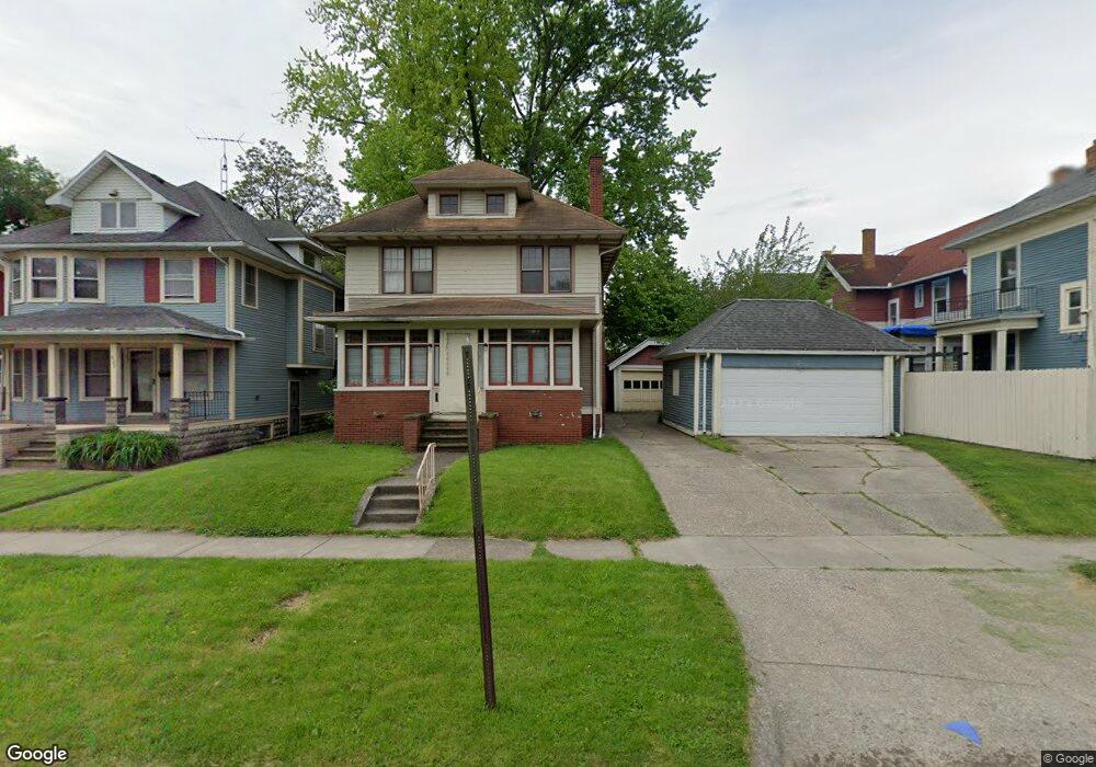
635 Collins St Toledo, OH 43610
Downtown Toledo NeighborhoodEstimated Value: $69,000 - $77,000
3
Beds
1
Bath
1,415
Sq Ft
$52/Sq Ft
Est. Value
About This Home
This home is located at 635 Collins St, Toledo, OH 43610 and is currently estimated at $72,963, approximately $51 per square foot. 635 Collins St is a home located in Lucas County with nearby schools including Glenwood Elementary School, Jesup W. Scott High School, and Rosary Cathedral School.
Ownership History
Date
Name
Owned For
Owner Type
Purchase Details
Closed on
May 15, 2001
Sold by
U S Bank National Assn
Bought by
Kemner Paul and Zdila Peggy
Current Estimated Value
Purchase Details
Closed on
Dec 13, 2000
Sold by
Ann Harris and Ann R
Bought by
U S Bank National Assn and Eqcc Home Equity Loan Trust 1999-2
Purchase Details
Closed on
Jan 29, 1999
Sold by
Harris A
Bought by
Harris Ann R
Purchase Details
Closed on
Jan 26, 1999
Sold by
Harris Tracy and Harris Tammy
Bought by
Harris Ann R
Create a Home Valuation Report for This Property
The Home Valuation Report is an in-depth analysis detailing your home's value as well as a comparison with similar homes in the area
Home Values in the Area
Average Home Value in this Area
Purchase History
| Date | Buyer | Sale Price | Title Company |
|---|---|---|---|
| Kemner Paul | $21,500 | Louisville Title Agency For | |
| U S Bank National Assn | $30,000 | -- | |
| Harris Ann R | -- | -- | |
| Harris Ann R | -- | -- | |
| Harris Ann R | -- | -- |
Source: Public Records
Tax History Compared to Growth
Tax History
| Year | Tax Paid | Tax Assessment Tax Assessment Total Assessment is a certain percentage of the fair market value that is determined by local assessors to be the total taxable value of land and additions on the property. | Land | Improvement |
|---|---|---|---|---|
| 2024 | $452 | $13,370 | $2,065 | $11,305 |
| 2023 | $578 | $7,560 | $4,095 | $3,465 |
| 2022 | $577 | $7,560 | $4,095 | $3,465 |
| 2021 | $585 | $7,560 | $4,095 | $3,465 |
| 2020 | $563 | $6,230 | $3,360 | $2,870 |
| 2019 | $548 | $6,230 | $3,360 | $2,870 |
| 2018 | $558 | $6,230 | $3,360 | $2,870 |
| 2017 | $556 | $6,090 | $2,835 | $3,255 |
| 2016 | $848 | $17,400 | $8,100 | $9,300 |
| 2015 | $564 | $17,400 | $8,100 | $9,300 |
| 2014 | $394 | $6,100 | $2,840 | $3,260 |
| 2013 | $394 | $6,100 | $2,840 | $3,260 |
Source: Public Records
Map
Nearby Homes
- 2840 Scottwood Ave
- 2631 Parkwood Ave
- 2740 Robinwood Ave
- 519 Nottingham Terrace
- 2535 Parkwood Ave
- 811 Collins St
- 2618 Collingwood Blvd
- 3024 N Detroit Ave
- 3107 Scottwood Ave
- 433 Islington St
- 2542 Maplewood Ave
- 922 Islington St
- 928 Islington St
- 3248 N Detroit Ave
- 3214 Maplewood Ave
- 952 Post St
- 3244 Glenwood Ave
- 630 Highland Ave
- 316 MacHen St
- 2368 Maplewood Ave
- 629 Collins St
- 2738 Scottwood Ave
- 625 Collins St
- 2742 Scottwood Ave
- 2734 Scottwood Ave
- 621 Collins St
- 2829 Rockwood Place
- 2730 Scottwood Ave
- 2832 Scottwood Ave
- 2726 Scottwood Ave
- 619 Collins St
- 2833 Rockwood Place
- 2836 Scottwood Ave
- 617 Collins St
- 2839 Rockwood Place
- 2830 Rockwood Place
- 2716 Scottwood Ave
- 2729 Parkwood Ave
- 2841 Rockwood Place
- 2844 Scottwood Ave