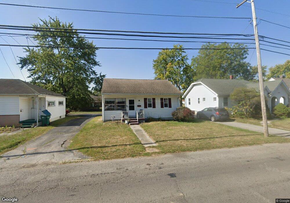
635 Columbus Ave Fostoria, OH 44830
Estimated Value: $89,000 - $130,000
3
Beds
2
Baths
900
Sq Ft
$121/Sq Ft
Est. Value
About This Home
This home is located at 635 Columbus Ave, Fostoria, OH 44830 and is currently estimated at $108,674, approximately $120 per square foot. 635 Columbus Ave is a home located in Seneca County with nearby schools including Fostoria Intermediate Elementary School and Fostoria Junior/Senior High School.
Ownership History
Date
Name
Owned For
Owner Type
Purchase Details
Closed on
Dec 3, 2012
Sold by
Siebenaller James A and Siebenaller Lisa J
Bought by
Good Shepherd Home
Current Estimated Value
Purchase Details
Closed on
Dec 20, 1999
Sold by
Myers Paul E
Bought by
Reinhard Ruth A
Purchase Details
Closed on
Jun 8, 1994
Sold by
Stein David D and Stein Esther S
Bought by
Myers Paul E
Create a Home Valuation Report for This Property
The Home Valuation Report is an in-depth analysis detailing your home's value as well as a comparison with similar homes in the area
Home Values in the Area
Average Home Value in this Area
Purchase History
| Date | Buyer | Sale Price | Title Company |
|---|---|---|---|
| Good Shepherd Home | $52,000 | None Available | |
| Reinhard Ruth A | $73,000 | -- | |
| Myers Paul E | $50,000 | -- |
Source: Public Records
Tax History Compared to Growth
Tax History
| Year | Tax Paid | Tax Assessment Tax Assessment Total Assessment is a certain percentage of the fair market value that is determined by local assessors to be the total taxable value of land and additions on the property. | Land | Improvement |
|---|---|---|---|---|
| 2024 | $1,150 | $22,180 | $2,700 | $19,480 |
| 2023 | $1,168 | $22,180 | $2,700 | $19,480 |
| 2022 | $1,273 | $21,770 | $2,330 | $19,440 |
| 2021 | $1,287 | $21,770 | $2,330 | $19,440 |
| 2020 | $1,293 | $21,774 | $2,335 | $19,439 |
| 2019 | $1,188 | $19,625 | $2,156 | $17,469 |
| 2018 | $1,206 | $19,551 | $2,156 | $17,395 |
| 2017 | $1,053 | $19,551 | $2,156 | $17,395 |
| 2016 | $912 | $16,422 | $2,345 | $14,077 |
| 2015 | $894 | $16,422 | $2,345 | $14,077 |
| 2014 | $846 | $16,422 | $2,345 | $14,077 |
| 2013 | $987 | $17,763 | $2,548 | $15,215 |
Source: Public Records
Map
Nearby Homes
- 129 Fall St
- 8 Christopher Dr
- 0 Bugner St Unit 6131864
- 429 S Town St
- 77 Barcelona Dr
- 412 E Center St
- 133 E South St
- 321 Mcdougal St
- 0 W South Route 12
- 11598 W Township Road 114 County Rd
- 481 Beverly Dr
- 220 E High St
- 540 N Poplar St
- 348 W South St
- 351 W South St
- 461 W Lytle St Unit L-148
- 461 W Lytle St Unit 43
- 461 W Lytle St Unit 145
- 461 W Lytle St Unit 106
- 203 N Union St
- 637 Columbus Ave
- 633 Columbus Ave
- 639 Columbus Ave
- 631 Columbus Ave
- 629 Columbus Ave
- 641 Columbus Ave
- 812 Springville Ave
- 636 Columbus Ave
- 638 Columbus Ave
- 627 Columbus Ave
- 634 Columbus Ave
- 640 Columbus Ave
- 630 Columbus Ave
- 625 Columbus Ave
- 802 Springville Ave
- 802 Springville Ave
- 700 Columbus Ave
- 628 Columbus Ave
- 115 Nichols St
- 619 Columbus Ave