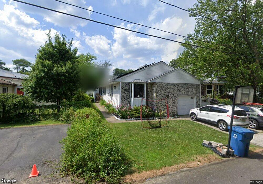
635 Forrest Ave South Amboy, NJ 08879
Estimated Value: $455,000 - $514,625
2
Beds
2
Baths
1,574
Sq Ft
$309/Sq Ft
Est. Value
About This Home
This home is located at 635 Forrest Ave, South Amboy, NJ 08879 and is currently estimated at $486,156, approximately $308 per square foot. 635 Forrest Ave is a home located in Middlesex County with nearby schools including Old Bridge High School, Matawan Montessori Academy, and St. Joseph Elementary School.
Ownership History
Date
Name
Owned For
Owner Type
Purchase Details
Closed on
Jul 28, 2009
Sold by
Mcguinness Elizabeth
Bought by
Denney Harold and Denney Christian
Current Estimated Value
Home Financials for this Owner
Home Financials are based on the most recent Mortgage that was taken out on this home.
Original Mortgage
$201,286
Interest Rate
5.06%
Mortgage Type
FHA
Create a Home Valuation Report for This Property
The Home Valuation Report is an in-depth analysis detailing your home's value as well as a comparison with similar homes in the area
Home Values in the Area
Average Home Value in this Area
Purchase History
| Date | Buyer | Sale Price | Title Company |
|---|---|---|---|
| Denney Harold | $205,000 | Multiple |
Source: Public Records
Mortgage History
| Date | Status | Borrower | Loan Amount |
|---|---|---|---|
| Previous Owner | Denney Harold | $201,286 |
Source: Public Records
Tax History Compared to Growth
Tax History
| Year | Tax Paid | Tax Assessment Tax Assessment Total Assessment is a certain percentage of the fair market value that is determined by local assessors to be the total taxable value of land and additions on the property. | Land | Improvement |
|---|---|---|---|---|
| 2025 | $7,671 | $133,900 | $40,000 | $93,900 |
| 2024 | $7,356 | $133,900 | $40,000 | $93,900 |
| 2023 | $7,356 | $133,900 | $40,000 | $93,900 |
| 2022 | $7,158 | $133,900 | $40,000 | $93,900 |
| 2021 | $5,248 | $133,900 | $40,000 | $93,900 |
| 2020 | $6,941 | $133,900 | $40,000 | $93,900 |
| 2019 | $6,830 | $133,900 | $40,000 | $93,900 |
| 2018 | $6,754 | $133,900 | $40,000 | $93,900 |
| 2017 | $6,544 | $133,900 | $40,000 | $93,900 |
| 2016 | $6,414 | $133,900 | $40,000 | $93,900 |
| 2015 | $6,301 | $133,900 | $40,000 | $93,900 |
| 2014 | $6,225 | $133,900 | $40,000 | $93,900 |
Source: Public Records
Map
Nearby Homes
- 615 Greenwood Ave
- 940 Grove Ave
- 438 Brookside Ave
- 737 Prospect Ave
- 250 Brookside Ave
- 169 Norwood Ave
- 146 Orchard Ave
- 181 Norwood Ave
- 243 Alpine Way
- 239 Alpine Way
- 429 Lea Ave
- 235 Garfield Ave
- 107 Boulevard W
- 106 Boulevard W
- 16 Harbor Bay Cir
- 301 Shoreland Cir
- 18 Bridgepointe Dr
- 18 Bridgepointe Dr Unit 207
- 21 Lantana Way
- 238 Shoreland Cir
- 638 Forrest Ave
- 633 Forrest Ave
- 631 Forrest Ave
- 607 Greenwood Ave
- 609 Greenwood Ave
- 605 Greenwood Ave
- 640 Forrest Ave
- 630 Forrest Ave
- 672 Forrest Ave
- 629 Forrest Ave
- 613 Greenwood Ave
- 668 Forrest Ave
- 676 Forrest Ave
- TBD Greenwood Ave
- 602 Greenwood Ave
- 678 Forrest Ave
- 626 Forrest Ave
- 571 Greenwood Ave
- 569 Greenwood Ave
- 681 Forrest Ave