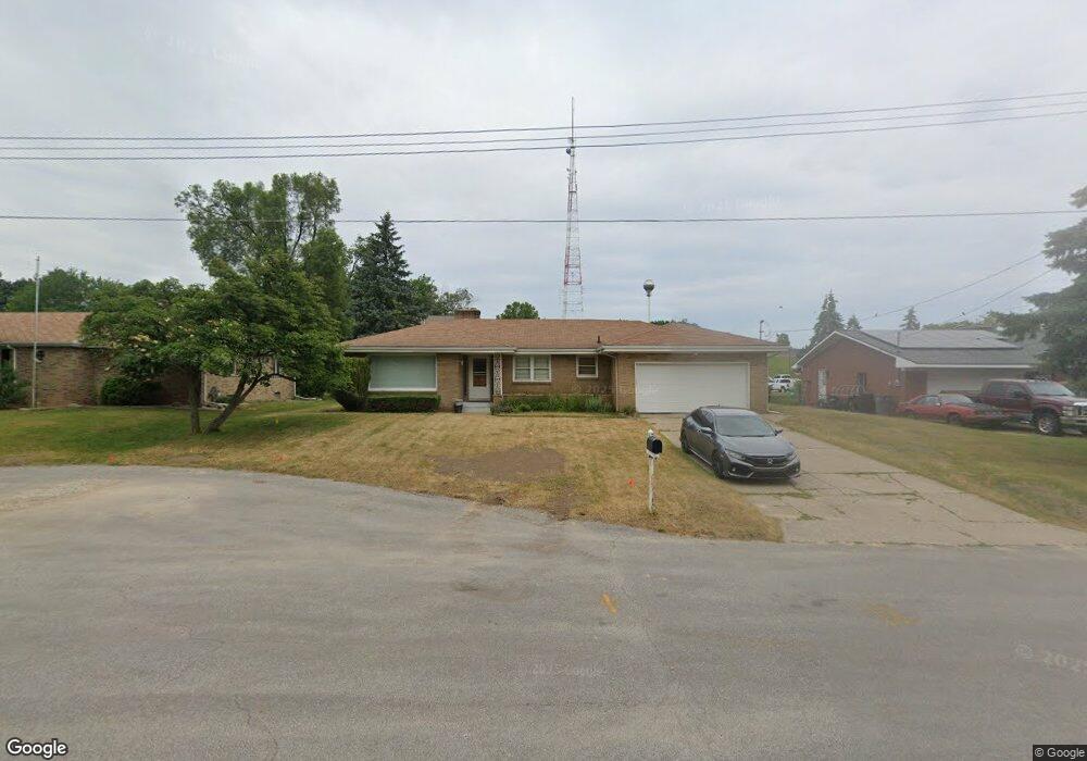
635 Lankamp St NW Grand Rapids, MI 49544
Estimated Value: $292,000 - $337,000
3
Beds
1
Bath
1,572
Sq Ft
$203/Sq Ft
Est. Value
About This Home
This home is located at 635 Lankamp St NW, Grand Rapids, MI 49544 and is currently estimated at $319,789, approximately $203 per square foot. 635 Lankamp St NW is a home located in Kent County with nearby schools including Kenowa Hills Central Elementary School, Kenowa Hills Middle School, and Kenowa Hills High School.
Ownership History
Date
Name
Owned For
Owner Type
Purchase Details
Closed on
Feb 15, 2008
Sold by
Zimmerman Iva Ruth and Zimmerman Ray D
Bought by
Garland Melvin T and Garland Rosalyn A
Current Estimated Value
Home Financials for this Owner
Home Financials are based on the most recent Mortgage that was taken out on this home.
Original Mortgage
$119,130
Interest Rate
6.17%
Mortgage Type
FHA
Purchase Details
Closed on
Jul 24, 2003
Sold by
Zimmerman Iva Ruth
Bought by
Zimmerman Iva Ruth and Zimmerman Ray D
Create a Home Valuation Report for This Property
The Home Valuation Report is an in-depth analysis detailing your home's value as well as a comparison with similar homes in the area
Home Values in the Area
Average Home Value in this Area
Purchase History
| Date | Buyer | Sale Price | Title Company |
|---|---|---|---|
| Garland Melvin T | $121,000 | None Available | |
| Zimmerman Iva Ruth | -- | -- |
Source: Public Records
Mortgage History
| Date | Status | Borrower | Loan Amount |
|---|---|---|---|
| Previous Owner | Garland Melvin T | $119,130 |
Source: Public Records
Tax History Compared to Growth
Tax History
| Year | Tax Paid | Tax Assessment Tax Assessment Total Assessment is a certain percentage of the fair market value that is determined by local assessors to be the total taxable value of land and additions on the property. | Land | Improvement |
|---|---|---|---|---|
| 2025 | $2,001 | $152,300 | $0 | $0 |
| 2024 | $2,001 | $127,600 | $0 | $0 |
| 2023 | $2,051 | $121,100 | $0 | $0 |
| 2022 | $2,206 | $112,900 | $0 | $0 |
| 2021 | $2,150 | $104,100 | $0 | $0 |
| 2020 | $1,887 | $98,200 | $0 | $0 |
| 2019 | $3,461 | $91,200 | $0 | $0 |
| 2018 | $2,040 | $85,400 | $0 | $0 |
| 2017 | $1,983 | $81,100 | $0 | $0 |
| 2016 | $1,906 | $75,900 | $0 | $0 |
| 2015 | $1,756 | $75,900 | $0 | $0 |
| 2013 | -- | $65,800 | $0 | $0 |
Source: Public Records
Map
Nearby Homes
- 2222 Hoyle Ave NW
- 825 Roger St NW
- 947 Roger St NW
- 3343 Springbrook Dr NW
- 1152 Birdie Dr NW Unit 55
- 2765 Oakwood Ave NE
- 2723 Oakwood Ave NE
- 132 Graceland St NE
- 2630 Oakwood Ave NE
- 114 Knapp St NE
- 1324 4 Mile Rd NW
- 1922 Coit Ave NE
- 1528 Alpine Ave NW
- 143 Dean St NE
- 120 Dean St NE
- 30 Palmer St NW
- 2919 Botsford Ave NE
- 536 Wright St NE
- 15 Palmer St NE
- 321 Knapp St NE
- 623 Lankamp St NW
- 643 Lankamp St NW
- 651 Lankamp St NW
- 611 Lankamp St NW
- 628 Lankamp St NW
- 661 Lankamp St NW
- 612 Lankamp St NW
- 600 3 Mile Rd NW Unit 200
- 2750 Angie Ave NW
- 669 Lankamp St NW
- 668 3 Mile Rd NW
- 575 Lankamp St NW
- 2651 Angie Ave NW
- 571 Lankamp St NW
- 611 Ferris St NW
- 625 Ferris St NW
- 576 Lankamp St NW
- 565 Lankamp St NW
- 649 Ferris St NW
- 645 Ferris St NW