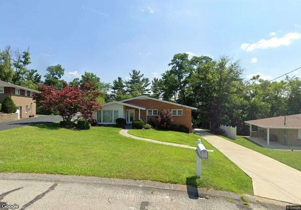
635 Longvue Dr Houston, PA 15342
Chartiers Township NeighborhoodEstimated Value: $252,000 - $318,000
3
Beds
2
Baths
1,310
Sq Ft
$219/Sq Ft
Est. Value
About This Home
This home is located at 635 Longvue Dr, Houston, PA 15342 and is currently estimated at $286,616, approximately $218 per square foot. 635 Longvue Dr is a home located in Washington County with nearby schools including Allison Park Elementary School, Chartiers-Houston Junior/Senior High School, and Central Christian Academy.
Ownership History
Date
Name
Owned For
Owner Type
Purchase Details
Closed on
Oct 21, 2013
Sold by
Pulaski Steven M and Pulaski Denine T
Bought by
Pulaski Denine T
Current Estimated Value
Purchase Details
Closed on
Aug 12, 1999
Sold by
Novatny William J
Bought by
Pulaski Steven M
Home Financials for this Owner
Home Financials are based on the most recent Mortgage that was taken out on this home.
Original Mortgage
$120,650
Interest Rate
7.6%
Create a Home Valuation Report for This Property
The Home Valuation Report is an in-depth analysis detailing your home's value as well as a comparison with similar homes in the area
Home Values in the Area
Average Home Value in this Area
Purchase History
| Date | Buyer | Sale Price | Title Company |
|---|---|---|---|
| Pulaski Denine T | -- | -- | |
| Pulaski Steven M | $127,000 | -- |
Source: Public Records
Mortgage History
| Date | Status | Borrower | Loan Amount |
|---|---|---|---|
| Previous Owner | Pulaski Steven M | $120,650 |
Source: Public Records
Tax History Compared to Growth
Tax History
| Year | Tax Paid | Tax Assessment Tax Assessment Total Assessment is a certain percentage of the fair market value that is determined by local assessors to be the total taxable value of land and additions on the property. | Land | Improvement |
|---|---|---|---|---|
| 2025 | $3,041 | $174,100 | $43,400 | $130,700 |
| 2024 | $2,953 | $174,100 | $43,400 | $130,700 |
| 2023 | $2,953 | $174,100 | $43,400 | $130,700 |
| 2022 | $2,953 | $174,100 | $43,400 | $130,700 |
| 2021 | $2,870 | $174,100 | $43,400 | $130,700 |
| 2020 | $2,798 | $174,100 | $43,400 | $130,700 |
| 2019 | $2,747 | $174,100 | $43,400 | $130,700 |
| 2018 | $2,660 | $174,100 | $43,400 | $130,700 |
| 2017 | $184 | $174,100 | $43,400 | $130,700 |
| 2016 | $567 | $15,773 | $1,412 | $14,361 |
| 2015 | $1,980 | $15,773 | $1,412 | $14,361 |
| 2014 | $393 | $15,773 | $1,412 | $14,361 |
| 2013 | $393 | $15,773 | $1,412 | $14,361 |
Source: Public Records
Map
Nearby Homes
- 528 Forrest Ave
- XX N Shady Ave
- X N Shady Ave
- 533 Hickory Ln
- 473 Hickory Ln
- 543 Birch Dr
- 572 Birch Dr
- 150 N Haft St
- 112 Cherry Ave
- 211 Reed Ave
- 211 Crawford St
- 401 N Main St
- 123 Latimer Ave
- 110 E Country Barn Rd
- 249 Walnut St
- Lot 6 Wylie Ave
- 352 Pershing Ave
- 415 North Ave
- 1024 Mcgovern Rd
- 330 Everest Cir
- 641 Longvue Dr
- 629 Longvue Dr
- 514 Leonard Ave
- 512 Leonard Ave
- 647 Longvue Dr
- 518 Leonard Ave
- 623 Longvue Dr
- 510 Leonard Ave
- 624 Longvue Dr
- 640 Longvue Dr
- 334 Forrest Ave
- 646 Longvue Dr
- 646 Longvue Dr
- 617 Longvue Dr
- 645 Longvue Dr
- 652 Longvue Dr
- 522 Regent St
- 520 Regent St
- 520 Regent St
- 526 Regent St