Estimated Value: $964,277 - $1,047,000
4
Beds
3
Baths
2,756
Sq Ft
$366/Sq Ft
Est. Value
About This Home
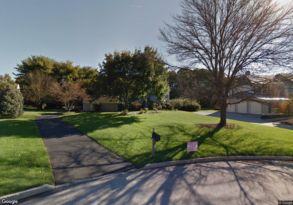
This home is located at 635 Lyndale Ct, Paoli, PA 19301 and is currently estimated at $1,009,319, approximately $366 per square foot. 635 Lyndale Ct is a home located in Chester County with nearby schools including Hillside Elementary School, Valley Forge Middle School, and Conestoga Senior High School.
Ownership History
Date
Name
Owned For
Owner Type
Purchase Details
Closed on
Apr 26, 2004
Sold by
Phan Dung A and Phan Christina M
Bought by
Li Kanning and Wei Xiangping
Current Estimated Value
Home Financials for this Owner
Home Financials are based on the most recent Mortgage that was taken out on this home.
Original Mortgage
$372,000
Outstanding Balance
$172,696
Interest Rate
5.36%
Mortgage Type
Fannie Mae Freddie Mac
Estimated Equity
$836,623
Purchase Details
Closed on
Nov 20, 1995
Sold by
Turner Robert E and Turner Carolyn W
Bought by
Phan Dung A and Phan Christina M
Home Financials for this Owner
Home Financials are based on the most recent Mortgage that was taken out on this home.
Original Mortgage
$203,000
Interest Rate
7.37%
Create a Home Valuation Report for This Property
The Home Valuation Report is an in-depth analysis detailing your home's value as well as a comparison with similar homes in the area
Home Values in the Area
Average Home Value in this Area
Purchase History
| Date | Buyer | Sale Price | Title Company |
|---|---|---|---|
| Li Kanning | $465,000 | -- | |
| Phan Dung A | $330,000 | -- |
Source: Public Records
Mortgage History
| Date | Status | Borrower | Loan Amount |
|---|---|---|---|
| Open | Li Kanning | $372,000 | |
| Previous Owner | Phan Dung A | $203,000 |
Source: Public Records
Tax History Compared to Growth
Tax History
| Year | Tax Paid | Tax Assessment Tax Assessment Total Assessment is a certain percentage of the fair market value that is determined by local assessors to be the total taxable value of land and additions on the property. | Land | Improvement |
|---|---|---|---|---|
| 2025 | $10,683 | $303,300 | $83,770 | $219,530 |
| 2024 | $10,683 | $303,300 | $83,770 | $219,530 |
| 2023 | $10,035 | $303,300 | $83,770 | $219,530 |
| 2022 | $9,776 | $303,300 | $83,770 | $219,530 |
| 2021 | $9,590 | $303,300 | $83,770 | $219,530 |
| 2020 | $9,326 | $303,300 | $83,770 | $219,530 |
| 2019 | $9,031 | $303,300 | $83,770 | $219,530 |
| 2018 | $8,852 | $303,300 | $83,770 | $219,530 |
| 2017 | $8,641 | $303,300 | $83,770 | $219,530 |
| 2016 | -- | $303,300 | $83,770 | $219,530 |
| 2015 | -- | $303,300 | $83,770 | $219,530 |
| 2014 | -- | $303,300 | $83,770 | $219,530 |
Source: Public Records
Map
Nearby Homes
- 1 Whitworth Ave
- 106 N Valley Rd
- 2175 Swedesford Rd
- 202 Shoreline Dr
- 109 Vincent Rd
- 21 Manor Rd
- 29 Manor Rd
- 12 Moreland Rd
- 1250 Swedesford Rd
- 104 Lynbrook Rd
- 201 Penns Ln
- 114 Manor Rd
- 3 Bryan Ave
- 340 Beechwood Rd
- 10 Arlington Rd
- 313 Central Ave
- 2102 Quail Ridge Dr
- 521 Foxwood Ln
- 5 Kent Ln
- 0000 the Willis Elite
- 623 Lyndale Ct
- 647 Lyndale Ct
- 1820 Glenwold Dr
- 1836 Glenwold Dr
- 1821 Black Rock Ln
- 1803 Black Rock Ln
- 1857 Black Rock Ln
- 611 Lyndale Ct
- 656 Lyndale Ct
- 1839 Black Rock Ln
- 1852 Glenwold Dr
- 620 Lyndale Ct
- 1868 Glenwold Dr
- 608 Lyndale Ct
- 1884 Glenwold Dr
- 1900 Glenwold Dr
- 644 Lyndale Ct
- 1831 Glenwold Dr
- 1849 Glenwold Dr
- 632 Lyndale Ct