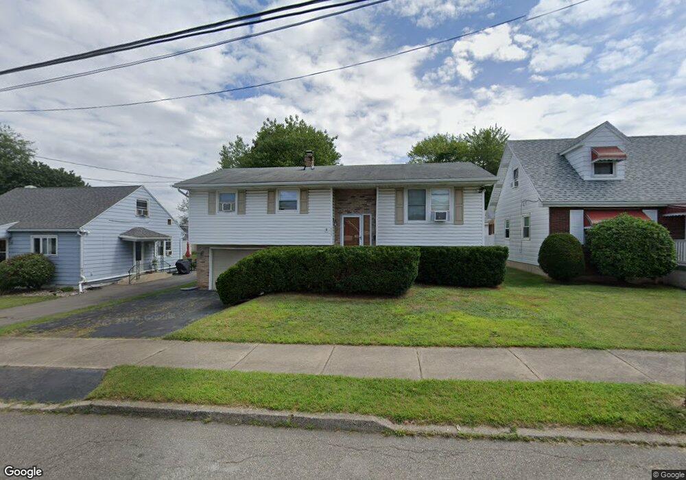
635 N Broad St West Hazleton, PA 18202
Estimated Value: $201,528 - $286,000
--
Bed
--
Bath
1,900
Sq Ft
$137/Sq Ft
Est. Value
About This Home
This home is located at 635 N Broad St, West Hazleton, PA 18202 and is currently estimated at $259,382, approximately $136 per square foot. 635 N Broad St is a home located in Luzerne County with nearby schools including Hazleton Area High School, Immanuel Christian School, and Bishop Hafey Junior/Senior High School.
Ownership History
Date
Name
Owned For
Owner Type
Purchase Details
Closed on
Jul 22, 2010
Sold by
Markarian Samantha M and Walter Samantha M
Bought by
Demauro John A and Demauro Pamela
Current Estimated Value
Home Financials for this Owner
Home Financials are based on the most recent Mortgage that was taken out on this home.
Original Mortgage
$70,000
Outstanding Balance
$46,539
Interest Rate
4.73%
Mortgage Type
New Conventional
Estimated Equity
$212,843
Purchase Details
Closed on
Dec 30, 2008
Sold by
Zunski Andrew J and Zunski Rita C
Bought by
Markarian Samantha M
Create a Home Valuation Report for This Property
The Home Valuation Report is an in-depth analysis detailing your home's value as well as a comparison with similar homes in the area
Home Values in the Area
Average Home Value in this Area
Purchase History
| Date | Buyer | Sale Price | Title Company |
|---|---|---|---|
| Demauro John A | $100,000 | None Available | |
| Markarian Samantha M | $122,000 | None Available |
Source: Public Records
Mortgage History
| Date | Status | Borrower | Loan Amount |
|---|---|---|---|
| Open | Demauro John A | $70,000 |
Source: Public Records
Tax History Compared to Growth
Tax History
| Year | Tax Paid | Tax Assessment Tax Assessment Total Assessment is a certain percentage of the fair market value that is determined by local assessors to be the total taxable value of land and additions on the property. | Land | Improvement |
|---|---|---|---|---|
| 2025 | $2,989 | $118,500 | $22,700 | $95,800 |
| 2024 | $2,890 | $118,500 | $22,700 | $95,800 |
| 2023 | $2,815 | $118,500 | $22,700 | $95,800 |
| 2022 | $2,794 | $118,500 | $22,700 | $95,800 |
| 2021 | $2,725 | $118,500 | $22,700 | $95,800 |
| 2020 | $2,686 | $118,500 | $22,700 | $95,800 |
| 2019 | $2,478 | $118,500 | $22,700 | $95,800 |
| 2018 | $2,400 | $118,500 | $22,700 | $95,800 |
| 2017 | $2,358 | $118,500 | $22,700 | $95,800 |
| 2016 | -- | $118,500 | $22,700 | $95,800 |
| 2015 | $1,634 | $118,500 | $22,700 | $95,800 |
| 2014 | $1,634 | $118,500 | $22,700 | $95,800 |
Source: Public Records
Map
Nearby Homes
- 609 Landmesser Ave
- 9 Park St
- 31 Park St
- 0 Pennsylvania 93
- 60 E Jefferson Ave
- 124 Putnam St
- 307 W Green St
- 667 Roosevelt St
- 328 W Green St
- 329 Ridge Ave
- 536 W Green St
- 1105 S Providence Rd
- 111 S Broad St
- 118 E Green St
- 590 Mckinley St
- 399 Mountain View Dr
- TV 202 Buttonbush & White Oak Ln
- 29 J Jahanna Cir
- 49 Creekside Dr
- 12 AV2 Opalanie Dr
- 643 N Broad St
- 633 N Broad St
- 645 N Broad St
- 646 Landmesser Ave
- 625 N Broad St
- 648 Landmesser Ave
- 649 N Broad St
- 644 N Broad St
- 644 N Broad St
- 638 N Broad St
- 650 Landmesser Ave
- 634 N Broad St
- 640 N Broad St
- 621 N Broad St
- 651 N Broad St
- 630 N Broad St
- 642 N Broad St
- 628 Landmesser Ave
- 654 Landmesser Ave
- 626 N Broad St