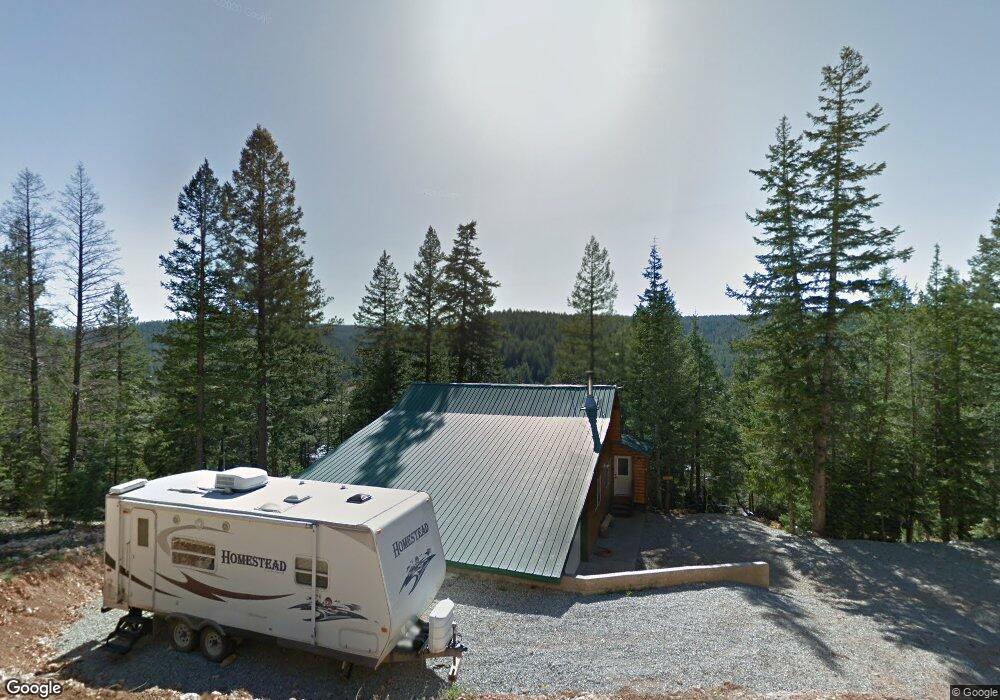
635 N Skyline Cir Kanab, UT 84741
Duck Creek Village NeighborhoodEstimated Value: $463,000 - $495,449
--
Bed
--
Bath
1,344
Sq Ft
$353/Sq Ft
Est. Value
About This Home
This home is located at 635 N Skyline Cir, Kanab, UT 84741 and is currently estimated at $474,816, approximately $353 per square foot. 635 N Skyline Cir is a home with nearby schools including Valley Elementary School and Valley High School.
Ownership History
Date
Name
Owned For
Owner Type
Purchase Details
Closed on
Jun 20, 2011
Sold by
Federal Home Loan Mortgage Corporation
Bought by
Dewhurst Nicky and Dewhurst Laetitia
Current Estimated Value
Purchase Details
Closed on
Apr 28, 2010
Sold by
Etitle Insurance Agency
Bought by
Federal Home Loan Mortgage Corp
Purchase Details
Closed on
Apr 6, 2010
Sold by
Us Bank Na
Bought by
Etitle Insurance Agency
Purchase Details
Closed on
Jun 27, 2005
Sold by
Cole George R and Cole Lori M
Bought by
Cole Ii George R and Cole Lori M
Home Financials for this Owner
Home Financials are based on the most recent Mortgage that was taken out on this home.
Original Mortgage
$217,550
Interest Rate
5.72%
Create a Home Valuation Report for This Property
The Home Valuation Report is an in-depth analysis detailing your home's value as well as a comparison with similar homes in the area
Home Values in the Area
Average Home Value in this Area
Purchase History
| Date | Buyer | Sale Price | Title Company |
|---|---|---|---|
| Dewhurst Nicky | -- | -- | |
| Federal Home Loan Mortgage Corp | -- | -- | |
| Etitle Insurance Agency | -- | -- | |
| Cole Ii George R | -- | -- | |
| Cole Ii George R | -- | -- |
Source: Public Records
Mortgage History
| Date | Status | Borrower | Loan Amount |
|---|---|---|---|
| Previous Owner | Cole Ii George R | $217,550 |
Source: Public Records
Tax History Compared to Growth
Tax History
| Year | Tax Paid | Tax Assessment Tax Assessment Total Assessment is a certain percentage of the fair market value that is determined by local assessors to be the total taxable value of land and additions on the property. | Land | Improvement |
|---|---|---|---|---|
| 2025 | $3,477 | $528,798 | $117,946 | $410,852 |
| 2024 | $3,477 | $275,536 | $56,460 | $219,076 |
| 2023 | $3,186 | $268,172 | $49,096 | $219,076 |
| 2022 | $3,180 | $236,926 | $37,766 | $199,160 |
| 2021 | $2,794 | $312,529 | $44,300 | $268,229 |
| 2020 | $2,703 | $291,796 | $43,677 | $248,119 |
| 2019 | $2,562 | $268,999 | $43,677 | $225,322 |
| 2018 | $2,332 | $242,664 | $48,530 | $194,134 |
| 2017 | $2,436 | $242,664 | $48,530 | $194,134 |
| 2016 | $2,175 | $210,816 | $42,200 | $168,616 |
| 2015 | $1,598 | $159,147 | $35,065 | $124,082 |
| 2014 | $1,598 | $154,573 | $30,491 | $124,082 |
| 2013 | -- | $136,103 | $0 | $0 |
Source: Public Records
Map
Nearby Homes
- 770 Skyline View Dr
- 550 Airport Dr
- 540 Airport Dr
- 675 N Swain's Creek Rd
- 470 Grassy Cir
- 520 Arrowhead Trail
- 2565 N Swains View Trail
- 535 Arrowhead Trail
- 520 & 530 N Grassy Trail
- 530 N Grassy Trail
- 520 N Grassy Trail
- 470 N Grassy Trail
- 145 N Apache Trail
- 580 Grassy Trail
- 175 N Apache Trail
- 890 Primrose Path
- 2375 Douglas Trail
- 615 Skyline Cir
- 630 N Skyline View Dr
- 398 Skyline Cir Unit 3
- 610 N Skyline Cir
- 670 N Skyline Cir
- 585 N Skyline Cir
- 655 N Skyline View Dr
- 680 N Skyline View Dr
- 635 Skyline View Dr
- 615 N Skyline Cir
- 690 N Skyline Cir
- 580 N Skyline Cir
- 575 N Skyline Cir
- 590 N Skyline View Dr
- 660 N Airport Dr
- 670 N Airport Dr
- 710 N Skyline View Dr
- 695 N Skyline View Dr
- 595 N Skyline Cir
- 570 Skyline Cir Unit SCP 3-392