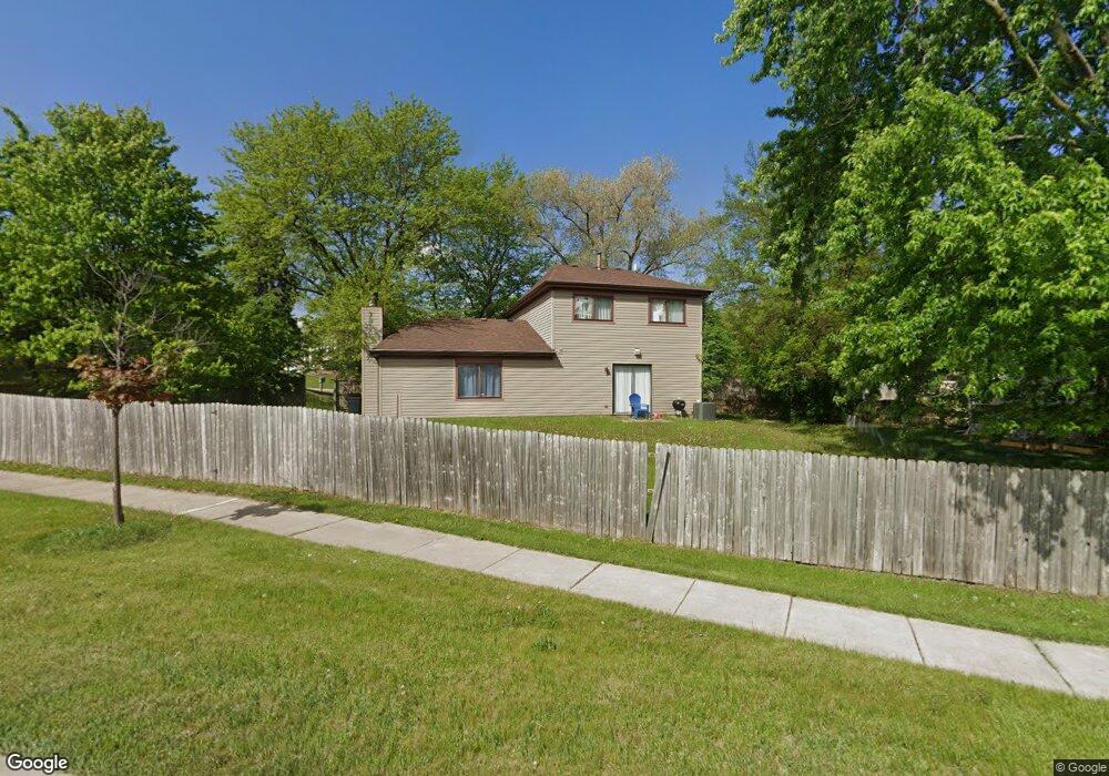
635 Oswego Dr Carol Stream, IL 60188
Estimated Value: $350,265 - $392,000
3
Beds
2
Baths
1,724
Sq Ft
$216/Sq Ft
Est. Value
About This Home
This home is located at 635 Oswego Dr, Carol Stream, IL 60188 and is currently estimated at $373,066, approximately $216 per square foot. 635 Oswego Dr is a home located in DuPage County with nearby schools including Evergreen Elementary School, Benjamin Middle School, and West Chicago Community High School.
Ownership History
Date
Name
Owned For
Owner Type
Purchase Details
Closed on
Jun 23, 2006
Sold by
Walsh Anthony F and Walsh Andrea S
Bought by
Delmonaco Connie G
Current Estimated Value
Home Financials for this Owner
Home Financials are based on the most recent Mortgage that was taken out on this home.
Original Mortgage
$197,000
Outstanding Balance
$112,377
Interest Rate
6.72%
Mortgage Type
Purchase Money Mortgage
Estimated Equity
$260,689
Purchase Details
Closed on
Sep 13, 2004
Sold by
Raethz Douglas D and Raethz Kimberly D
Bought by
Green Andrea S and Walsh Anthony F
Home Financials for this Owner
Home Financials are based on the most recent Mortgage that was taken out on this home.
Original Mortgage
$183,600
Interest Rate
5.25%
Mortgage Type
Purchase Money Mortgage
Create a Home Valuation Report for This Property
The Home Valuation Report is an in-depth analysis detailing your home's value as well as a comparison with similar homes in the area
Home Values in the Area
Average Home Value in this Area
Purchase History
We collect this data history from publicly available records. To have your information removed, we recommend requesting removal directly through your county’s website.
| Date | Buyer | Sale Price | Title Company |
|---|---|---|---|
| Delmonaco Connie G | $265,000 | None Available | |
| Green Andrea S | $229,500 | Fox Title Company |
Source: Public Records
Mortgage History
We collect this data history from publicly available records. To have your information removed, we recommend requesting removal directly through your county’s website.
| Date | Status | Borrower | Loan Amount |
|---|---|---|---|
| Open | Delmonaco Connie G | $197,000 | |
| Previous Owner | Green Andrea S | $183,600 | |
| Closed | Green Andrea S | $22,950 |
Source: Public Records
Tax History
| Year | Tax Paid | Tax Assessment Tax Assessment Total Assessment is a certain percentage of the fair market value that is determined by local assessors to be the total taxable value of land and additions on the property. | Land | Improvement |
|---|---|---|---|---|
| 2024 | $8,500 | $106,825 | $34,212 | $72,613 |
| 2023 | $8,144 | $96,920 | $31,040 | $65,880 |
| 2022 | $7,765 | $90,080 | $28,850 | $61,230 |
| 2021 | $7,425 | $85,520 | $27,390 | $58,130 |
| 2020 | $7,234 | $82,960 | $26,570 | $56,390 |
| 2019 | $7,054 | $80,000 | $25,620 | $54,380 |
| 2018 | $6,561 | $75,430 | $24,160 | $51,270 |
| 2017 | $6,434 | $72,430 | $23,200 | $49,230 |
| 2016 | $6,302 | $69,180 | $22,160 | $47,020 |
| 2015 | $6,231 | $65,490 | $20,980 | $44,510 |
| 2014 | $5,980 | $61,760 | $20,450 | $41,310 |
| 2013 | $5,866 | $63,240 | $20,940 | $42,300 |
Source: Public Records
Map
Nearby Homes
- 593 Iroquois Trail
- 854 Plains Ct
- 554 Alton Ct Unit 224
- 548 Alton Ct
- 545 Alton Ct Unit 273
- 526 Alton Ct
- 553 Alton Ct Unit 2113
- 514 Alton Ct Unit 2
- 725 Buffalo Cir
- 772 Colorado Ct Unit 2301
- 701 Buffalo Cir
- 454 Esselen Ct Unit 2
- 734 Colorado Ct Unit 734
- 27W270 Jefferson St
- 2N629 Jefferson St
- 873 Hampton Dr
- 612 Stuart Dr
- 605 Commanche Ct
- 892 Somerset Dr
- 733 Cypress Ln
Your Personal Tour Guide
Ask me questions while you tour the home.