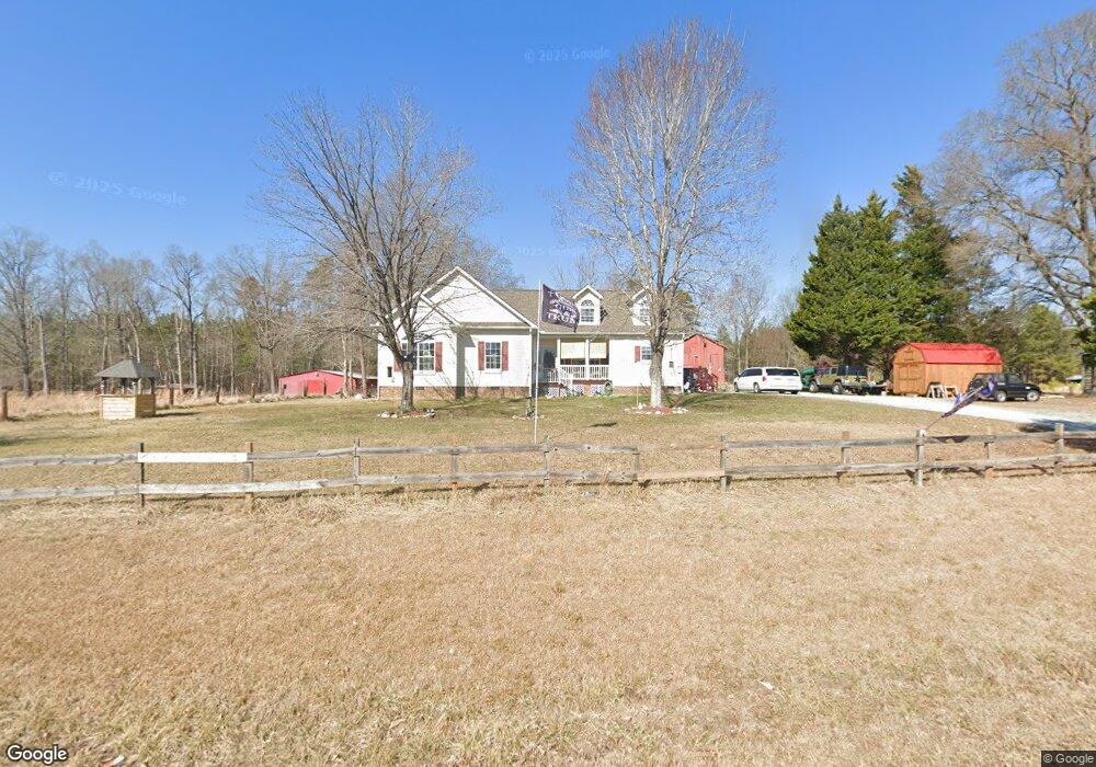
635 Polk Huff Rd Roxboro, NC 27574
Estimated Value: $263,000 - $500,170
3
Beds
3
Baths
2,691
Sq Ft
$142/Sq Ft
Est. Value
About This Home
This home is located at 635 Polk Huff Rd, Roxboro, NC 27574 and is currently estimated at $382,793, approximately $142 per square foot. 635 Polk Huff Rd is a home located in Person County with nearby schools including Person High School.
Ownership History
Date
Name
Owned For
Owner Type
Purchase Details
Closed on
Jul 18, 2008
Sold by
Martin Bobby Ray and Martin Cathie Candello
Bought by
Spinelli Clyde and Spinelli Cynthia K
Current Estimated Value
Home Financials for this Owner
Home Financials are based on the most recent Mortgage that was taken out on this home.
Original Mortgage
$203,920
Outstanding Balance
$131,288
Interest Rate
6.03%
Mortgage Type
New Conventional
Estimated Equity
$251,505
Create a Home Valuation Report for This Property
The Home Valuation Report is an in-depth analysis detailing your home's value as well as a comparison with similar homes in the area
Home Values in the Area
Average Home Value in this Area
Purchase History
| Date | Buyer | Sale Price | Title Company |
|---|---|---|---|
| Spinelli Clyde | $255,000 | -- |
Source: Public Records
Mortgage History
| Date | Status | Borrower | Loan Amount |
|---|---|---|---|
| Open | Spinelli Clyde | $203,920 |
Source: Public Records
Tax History Compared to Growth
Tax History
| Year | Tax Paid | Tax Assessment Tax Assessment Total Assessment is a certain percentage of the fair market value that is determined by local assessors to be the total taxable value of land and additions on the property. | Land | Improvement |
|---|---|---|---|---|
| 2025 | $3,025 | $447,286 | $0 | $0 |
| 2024 | $2,437 | $311,301 | $0 | $0 |
| 2023 | $2,428 | $311,301 | $0 | $0 |
| 2022 | $2,468 | $311,301 | $0 | $0 |
| 2021 | $2,404 | $311,301 | $0 | $0 |
| 2020 | $1,955 | $250,669 | $0 | $0 |
| 2019 | $1,986 | $250,669 | $0 | $0 |
| 2018 | $1,790 | $250,669 | $0 | $0 |
| 2017 | $1,765 | $250,669 | $0 | $0 |
| 2016 | $1,765 | $250,669 | $0 | $0 |
| 2015 | $1,765 | $250,669 | $0 | $0 |
| 2014 | $1,765 | $250,669 | $0 | $0 |
Source: Public Records
Map
Nearby Homes
- 1806 Polk Huff Rd
- 1387 Saint Paul Church Rd
- 652 Hazel Lawson Rd
- 1 McCoy Jeffers Dr
- 1060 Saint Paul Church Rd
- 204 Deep Woods Trail
- 1923 Lawson Chapel Church Rd
- 531 Pointe Mayo Dr
- 1310 Gillis Rd
- 1002 Dennys Store Rd
- 249 Fishermans Point Rd
- 641 Fishermans Point Rd
- 0 Webb Chapel Rd Unit 10099652
- 0 Noel Tuck Rd
- 6688 Goshen Rd
- 6160 Virgilina Rd
- Lot 3 Grapevine Dr
- 210 Grapevine Dr
- 6708 Old Roxboro Rd
- Lot 1 & 2 Stillwater Ln
- 610 Polk Huff Rd
- 350 Polk Huff Rd
- 288 Polk Huff Rd
- 1111 Polk Huff Rd
- 000 Polk Huff Rd
- 0 Polk Huff Rd Unit TR2278416
- 0 Polk Huff Rd Unit 1626990
- 0 Polk Huff Rd
- 555 Tuck Rd
- 3903 Dirgie Mine Rd
- 2080 St Paul Church Rd
- 2080 Saint Paul Church Rd
- 3136 Dirgie Mine Rd
- 3479 Dirgie Mine Rd
- 2051 Saint Paul Church Rd
- 0 St Paul Church Rd Unit 2400198
- 3388 Dirgie Mine Rd
- Lot A St Paul Church Rd
- 3379 Dirgie Mine Rd
- 3268 Dirgie Mine Rd