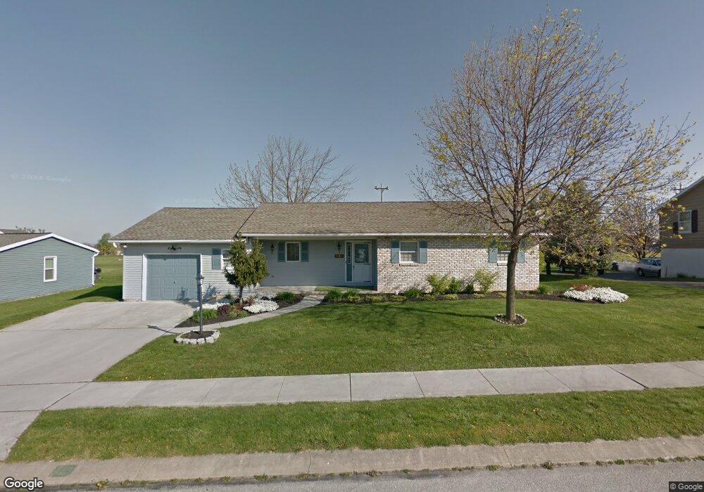
635 Poplar St Unit 79 Hanover, PA 17331
Estimated Value: $243,000 - $291,000
3
Beds
2
Baths
1,291
Sq Ft
$208/Sq Ft
Est. Value
About This Home
This home is located at 635 Poplar St Unit 79, Hanover, PA 17331 and is currently estimated at $268,990, approximately $208 per square foot. 635 Poplar St Unit 79 is a home located in Adams County with nearby schools including New Oxford Senior High School, St. Teresa of Calcutta Catholic School - McSherrystown Campus, and St. Teresa of Calcutta Catholic School - Conewago Campus.
Ownership History
Date
Name
Owned For
Owner Type
Purchase Details
Closed on
Apr 3, 2019
Sold by
Degroft Kim R and Degrroft Christine E
Bought by
Topper Donna L
Current Estimated Value
Home Financials for this Owner
Home Financials are based on the most recent Mortgage that was taken out on this home.
Original Mortgage
$135,920
Outstanding Balance
$119,498
Interest Rate
4.3%
Mortgage Type
New Conventional
Estimated Equity
$149,492
Purchase Details
Closed on
Mar 10, 2014
Sold by
Degroft Jean E and Degroft Robert B
Bought by
Degroft Kim R and Suter Kristina J
Purchase Details
Closed on
Oct 26, 1987
Bought by
Degroft Robert B and Degroft Jean E
Create a Home Valuation Report for This Property
The Home Valuation Report is an in-depth analysis detailing your home's value as well as a comparison with similar homes in the area
Home Values in the Area
Average Home Value in this Area
Purchase History
| Date | Buyer | Sale Price | Title Company |
|---|---|---|---|
| Topper Donna L | $169,900 | -- | |
| Degroft Kim R | -- | None Available | |
| Degroft Robert B | $17,800 | -- |
Source: Public Records
Mortgage History
| Date | Status | Borrower | Loan Amount |
|---|---|---|---|
| Open | Topper Donna L | $135,920 |
Source: Public Records
Tax History Compared to Growth
Tax History
| Year | Tax Paid | Tax Assessment Tax Assessment Total Assessment is a certain percentage of the fair market value that is determined by local assessors to be the total taxable value of land and additions on the property. | Land | Improvement |
|---|---|---|---|---|
| 2025 | $4,337 | $181,100 | $38,000 | $143,100 |
| 2024 | $4,006 | $181,100 | $38,000 | $143,100 |
| 2023 | $3,858 | $181,100 | $38,000 | $143,100 |
| 2022 | $3,740 | $181,100 | $38,000 | $143,100 |
| 2021 | $3,644 | $181,100 | $38,000 | $143,100 |
| 2020 | $3,649 | $181,100 | $38,000 | $143,100 |
| 2019 | $3,485 | $181,100 | $38,000 | $143,100 |
| 2018 | $3,412 | $181,100 | $38,000 | $143,100 |
| 2017 | $3,272 | $181,100 | $38,000 | $143,100 |
| 2016 | -- | $181,100 | $38,000 | $143,100 |
| 2015 | -- | $181,100 | $38,000 | $143,100 |
| 2014 | -- | $181,100 | $38,000 | $143,100 |
Source: Public Records
Map
Nearby Homes
- 602 Cricket Ln Unit 19A
- 617 Cricket Ln Unit 23B
- 285 S Jefferson St Unit 181
- 737 Poplar St Unit 126
- 10 Bear Cir Unit 29
- 409 Turkey Rd
- 19 S 4th St
- 417 Main St
- 1012 W Elm Ave
- 355 Main St
- 908 Poplar St Unit 11
- 415 Ridge Ave
- 7 S 3rd St
- 266 Princess St
- 85 South St
- 263 3rd St
- 219 N 3rd St
- 128 North St
- 228 Princess St
- 429 High St
- 641 Poplar St Unit 80
- 631 Poplar St Unit 78
- 638 Poplar St Unit 94
- 632 Poplar St Unit 95
- 645 Poplar St Unit 81
- 627 Poplar St Unit 77
- 644 Poplar St Unit 93
- 626 Poplar St Unit 96
- 26 Caribou St Unit 102
- 32 Caribou St Unit 101
- 649 Poplar St Unit 82
- 650 Poplar St Unit 92
- 623 Poplar St Unit 76
- 20 Caribou St Unit 103
- 620 Poplar St Unit 97
- 38 Caribou St Unit 100
- 655 Poplar St Unit 83
- 619 Poplar St Unit 75
- 14 Caribou St Unit 104
- 614 Poplar St Unit 98