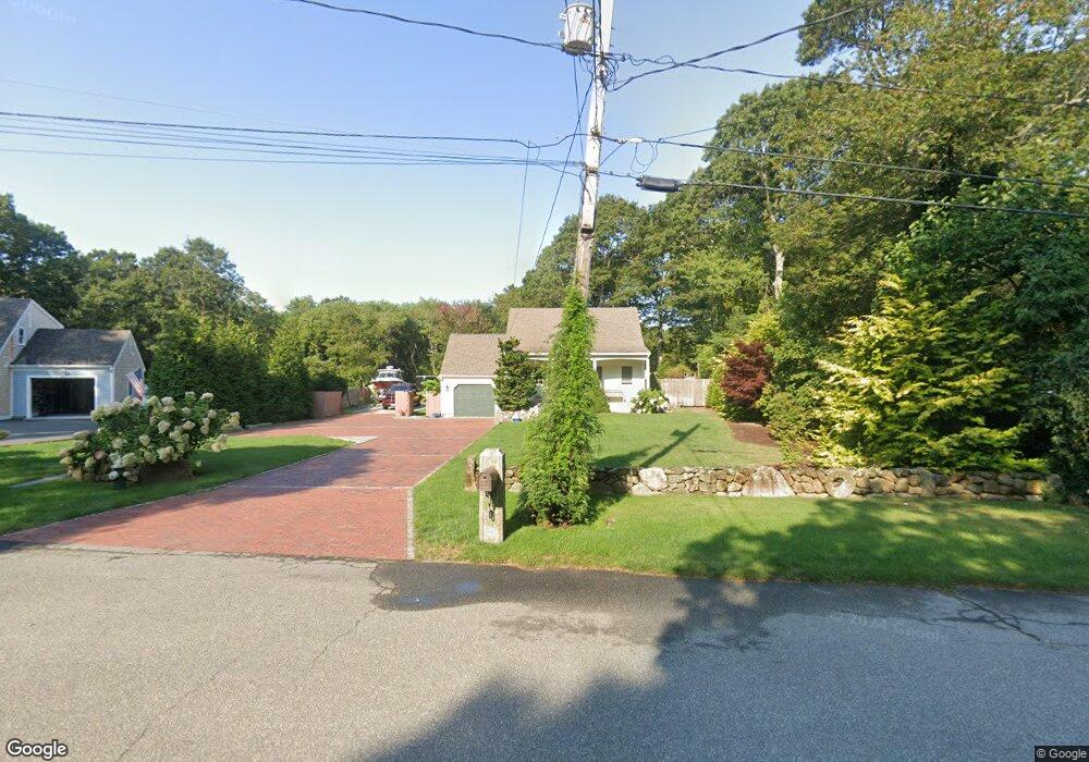
635 Skunknet Rd Centerville, MA 02632
Centerville NeighborhoodEstimated Value: $606,000 - $732,000
2
Beds
1
Bath
728
Sq Ft
$908/Sq Ft
Est. Value
About This Home
This home is located at 635 Skunknet Rd, Centerville, MA 02632 and is currently estimated at $661,116, approximately $908 per square foot. 635 Skunknet Rd is a home located in Barnstable County with nearby schools including West Villages Elementary School, Barnstable United Elementary School, and Barnstable Intermediate School.
Ownership History
Date
Name
Owned For
Owner Type
Purchase Details
Closed on
Apr 24, 2015
Sold by
Lafrance Tyler W
Bought by
Lafrance Tyler W
Current Estimated Value
Purchase Details
Closed on
Jul 1, 2008
Sold by
Timoney Peggy E and Timoney Peter F
Bought by
Lafrance Tyler W
Home Financials for this Owner
Home Financials are based on the most recent Mortgage that was taken out on this home.
Original Mortgage
$231,325
Interest Rate
6.07%
Mortgage Type
Purchase Money Mortgage
Purchase Details
Closed on
Mar 22, 1991
Sold by
Timoney Peter F and Timoney Paul E
Bought by
Timoney Peter F
Home Financials for this Owner
Home Financials are based on the most recent Mortgage that was taken out on this home.
Original Mortgage
$64,000
Interest Rate
9.27%
Mortgage Type
Purchase Money Mortgage
Create a Home Valuation Report for This Property
The Home Valuation Report is an in-depth analysis detailing your home's value as well as a comparison with similar homes in the area
Home Values in the Area
Average Home Value in this Area
Purchase History
| Date | Buyer | Sale Price | Title Company |
|---|---|---|---|
| Lafrance Tyler W | -- | -- | |
| Lafrance Tyler W | $243,500 | -- | |
| Timoney Peter F | $21,000 | -- |
Source: Public Records
Mortgage History
| Date | Status | Borrower | Loan Amount |
|---|---|---|---|
| Previous Owner | Timoney Peter F | $224,000 | |
| Previous Owner | Lafrance Tyler W | $231,325 | |
| Previous Owner | Timoney Peter F | $106,000 | |
| Previous Owner | Timoney Peter F | $63,500 | |
| Previous Owner | Timoney Peter F | $64,000 |
Source: Public Records
Tax History
| Year | Tax Paid | Tax Assessment Tax Assessment Total Assessment is a certain percentage of the fair market value that is determined by local assessors to be the total taxable value of land and additions on the property. | Land | Improvement |
|---|---|---|---|---|
| 2025 | $4,852 | $599,800 | $155,500 | $444,300 |
| 2024 | $4,502 | $576,500 | $155,500 | $421,000 |
| 2023 | $4,306 | $516,300 | $141,400 | $374,900 |
| 2022 | $4,090 | $424,300 | $104,700 | $319,600 |
| 2021 | $3,989 | $380,300 | $104,700 | $275,600 |
| 2020 | $4,131 | $376,900 | $104,700 | $272,200 |
| 2019 | $3,932 | $348,600 | $104,700 | $243,900 |
| 2018 | $3,636 | $324,100 | $110,200 | $213,900 |
| 2017 | $3,388 | $314,900 | $110,200 | $204,700 |
| 2016 | $3,444 | $316,000 | $111,300 | $204,700 |
| 2015 | $3,306 | $304,700 | $108,700 | $196,000 |
Source: Public Records
Map
Nearby Homes
- 200 Lumbert Mill Rd
- 51 Larch Ln
- 53 Meadow Farm Rd
- 52 Meadow Farm Rd
- 1309 Shootflying Hill Rd
- 1309 Shootflying Hill Rd
- 31 Galahad Cir
- 315 Prince Hinckley Rd
- 7 Ebenezer
- 352 Nye Rd
- 344 Main St Unit 5
- 1115 Shootflying Hill Rd
- 351 Swift Ave
- 122 Park Ave
- 64 Falling Leaf Ln
- 436 Nye Rd
- 5 Briar Patch Rd
- 123 Old Post Rd
- 82 Yacht Club Rd
- 169 Cedric Rd
- 645 Skunknet Rd
- 621 Skunknet Rd
- 613 Skunknet Rd
- 31 Manni Cir
- 628 Skunknet Rd
- 640 Skunknet Rd
- 29 Manni Cir
- 618 Skunknet Rd
- 611 Skunknet Rd
- 662 Skunknet Rd
- 603 Skunknet Rd
- 634 Skunknet Rd
- 28 Manni Cir
- 2170 Falmouth Rd
- 602 Skunknet Rd
- 33 Manni Cir
- 19 Manni Cir
- 610 Skunknet Rd
- 2156 Falmouth Rd
- 589 Skunknet Rd
Your Personal Tour Guide
Ask me questions while you tour the home.