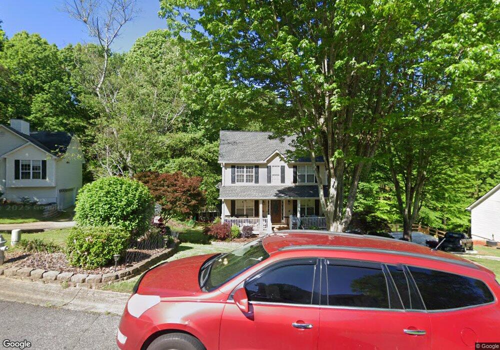
6350 Countryland Dr Dawsonville, GA 30534
Lake Lanier NeighborhoodEstimated Value: $390,598 - $438,000
4
Beds
3
Baths
1,857
Sq Ft
$226/Sq Ft
Est. Value
About This Home
This home is located at 6350 Countryland Dr, Dawsonville, GA 30534 and is currently estimated at $419,650, approximately $225 per square foot. 6350 Countryland Dr is a home located in Forsyth County with nearby schools including Chestatee Elementary School, North Forsyth Middle School, and War Hill Christian Academy.
Ownership History
Date
Name
Owned For
Owner Type
Purchase Details
Closed on
Jul 5, 2018
Sold by
Nielson Edna L
Bought by
Nielson Jeffrey T
Current Estimated Value
Purchase Details
Closed on
Jun 28, 1999
Sold by
Byas Builder Inc
Bought by
Nielson Jeffrey T and Nielson Edna L
Home Financials for this Owner
Home Financials are based on the most recent Mortgage that was taken out on this home.
Original Mortgage
$143,005
Interest Rate
7.43%
Mortgage Type
FHA
Create a Home Valuation Report for This Property
The Home Valuation Report is an in-depth analysis detailing your home's value as well as a comparison with similar homes in the area
Home Values in the Area
Average Home Value in this Area
Purchase History
| Date | Buyer | Sale Price | Title Company |
|---|---|---|---|
| Nielson Jeffrey T | -- | -- | |
| Nielson Jeffrey T | $143,900 | -- |
Source: Public Records
Mortgage History
| Date | Status | Borrower | Loan Amount |
|---|---|---|---|
| Previous Owner | Nielson Jeffrey T | $143,005 |
Source: Public Records
Tax History Compared to Growth
Tax History
| Year | Tax Paid | Tax Assessment Tax Assessment Total Assessment is a certain percentage of the fair market value that is determined by local assessors to be the total taxable value of land and additions on the property. | Land | Improvement |
|---|---|---|---|---|
| 2025 | $3,645 | $148,816 | $44,000 | $104,816 |
| 2024 | $3,645 | $148,644 | $40,000 | $108,644 |
| 2023 | $3,358 | $136,424 | $34,000 | $102,424 |
| 2022 | $2,809 | $90,976 | $18,000 | $72,976 |
| 2021 | $2,512 | $90,976 | $18,000 | $72,976 |
| 2020 | $2,315 | $83,840 | $14,000 | $69,840 |
| 2019 | $2,284 | $82,584 | $14,000 | $68,584 |
| 2018 | $2,047 | $74,008 | $14,000 | $60,008 |
| 2017 | $1,865 | $67,196 | $14,000 | $53,196 |
| 2016 | $1,754 | $63,196 | $10,000 | $53,196 |
| 2015 | $1,757 | $63,196 | $10,000 | $53,196 |
| 2014 | $1,554 | $58,704 | $0 | $0 |
Source: Public Records
Map
Nearby Homes
- 0 Pea Ridge Rd (Tract2a)
- 5935 Whitney Ct
- 5925 Whitney Ct
- 5725 Jot Em Down Rd
- 6675 Jot Em Down Rd
- 6785 Anderson Lake Rd
- 6605 Trailway Trace
- 6750 Dawg Ridge
- 0 Birchfield Trail Unit 7659293
- 0 Birchfield Trail Unit 10617039
- 6370 Stillwood Ln
- 0 Pea Ridge Rd Unit (TRACT 2B) 10599466
- 0 Pea Ridge Rd Unit 7641431
- 0 Pea Ridge Rd Unit 7641430
- 0 Pea Ridge Rd Unit 10433447
- 6865 N Creekside Point
- 6945 W Mountain Crossing
- 7120 Hampton Creek Dr
- 6710 Timber Cove Point
- 6765 Creek View Ln
- 6360 Countryland Dr
- 6340 Countryland Dr
- 6370 Countryland Dr
- 6355 Countryland Dr
- 6335 Countryland Dr
- 6415 Taylor Creek Ct
- 0 Countryland Dr Unit 7510994
- 0 Countryland Dr Unit 7329558
- 0 Countryland Dr Unit 8872776
- 0 Countryland Dr Unit 8787183
- 0 Countryland Dr Unit 8716908
- 0 Countryland Dr Unit 8631859
- 0 Countryland Dr Unit 8623076
- 0 Countryland Dr Unit 7232790
- 0 Countryland Dr Unit 3232512
- 0 Countryland Dr Unit 3139650
- 0 Taylor Creek Ct Unit 7429376
- 0 Taylor Creek Ct Unit 8372379
- 0 Taylor Creek Ct
- 6380 Countryland Dr