Estimated Value: $254,000 - $274,270
4
Beds
3
Baths
2,070
Sq Ft
$127/Sq Ft
Est. Value
About This Home
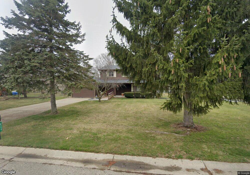
This home is located at 6350 Wreckenridge Rd, Flint, MI 48532 and is currently estimated at $262,818, approximately $126 per square foot. 6350 Wreckenridge Rd is a home located in Genesee County with nearby schools including Carman-Ainsworth High School, Genesee STEM Academy, and Linden Charter Academy.
Ownership History
Date
Name
Owned For
Owner Type
Purchase Details
Closed on
Nov 7, 2022
Sold by
Kennedy Mary A
Bought by
Kennedy Mary A
Current Estimated Value
Purchase Details
Closed on
Oct 12, 2001
Sold by
Kennedy James E
Bought by
Kennedy James E and Kennedy Mary
Purchase Details
Closed on
Dec 24, 1999
Sold by
Kennedy Thelma A
Bought by
Kennedy James E
Home Financials for this Owner
Home Financials are based on the most recent Mortgage that was taken out on this home.
Original Mortgage
$94,800
Interest Rate
7.76%
Mortgage Type
Purchase Money Mortgage
Create a Home Valuation Report for This Property
The Home Valuation Report is an in-depth analysis detailing your home's value as well as a comparison with similar homes in the area
Home Values in the Area
Average Home Value in this Area
Purchase History
| Date | Buyer | Sale Price | Title Company |
|---|---|---|---|
| Kennedy Mary A | -- | Michigan Land Title | |
| Kennedy James E | -- | First American Title Ins Co | |
| Kennedy James E | -- | -- |
Source: Public Records
Mortgage History
| Date | Status | Borrower | Loan Amount |
|---|---|---|---|
| Previous Owner | Kennedy James E | $94,800 |
Source: Public Records
Tax History Compared to Growth
Tax History
| Year | Tax Paid | Tax Assessment Tax Assessment Total Assessment is a certain percentage of the fair market value that is determined by local assessors to be the total taxable value of land and additions on the property. | Land | Improvement |
|---|---|---|---|---|
| 2025 | $2,488 | $126,400 | $0 | $0 |
| 2024 | $1,313 | $121,700 | $0 | $0 |
| 2023 | $2,053 | $103,800 | $0 | $0 |
| 2022 | $1,050 | $85,400 | $0 | $0 |
| 2021 | $2,197 | $73,900 | $0 | $0 |
| 2020 | $1,126 | $73,300 | $0 | $0 |
| 2019 | $1,109 | $68,600 | $0 | $0 |
| 2018 | $2,061 | $65,500 | $0 | $0 |
| 2017 | $1,959 | $65,500 | $0 | $0 |
| 2016 | $2,012 | $52,500 | $0 | $0 |
| 2015 | $1,863 | $48,900 | $0 | $0 |
| 2014 | $1,105 | $46,800 | $0 | $0 |
| 2012 | -- | $47,300 | $47,300 | $0 |
Source: Public Records
Map
Nearby Homes
- 1066 Ramsgate Rd
- 6358 Yorkshire North Riding Rd
- 1165 S Elms Rd
- 3073 S Elms
- 6456 W Court St
- 7030 Saratoga Dr
- 7035 Saratoga Dr
- 0 S Elms Rd Unit 50166557
- 7042 Saratoga Dr
- 0 Country Ridge Trail
- 1191 Derby Blvd
- 6172 W Court St
- oo Walnut Creek Dr
- 1192 Citation Dr
- 1184 Citation Dr
- 00 Graham St
- Integrity 1880 Plan at Country Ridge of Flint
- 7075 Saratoga Dr
- 6142 Noel Dr
- 6090 Lancaster Dr
- 6340 Wreckenridge Rd
- 6360 Wreckenridge Rd
- 1275 Stonehenge Rd
- 6330 Wreckenridge Rd
- 1253 Stonehenge Rd Unit Bldg-Unit
- 1253 Stonehenge Rd
- 1239 Stonehenge Rd
- 6353 Wreckenridge Rd
- 6343 Wreckenridge Rd
- 1231 Stonehenge Rd
- 6322 Wreckenridge Rd
- 6333 Wreckenridge Rd
- 6361 Wreckenridge Rd
- 1223 Stonehenge Rd
- 6323 Wreckenridge Rd
- 1282 Stonehenge Rd
- 1290 Stonehenge Rd
- 6312 Wreckenridge Rd
- 6367 Wreckenridge Rd
- 1274 Stonehenge Rd