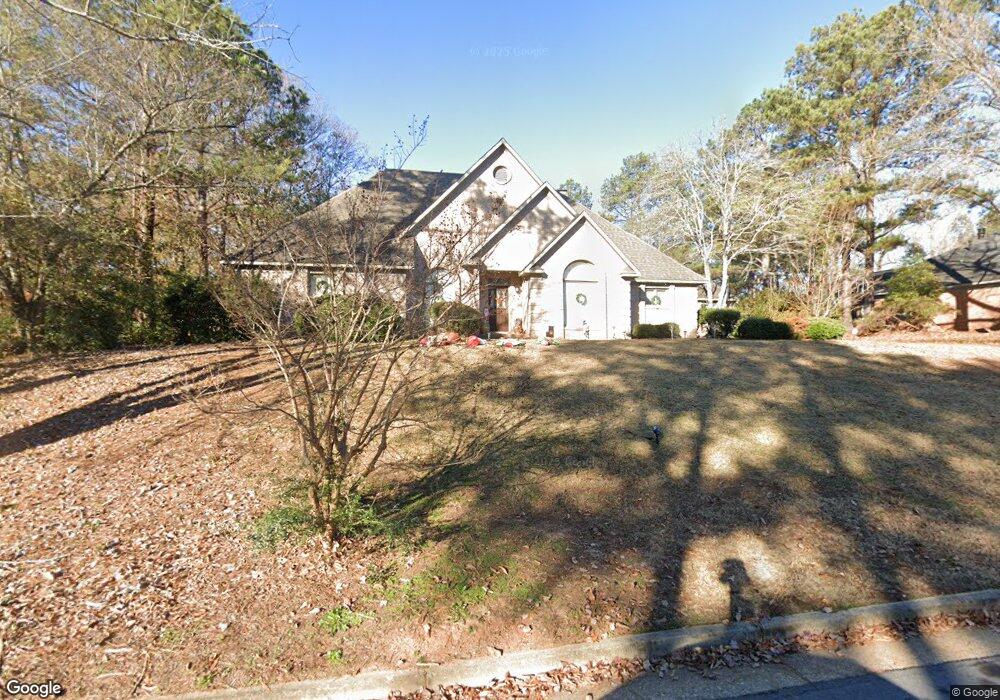
6351 Brookstone Blvd Columbus, GA 31904
North Columbus NeighborhoodEstimated Value: $442,844 - $469,000
4
Beds
4
Baths
3,346
Sq Ft
$137/Sq Ft
Est. Value
About This Home
This home is located at 6351 Brookstone Blvd, Columbus, GA 31904 and is currently estimated at $457,961, approximately $136 per square foot. 6351 Brookstone Blvd is a home located in Muscogee County with nearby schools including River Road Elementary School, Double Churches Middle School, and Northside High School.
Ownership History
Date
Name
Owned For
Owner Type
Purchase Details
Closed on
Apr 17, 2014
Sold by
Behar I Robert
Bought by
Mcelroy Colin
Current Estimated Value
Home Financials for this Owner
Home Financials are based on the most recent Mortgage that was taken out on this home.
Original Mortgage
$352,417
Outstanding Balance
$268,205
Interest Rate
4.37%
Mortgage Type
VA
Estimated Equity
$189,756
Purchase Details
Closed on
Jun 15, 2011
Sold by
Trussell Walter
Bought by
Behar I Robert
Home Financials for this Owner
Home Financials are based on the most recent Mortgage that was taken out on this home.
Original Mortgage
$230,000
Interest Rate
4.63%
Mortgage Type
New Conventional
Create a Home Valuation Report for This Property
The Home Valuation Report is an in-depth analysis detailing your home's value as well as a comparison with similar homes in the area
Home Values in the Area
Average Home Value in this Area
Purchase History
| Date | Buyer | Sale Price | Title Company |
|---|---|---|---|
| Mcelroy Colin | $345,000 | -- | |
| Behar I Robert | $371,000 | -- |
Source: Public Records
Mortgage History
| Date | Status | Borrower | Loan Amount |
|---|---|---|---|
| Open | Mcelroy Colin | $352,417 | |
| Previous Owner | Behar I Robert | $230,000 |
Source: Public Records
Tax History
| Year | Tax Paid | Tax Assessment Tax Assessment Total Assessment is a certain percentage of the fair market value that is determined by local assessors to be the total taxable value of land and additions on the property. | Land | Improvement |
|---|---|---|---|---|
| 2025 | $458 | $165,444 | $23,412 | $142,032 |
| 2024 | $4,578 | $165,444 | $23,412 | $142,032 |
| 2023 | $3,913 | $165,444 | $23,412 | $142,032 |
| 2022 | $4,775 | $124,848 | $23,412 | $101,436 |
| 2021 | $4,768 | $130,176 | $23,412 | $106,764 |
| 2020 | $4,770 | $130,176 | $23,412 | $106,764 |
| 2019 | $4,787 | $130,176 | $23,412 | $106,764 |
| 2018 | $4,787 | $130,176 | $23,412 | $106,764 |
| 2017 | $5,350 | $130,176 | $23,412 | $106,764 |
| 2016 | $5,693 | $138,000 | $14,074 | $123,926 |
| 2015 | $5,699 | $138,000 | $14,074 | $123,926 |
| 2014 | $6,225 | $150,547 | $14,074 | $136,473 |
| 2013 | -- | $150,547 | $14,074 | $136,473 |
Source: Public Records
Map
Nearby Homes
- 16 Kylemore Ct
- 6390 Cape Cod Dr
- 6333 Cape Cod Dr
- 7281 Mobley Walk Dr
- 280 Zachary Ct
- 268 Woodstream Dr
- 1325 Autumnridge Dr
- 7015 Spring Walk Dr
- 312 Woodstream Dr
- 264 Woodstream Dr
- 6801 River Rd Unit 406
- 6801 River Rd Unit 407
- 1195 Cloverdale Rd
- 6400 Green Island Dr Unit 42
- 6400 Green Island Dr Unit 11
- 6400 Green Island Dr Unit 43
- 6101 River Rd Unit 14
- 6101 River Rd Unit 13
- 6101 River Rd Unit 2
- 6101 River Rd Unit 5
- 6359 Brookstone Blvd
- 6337 Brookstone Blvd
- 11 Pinecreek Dr
- 12 Pinecreek Dr
- 6352 Brookstone Blvd
- 6329 Brookstone Blvd
- 905 Woodpine Ct
- 6360 Brookstone Blvd
- 6344 Brookstone Blvd
- 6426 Spring Water Dr
- 911 Woodpine Ct
- 6336 Brookstone Blvd
- 6366 Brookstone Blvd
- 6430 Spring Water Dr
- 13 Pinecreek Dr
- 6420 Spring Water Dr
- 6328 Brookstone Blvd
- 917 Woodpine Ct
- 6372 Brookstone Blvd
- 871 Lismore Dr
Your Personal Tour Guide
Ask me questions while you tour the home.