Estimated Value: $192,000
--
Bed
1
Bath
1,460
Sq Ft
$132/Sq Ft
Est. Value
About This Home
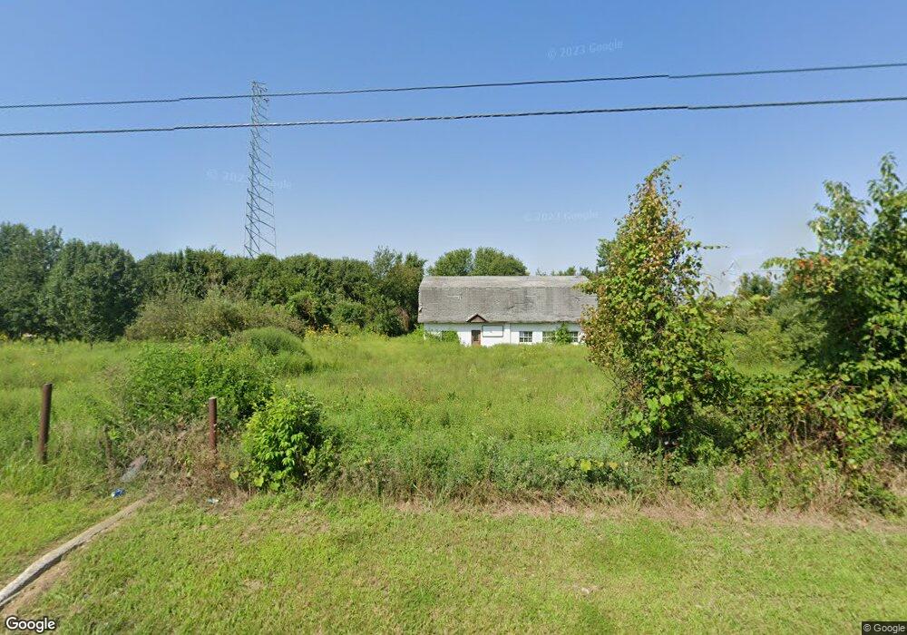
This home is located at 6351 State Highway Nn, Ozark, MO 65721 and is currently estimated at $192,000, approximately $131 per square foot. 6351 State Highway Nn is a home located in Christian County with nearby schools including North Elementary School, Ozark Middle School, and Ozark Junior High School.
Ownership History
Date
Name
Owned For
Owner Type
Purchase Details
Closed on
Sep 9, 2024
Sold by
Hiller Holdings Llc
Bought by
D & R Equity Investments Llc
Current Estimated Value
Home Financials for this Owner
Home Financials are based on the most recent Mortgage that was taken out on this home.
Original Mortgage
$170,000
Outstanding Balance
$168,715
Interest Rate
8.5%
Mortgage Type
Seller Take Back
Estimated Equity
$23,285
Purchase Details
Closed on
Nov 4, 2022
Sold by
Chapman Gary Boyd and Chapman Rosalie A
Bought by
Hiller Holdings Llc
Create a Home Valuation Report for This Property
The Home Valuation Report is an in-depth analysis detailing your home's value as well as a comparison with similar homes in the area
Home Values in the Area
Average Home Value in this Area
Purchase History
| Date | Buyer | Sale Price | Title Company |
|---|---|---|---|
| D & R Equity Investments Llc | -- | Meridian Title | |
| Hiller Holdings Llc | -- | Great American Title |
Source: Public Records
Mortgage History
| Date | Status | Borrower | Loan Amount |
|---|---|---|---|
| Open | D & R Equity Investments Llc | $170,000 |
Source: Public Records
Tax History Compared to Growth
Tax History
| Year | Tax Paid | Tax Assessment Tax Assessment Total Assessment is a certain percentage of the fair market value that is determined by local assessors to be the total taxable value of land and additions on the property. | Land | Improvement |
|---|---|---|---|---|
| 2024 | $1,581 | $25,020 | -- | -- |
| 2023 | $1,581 | $25,020 | $0 | $0 |
| 2022 | $407 | $6,430 | $0 | $0 |
| 2021 | $394 | $6,430 | $0 | $0 |
| 2020 | $389 | $6,430 | $0 | $0 |
| 2019 | $389 | $6,430 | $0 | $0 |
| 2018 | $386 | $6,430 | $0 | $0 |
| 2017 | $386 | $6,430 | $0 | $0 |
| 2016 | $380 | $6,430 | $0 | $0 |
| 2015 | -- | $6,430 | $6,430 | $0 |
| 2014 | $376 | $6,430 | $0 | $0 |
| 2013 | $4 | $6,430 | $0 | $0 |
| 2011 | $4 | $12,860 | $0 | $0 |
Source: Public Records
Map
Nearby Homes
- 2584 E Southernview Rd
- 1105 E Eagle Rock Dr
- 6011 N 9th Ave
- 1108 E Lily Dr
- 5622 N 12th Ave
- 803 E Bayshore Dr
- 5605 N Seacrest Dr
- 5250 N Seacrest Dr
- 1106 E Torrey Pines Dr
- 607 E Falls Cir
- 1513 E Peartree Dr
- 151 Blue Sky Dr
- 1875 E Skyline
- 1861 E Skyline
- 1010 E Cobblestone Dr
- 1625 E Lakecrest Dr
- 1249 E Stonebrook Rd
- 104 Walnut Hill Ln
- 1526 E Lakecrest Dr
- 1837 E Cobblestone Dr
- 2186 E Southernview Rd
- 128 E Scottsdale Dr
- 168 E Scottsdale Dr
- 2168 E Southernview Rd
- 208 E Scottsdale Dr
- 2162 E Southernview Rd
- 129 N Tanglewood Dr
- 254 E Scottsdale Dr
- 2136 E Southernview Rd
- 169 N Tanglewood Dr
- Lot 2 Southernview Estates
- 2072 E Southernview Rd
- 6190 State Highway Nn
- 207 N Tanglewood Dr
- 189 E Wisteria Ln
- 302 E Scottsdale Dr
- Lot 3 Southernview Estates
- Lot 3 Wisteria Ln
- Lot 1 Southernview Estates
- 2010 E Southernview Rd