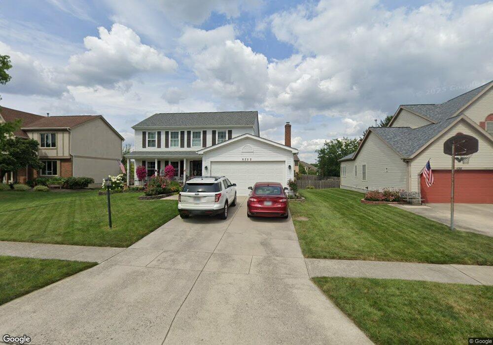
6352 Buckeye Path Dr N Grove City, OH 43123
Estimated Value: $395,000 - $409,000
4
Beds
3
Baths
2,136
Sq Ft
$187/Sq Ft
Est. Value
About This Home
This home is located at 6352 Buckeye Path Dr N, Grove City, OH 43123 and is currently estimated at $399,651, approximately $187 per square foot. 6352 Buckeye Path Dr N is a home located in Franklin County with nearby schools including Buckeye Woods Elementary School, Hayes Intermediate School, and Jackson Middle School.
Ownership History
Date
Name
Owned For
Owner Type
Purchase Details
Closed on
Dec 5, 2017
Sold by
Moore Robyn S
Bought by
Moore Ryan A and Buchacevich Andrea R
Current Estimated Value
Purchase Details
Closed on
Jun 12, 1991
Bought by
Moore Jeffrey L and Moore Robyn S
Purchase Details
Closed on
Nov 21, 1990
Purchase Details
Closed on
Jul 19, 1990
Create a Home Valuation Report for This Property
The Home Valuation Report is an in-depth analysis detailing your home's value as well as a comparison with similar homes in the area
Home Values in the Area
Average Home Value in this Area
Purchase History
| Date | Buyer | Sale Price | Title Company |
|---|---|---|---|
| Moore Ryan A | -- | None Available | |
| Moore Ryan A | -- | None Available | |
| Moore Jeffery L | -- | None Available | |
| Moore Jeffrey L | $114,500 | -- | |
| -- | $33,000 | -- | |
| -- | $597,900 | -- |
Source: Public Records
Tax History Compared to Growth
Tax History
| Year | Tax Paid | Tax Assessment Tax Assessment Total Assessment is a certain percentage of the fair market value that is determined by local assessors to be the total taxable value of land and additions on the property. | Land | Improvement |
|---|---|---|---|---|
| 2024 | $5,065 | $111,370 | $33,390 | $77,980 |
| 2023 | $4,993 | $111,370 | $33,390 | $77,980 |
| 2022 | $4,521 | $74,140 | $14,460 | $59,680 |
| 2021 | $4,609 | $74,140 | $14,460 | $59,680 |
| 2020 | $4,594 | $74,140 | $14,460 | $59,680 |
| 2019 | $4,157 | $62,240 | $12,080 | $50,160 |
| 2018 | $4,213 | $62,240 | $12,080 | $50,160 |
| 2017 | $4,204 | $62,240 | $12,080 | $50,160 |
| 2016 | $4,283 | $59,090 | $11,730 | $47,360 |
| 2015 | $4,284 | $59,090 | $11,730 | $47,360 |
| 2014 | $4,287 | $59,090 | $11,730 | $47,360 |
| 2013 | $1,927 | $56,280 | $11,165 | $45,115 |
Source: Public Records
Map
Nearby Homes
- 6295 Rising Sun Dr
- 6259 Rising Sun Dr
- 1571 Cree Ct
- 6477 Buckeye Path Dr S
- 6229 Brookmeade Cir
- 1370 Wild Horse Dr
- 6358 Shawnee St
- 1717 London Groveport Rd
- 5976 Sweet Basil Ln
- 5990 Sweet Basil Ln
- 6032 Sweet Basil Ln
- 6075 Sweet Basil Ln
- 6092 Winnebago St
- The Iris Residence Plan at Plum Run Crossing
- Scarlett Custom Plan A at Plum Run Crossing
- Ferryman Residence Plan at Plum Run Crossing
- Ashford Plan at Plum Run Crossing
- Sawyer Plan at Plum Run Crossing
- Scarlett Plan at Plum Run Crossing
- Carroll Residence Plan at Plum Run Crossing
- 6358 Buckeye Path Dr N
- 6346 Buckeye Path Dr N
- 1465 Hawthorne Pkwy
- 6364 Buckeye Path Dr N
- 1475 Hawthorne Pkwy
- 1475 Hawthorne Pkwy Unit 1
- 1455 Hawthorne Pkwy
- 6349 Buckeye Path Dr N
- 6355 Buckeye Path Dr N
- 6348 Buckeye Path Dr N
- 6370 Buckeye Path Dr N
- 6367 Buckeye Path Dr N
- 1445 Hawthorne Pkwy
- 1511 Ojibwas Ct
- 6376 Buckeye Path Dr N
- 6379 Buckeye Path Dr N
- 1508 Ojibwas Ct
- 1500 Trail Ct
- 1508 Trail Ct
- 1530 Cree Ct