Estimated Value: $280,006 - $329,000
3
Beds
2
Baths
1,268
Sq Ft
$238/Sq Ft
Est. Value
About This Home
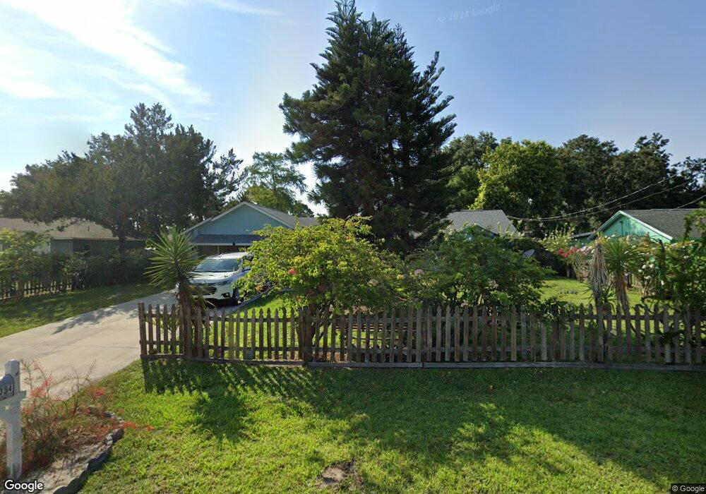
This home is located at 6354 Hudson Rd, Cocoa, FL 32927 and is currently estimated at $301,752, approximately $237 per square foot. 6354 Hudson Rd is a home located in Brevard County with nearby schools including Enterprise Elementary School, Space Coast Junior/Senior High School, and East Atlantic Prep of Brevard County.
Ownership History
Date
Name
Owned For
Owner Type
Purchase Details
Closed on
Aug 25, 1999
Sold by
Pham Tam
Bought by
Gonzales Amado S and Gonzales Fe
Current Estimated Value
Purchase Details
Closed on
Mar 30, 1994
Sold by
Wilborn Dawn M
Bought by
Gonzales Amado S and Pham Tam M
Home Financials for this Owner
Home Financials are based on the most recent Mortgage that was taken out on this home.
Original Mortgage
$60,650
Interest Rate
7.1%
Create a Home Valuation Report for This Property
The Home Valuation Report is an in-depth analysis detailing your home's value as well as a comparison with similar homes in the area
Home Values in the Area
Average Home Value in this Area
Purchase History
| Date | Buyer | Sale Price | Title Company |
|---|---|---|---|
| Gonzales Amado S | $25,000 | -- | |
| Gonzales Amado S | $60,000 | -- |
Source: Public Records
Mortgage History
| Date | Status | Borrower | Loan Amount |
|---|---|---|---|
| Previous Owner | Gonzales Amado S | $60,650 |
Source: Public Records
Tax History Compared to Growth
Tax History
| Year | Tax Paid | Tax Assessment Tax Assessment Total Assessment is a certain percentage of the fair market value that is determined by local assessors to be the total taxable value of land and additions on the property. | Land | Improvement |
|---|---|---|---|---|
| 2025 | $967 | $77,200 | -- | -- |
| 2024 | $943 | $75,030 | -- | -- |
| 2023 | $943 | $72,850 | $0 | $0 |
| 2022 | $880 | $70,730 | $0 | $0 |
| 2021 | $874 | $68,670 | $0 | $0 |
| 2020 | $918 | $67,730 | $0 | $0 |
| 2019 | $866 | $66,210 | $0 | $0 |
| 2018 | $867 | $64,980 | $0 | $0 |
| 2017 | $868 | $63,650 | $0 | $0 |
| 2016 | $875 | $62,350 | $18,000 | $44,350 |
| 2015 | $882 | $61,920 | $15,000 | $46,920 |
| 2014 | $887 | $61,430 | $11,000 | $50,430 |
Source: Public Records
Map
Nearby Homes
- 6309 Alleghany Ave
- 6003 Gilson
- 5460 Holden Rd
- 5940 Flamingo Ave
- 6017 Flamingo Ave
- 5446 Jamaica Rd
- 5715 Fairbridge St
- 4650 N Highway 1 Hwy
- 6365 Homestead Ave
- 5997 Jenkins Ave
- 23-35-21-JX-B-2 Aruin St
- 5575 Curtis Blvd
- 6010 Fay Blvd
- 5946 Deer Ln
- 6581 Bancroft Ave
- 5955 Keystone Ave
- 5275 Holden Rd
- 6545 Addie Ave
- 6643 Emil Ave
- 5220 Holden Rd