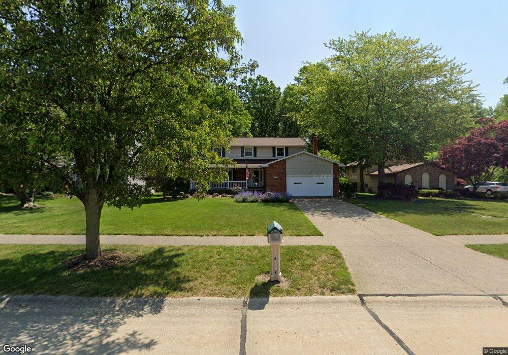
6357 Carter Blvd Mentor, OH 44060
Estimated Value: $325,000 - $431,000
4
Beds
3
Baths
1,576
Sq Ft
$228/Sq Ft
Est. Value
About This Home
This home is located at 6357 Carter Blvd, Mentor, OH 44060 and is currently estimated at $359,897, approximately $228 per square foot. 6357 Carter Blvd is a home located in Lake County with nearby schools including Bellflower Elementary School, Shore Middle School, and Mentor High School.
Ownership History
Date
Name
Owned For
Owner Type
Purchase Details
Closed on
Jul 8, 1996
Sold by
Busher Joseph A
Bought by
Huszar Ronald J and Huszar Mary R
Current Estimated Value
Home Financials for this Owner
Home Financials are based on the most recent Mortgage that was taken out on this home.
Original Mortgage
$144,000
Outstanding Balance
$7,249
Interest Rate
8.07%
Mortgage Type
New Conventional
Estimated Equity
$352,648
Create a Home Valuation Report for This Property
The Home Valuation Report is an in-depth analysis detailing your home's value as well as a comparison with similar homes in the area
Home Values in the Area
Average Home Value in this Area
Purchase History
| Date | Buyer | Sale Price | Title Company |
|---|---|---|---|
| Huszar Ronald J | $180,000 | -- |
Source: Public Records
Mortgage History
| Date | Status | Borrower | Loan Amount |
|---|---|---|---|
| Open | Huszar Ronald J | $144,000 |
Source: Public Records
Tax History
| Year | Tax Paid | Tax Assessment Tax Assessment Total Assessment is a certain percentage of the fair market value that is determined by local assessors to be the total taxable value of land and additions on the property. | Land | Improvement |
|---|---|---|---|---|
| 2025 | -- | $99,680 | $19,300 | $80,380 |
| 2024 | -- | $99,680 | $19,300 | $80,380 |
| 2023 | $9,493 | $91,360 | $15,810 | $75,550 |
| 2022 | $4,317 | $91,360 | $15,810 | $75,550 |
| 2021 | $4,312 | $91,360 | $15,810 | $75,550 |
| 2020 | $4,175 | $77,420 | $13,400 | $64,020 |
| 2019 | $4,180 | $77,420 | $13,400 | $64,020 |
| 2018 | $3,986 | $67,540 | $19,320 | $48,220 |
| 2017 | $3,816 | $67,540 | $19,320 | $48,220 |
| 2016 | $3,791 | $67,540 | $19,320 | $48,220 |
| 2015 | $3,383 | $67,540 | $19,320 | $48,220 |
| 2014 | $3,318 | $65,260 | $19,320 | $45,940 |
| 2013 | $3,321 | $65,260 | $19,320 | $45,940 |
Source: Public Records
Map
Nearby Homes
- 7415 N Chestnut Commons Dr
- 7391 Willow Run Dr
- 6443 Chase Dr
- 6452 Brooks Blvd
- 7506 Jeremy Ave
- 7260 Port Royal Ct
- 7505 Dahlia Dr
- 7366 Primrose Dr
- 6239 Dunbar Dr
- 7416 Larkspur Dr
- 7723 Rutland Dr
- 6263 Seneca Trail
- 6009 Campbell Rd
- 6082 Andrews Rd
- 7641 Fern Dr
- 6398 Iroquois Trail
- 7519 Miami Rd
- 6147 Iroquois Trail
- 1139 Cherokee Trail
- 766 Cherokee Trail
- 6349 Carter Blvd
- 6343 Carter Blvd
- 6371 Carter Blvd
- 6335 Carter Blvd
- 6377 Carter Blvd
- 6370 Carter Blvd
- 6376 Carter Blvd
- 6329 Carter Blvd
- 6364 Carter Blvd
- 6382 Carter Blvd
- 6388 Carter Blvd
- 6394 Carter Blvd
- 6358 Carter Blvd
- 6330 Clearair Dr
- 6340 Clearair Dr
- 6324 Clearair Dr
- 6385 Carter Blvd
- 6348 Clearair Dr
- 6314 Clearair Dr
- 6400 Carter Blvd
Your Personal Tour Guide
Ask me questions while you tour the home.