Estimated Value: $249,469 - $381,000
4
Beds
3
Baths
2,200
Sq Ft
$141/Sq Ft
Est. Value
About This Home
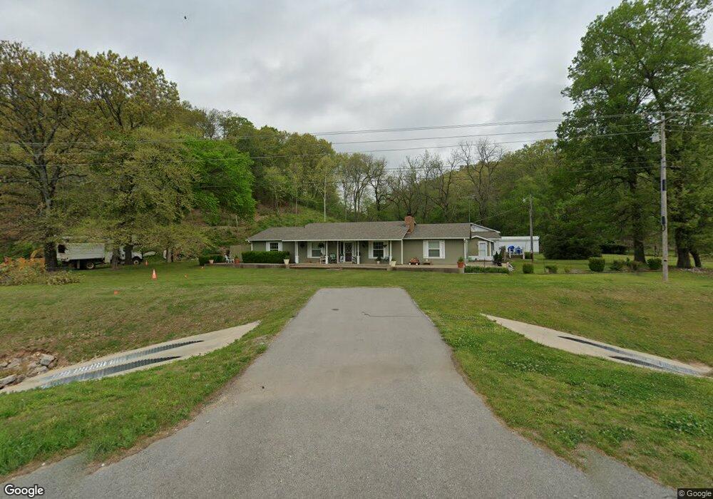
This home is located at 63578 Highway 59, Watts, OK 74964 and is currently estimated at $309,617, approximately $140 per square foot. 63578 Highway 59 is a home located in Adair County with nearby schools including Watts Elementary School and Watts High School.
Ownership History
Date
Name
Owned For
Owner Type
Purchase Details
Closed on
Jul 18, 2022
Sold by
Oklahoma Department Of Transportation
Bought by
Jones Kenneth L and Jones Linda M
Current Estimated Value
Purchase Details
Closed on
Mar 1, 2022
Sold by
Jones Kenneth K Jones Kenneth K and Jones Linda
Bought by
Jones Michael K
Purchase Details
Closed on
Jan 28, 2015
Sold by
Jones Kenneth L and Jones Linda M
Bought by
State Of Oklahoma
Create a Home Valuation Report for This Property
The Home Valuation Report is an in-depth analysis detailing your home's value as well as a comparison with similar homes in the area
Home Values in the Area
Average Home Value in this Area
Purchase History
| Date | Buyer | Sale Price | Title Company |
|---|---|---|---|
| Jones Kenneth L | $10,101 | None Listed On Document | |
| Jones Michael K | -- | None Listed On Document | |
| State Of Oklahoma | -- | None Available |
Source: Public Records
Tax History Compared to Growth
Tax History
| Year | Tax Paid | Tax Assessment Tax Assessment Total Assessment is a certain percentage of the fair market value that is determined by local assessors to be the total taxable value of land and additions on the property. | Land | Improvement |
|---|---|---|---|---|
| 2024 | $832 | $12,392 | $645 | $11,747 |
| 2023 | $832 | $12,391 | $888 | $11,503 |
| 2022 | $805 | $12,392 | $874 | $11,518 |
| 2021 | $701 | $10,605 | $1,031 | $9,574 |
| 2020 | $724 | $10,920 | $1,031 | $9,889 |
| 2019 | $736 | $11,082 | $1,031 | $10,051 |
| 2018 | $723 | $11,252 | $1,031 | $10,221 |
| 2017 | $740 | $11,500 | $1,025 | $10,475 |
| 2016 | $717 | $11,165 | $791 | $10,374 |
| 2015 | $690 | $10,840 | $791 | $10,049 |
| 2014 | $690 | $10,787 | $791 | $9,996 |
Source: Public Records
Map
Nearby Homes
- 65435 S 4743 Rd
- 873 Snyder Springs Loop
- 473298 E County Road 660
- 63125 S 4750 Rd
- 63155 S 4700 Rd
- 0 S 608 Rd Unit 2028649
- 114 Main St
- 25036 Lake Frances Rd
- 23063 Lookout Point Rd
- 22750 W Spring Harbor Rd
- Rd Unit LotWP001
- 472899 E 640 Rd
- TBD Lake Francis Rd
- 65311 U S 59
- 0 Marsh Rd
- 22624 Marsh Rd
- 14921 N Highway 59
- 0 S 4730 Road1
- 475834 E 649 Rd
- 64594 S 4725 Rd
- 65311 Highway 59
- 66818 Highway 59
- 63480 Highway 59
- 66818 Highway 59
- 66044 S 4730 Rd
- 60751 S 4748 Rd
- 473182 E 610 Rd
- 65459 S 4743 Rd
- 462648 Chewy Dr
- 473542 E 610 Rd
- 462413 Oakball Dr
- 462615 Oakball Dr
- 65166 S 4730 Rd
- 59099 S 4744 Rd
- 64559 S 4740 Rd
- 63298 S 4734 Rd
- 60325 S 4748 Rd
- 63514 Highway 59
- 462600 Chewy Dr
- 65311 Highway 59