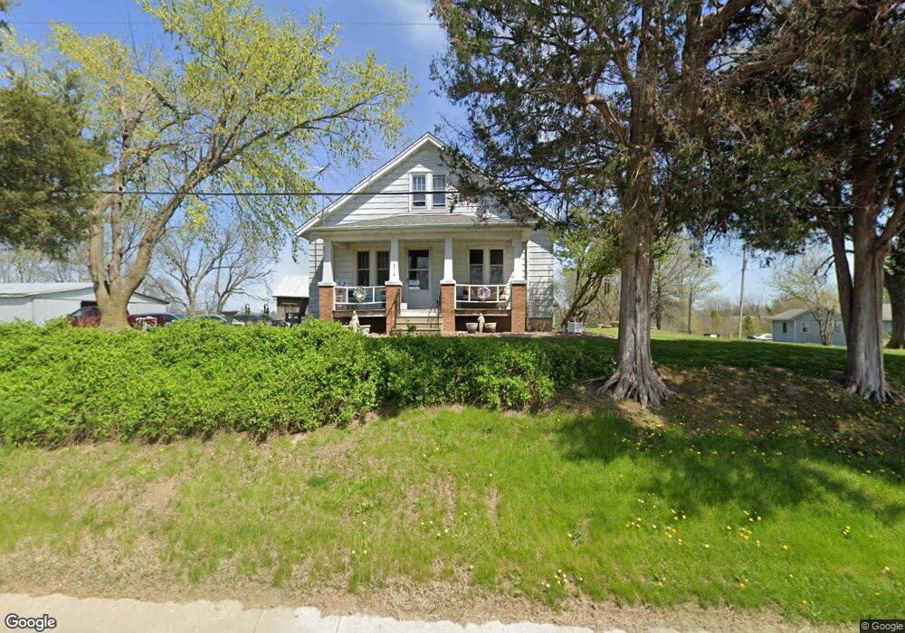
6358 State Route 159 New Athens, IL 62264
Estimated Value: $278,000 - $465,143
--
Bed
--
Bath
1,200
Sq Ft
$287/Sq Ft
Est. Value
About This Home
This home is located at 6358 State Route 159, New Athens, IL 62264 and is currently estimated at $344,714, approximately $287 per square foot. 6358 State Route 159 is a home located in St. Clair County with nearby schools including New Athens Elementary School and New Athens High School.
Ownership History
Date
Name
Owned For
Owner Type
Purchase Details
Closed on
Nov 30, 2019
Sold by
Coop Gary A
Bought by
Coop Family Farm Llc
Current Estimated Value
Purchase Details
Closed on
Nov 21, 2019
Sold by
Parker Andrew and Parker April
Bought by
Coop Family Farm Llc
Purchase Details
Closed on
Oct 19, 2019
Sold by
Cooop Gerard C
Bought by
Coop Family Farm Llc
Purchase Details
Closed on
Oct 16, 2019
Sold by
Coop James P and Coop Mary K
Bought by
Coop Family Farm Llc
Purchase Details
Closed on
Mar 25, 2019
Sold by
Coop Michael J
Bought by
Parker Andrew and Parker April
Home Financials for this Owner
Home Financials are based on the most recent Mortgage that was taken out on this home.
Original Mortgage
$92,000
Interest Rate
4.99%
Mortgage Type
Commercial
Purchase Details
Closed on
Feb 4, 2019
Sold by
Coop Melvin C
Bought by
Parker Andrew and Parker April
Home Financials for this Owner
Home Financials are based on the most recent Mortgage that was taken out on this home.
Original Mortgage
$92,000
Interest Rate
4.99%
Mortgage Type
Commercial
Purchase Details
Closed on
Feb 1, 2019
Sold by
Coop Mark E
Bought by
Parker Andrw and Parker April
Home Financials for this Owner
Home Financials are based on the most recent Mortgage that was taken out on this home.
Original Mortgage
$92,000
Interest Rate
4.99%
Mortgage Type
Commercial
Purchase Details
Closed on
Jan 19, 2001
Sold by
Coop Gerard C
Bought by
Coop Gerard C and Coop Gary A
Create a Home Valuation Report for This Property
The Home Valuation Report is an in-depth analysis detailing your home's value as well as a comparison with similar homes in the area
Home Values in the Area
Average Home Value in this Area
Purchase History
| Date | Buyer | Sale Price | Title Company |
|---|---|---|---|
| Coop Family Farm Llc | -- | None Available | |
| Coop Family Farm Llc | -- | Attorney | |
| Coop Family Farm Llc | -- | Attorney | |
| Coop Family Farm Llc | -- | Attorney | |
| Parker Andrew | $92,000 | Randolph County Abstract Llc | |
| Parker Andrew | $92,000 | None Available | |
| Parker Andrw | $92,000 | Attorney | |
| Coop Gerard C | -- | Chicago Title |
Source: Public Records
Mortgage History
| Date | Status | Borrower | Loan Amount |
|---|---|---|---|
| Previous Owner | Parker Andrew | $92,000 | |
| Previous Owner | Parker Andrew | $184,000 |
Source: Public Records
Tax History Compared to Growth
Tax History
| Year | Tax Paid | Tax Assessment Tax Assessment Total Assessment is a certain percentage of the fair market value that is determined by local assessors to be the total taxable value of land and additions on the property. | Land | Improvement |
|---|---|---|---|---|
| 2024 | $4,127 | $60,048 | $15,239 | $44,809 |
| 2023 | $3,822 | $55,499 | $13,383 | $42,116 |
| 2022 | $3,768 | $50,863 | $11,674 | $39,189 |
| 2021 | $3,615 | $47,261 | $10,145 | $37,116 |
| 2020 | $3,241 | $40,474 | $8,810 | $31,664 |
| 2019 | $3,048 | $39,256 | $7,592 | $31,664 |
| 2018 | $2,864 | $36,710 | $6,441 | $30,269 |
| 2017 | $1,376 | $35,117 | $5,426 | $29,691 |
| 2016 | $2,827 | $35,957 | $4,530 | $31,427 |
| 2014 | $1,273 | $34,307 | $3,230 | $31,077 |
| 2013 | $1,580 | $35,436 | $3,100 | $32,336 |
Source: Public Records
Map
Nearby Homes
- 5451 Club Congress Rd
- 110 N Park St
- Lot 1 E Back St
- Lot 2 E Back St
- 2622 Kaiser Rd
- 9024 Range Dr
- 9037 Range Dr
- 2230 Kaiser Rd
- 4057 Bur Oak Dr
- 4017 Autumn Oak Dr
- 4016 Autumn Oak Dr
- 4112 Summer Oak Dr
- 4122 Knab Rd
- 4132 Tbb Summer Oak Rd
- 7057 State Route 156
- 0 Unknown Unit 22065045
- 4916 Wilderness Pointe
- 4901 Wilderness Point
- 4517 Boardwalk
- 4525 Boardwalk
- 6353 State Route 159
- 6341 State Route 159
- 6315 State Route 159
- 6303 State Route 159
- 6235 State Route 159
- 6544 State Route 159
- 5816 Probst Rd
- 5734 State Route 156
- 5844 Probst Rd
- 5929 State Route 156
- 6100 State Route 159
- 6100 State Route 159
- 5433 Club Congress Rd
- 5900 State Route 156
- 6655 State Route 159
- 5925 State Route 156
- 5354 Club Congress Rd
- 6730 State Route 159
- 6033 State Route 159