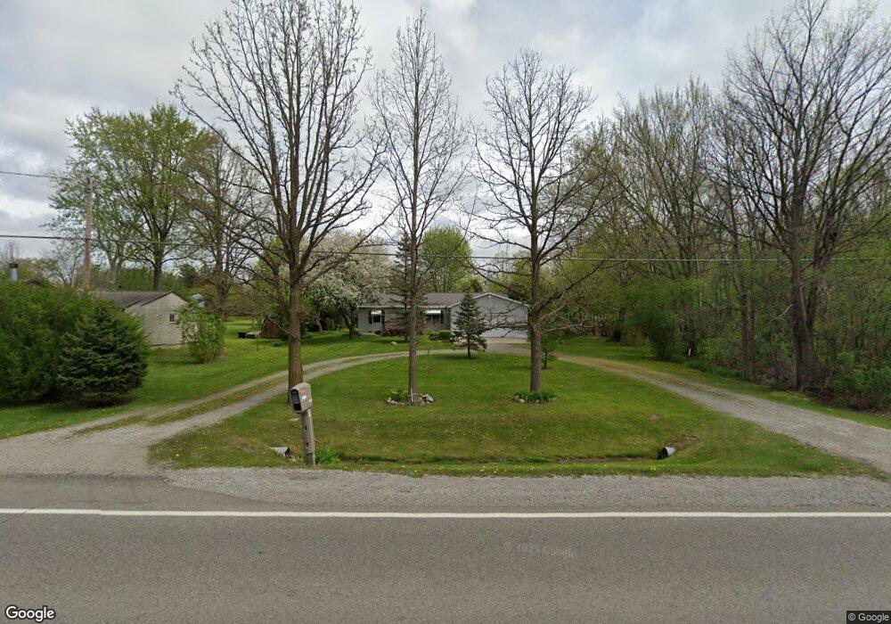
6359 Porter Rd Grand Blanc, MI 48439
Estimated Value: $231,000 - $282,000
3
Beds
2
Baths
1,456
Sq Ft
$176/Sq Ft
Est. Value
About This Home
This home is located at 6359 Porter Rd, Grand Blanc, MI 48439 and is currently estimated at $256,050, approximately $175 per square foot. 6359 Porter Rd is a home located in Genesee County with nearby schools including Anderson Elementary School, McGrath Elementary School, and Grand Blanc West Middle School.
Ownership History
Date
Name
Owned For
Owner Type
Purchase Details
Closed on
Feb 22, 2022
Sold by
Duby Marie Louise
Bought by
Duby Steve J and Duby Todd W
Current Estimated Value
Purchase Details
Closed on
Feb 8, 2016
Sold by
Duby Marie Louise
Bought by
Duby Marie Louise and Duby Todd William
Purchase Details
Closed on
Jun 24, 2008
Sold by
Winton Ronald
Bought by
Winton Marie
Purchase Details
Closed on
Apr 23, 2001
Sold by
Winton Marie L and Duby Marie L
Bought by
Winton Ronald Arthur and Winton Marie L
Create a Home Valuation Report for This Property
The Home Valuation Report is an in-depth analysis detailing your home's value as well as a comparison with similar homes in the area
Home Values in the Area
Average Home Value in this Area
Purchase History
| Date | Buyer | Sale Price | Title Company |
|---|---|---|---|
| Duby Steve J | -- | -- | |
| Duby Marie Louise | -- | -- | |
| Duby Marie Louise | -- | None Available | |
| Winton Marie | -- | None Available | |
| Winton Ronald Arthur | -- | -- |
Source: Public Records
Tax History Compared to Growth
Tax History
| Year | Tax Paid | Tax Assessment Tax Assessment Total Assessment is a certain percentage of the fair market value that is determined by local assessors to be the total taxable value of land and additions on the property. | Land | Improvement |
|---|---|---|---|---|
| 2025 | $2,668 | $112,300 | $0 | $0 |
| 2024 | $1,556 | $109,300 | $0 | $0 |
| 2023 | $1,484 | $96,600 | $0 | $0 |
| 2022 | $2,367 | $89,600 | $0 | $0 |
| 2021 | $2,330 | $86,200 | $0 | $0 |
| 2020 | $1,369 | $77,800 | $0 | $0 |
| 2019 | $1,349 | $75,200 | $0 | $0 |
| 2018 | $2,156 | $73,200 | $0 | $0 |
| 2017 | $2,044 | $62,300 | $0 | $0 |
| 2016 | $2,029 | $62,600 | $0 | $0 |
| 2015 | $1,928 | $55,900 | $0 | $0 |
| 2012 | -- | $50,200 | $50,200 | $0 |
Source: Public Records
Map
Nearby Homes
- 6314 Woodsdale Dr
- 6230 Woodsdale Dr
- 6094 Grove Ave
- 00 Reid Rd
- 6085 Westdale Dr
- 2161 Neeper St
- 00 S Dort Hwy
- 3042 E Reid Rd
- VL S Saginaw St
- 01 S Saginaw St
- 000 S Saginaw St
- 00 S Saginaw St
- 2346 Rollins St
- 5391 Antoinette Dr
- 1234 Fisher Heights
- 5368 Boland Dr
- 3049 Baker Heights
- 5400 Ali Dr
- 1482 Wagon Wheel Ln
- 00 Durant Heights