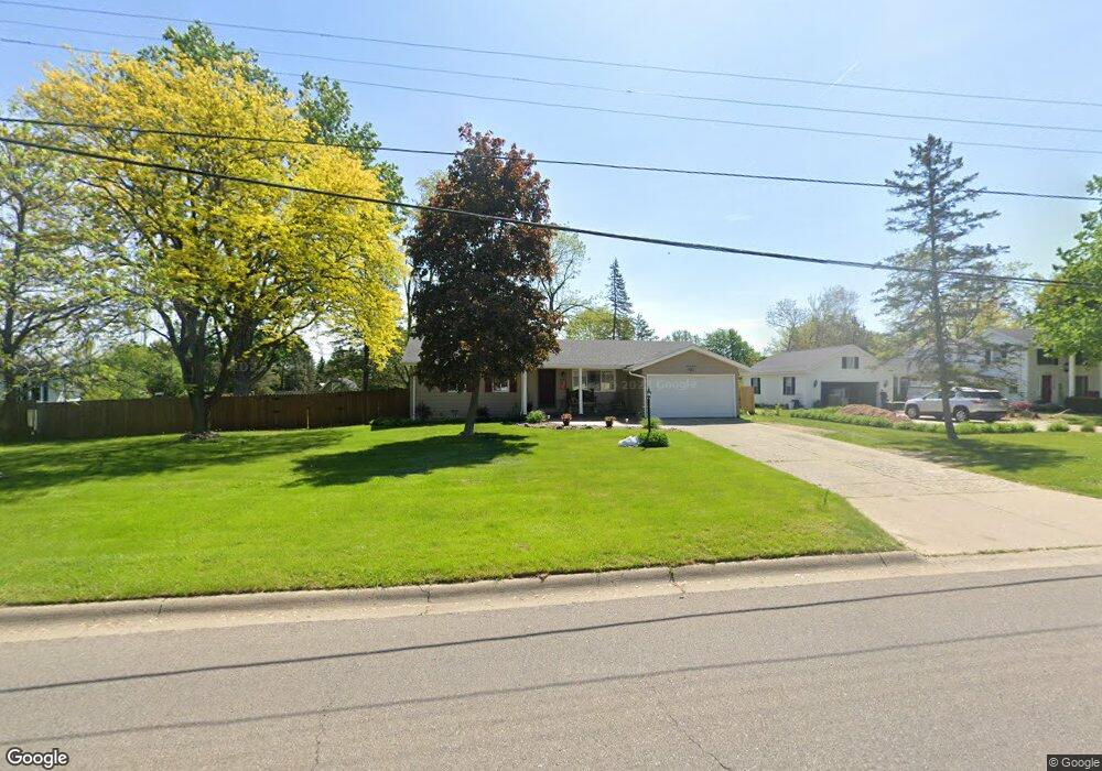
636 Deland Rd Flushing, MI 48433
Estimated Value: $234,000 - $241,000
--
Bed
1
Bath
1,316
Sq Ft
$180/Sq Ft
Est. Value
About This Home
This home is located at 636 Deland Rd, Flushing, MI 48433 and is currently estimated at $237,132, approximately $180 per square foot. 636 Deland Rd is a home located in Genesee County with nearby schools including Central Elementary School, Flushing Middle School, and Flushing High School.
Ownership History
Date
Name
Owned For
Owner Type
Purchase Details
Closed on
Dec 15, 1998
Sold by
Brasseur Irma F
Bought by
Reitano Joey B and Reitano Tammy J
Current Estimated Value
Home Financials for this Owner
Home Financials are based on the most recent Mortgage that was taken out on this home.
Original Mortgage
$110,086
Outstanding Balance
$24,963
Interest Rate
6.76%
Mortgage Type
Purchase Money Mortgage
Estimated Equity
$212,169
Create a Home Valuation Report for This Property
The Home Valuation Report is an in-depth analysis detailing your home's value as well as a comparison with similar homes in the area
Home Values in the Area
Average Home Value in this Area
Purchase History
| Date | Buyer | Sale Price | Title Company |
|---|---|---|---|
| Reitano Joey B | $125,000 | First American Title |
Source: Public Records
Mortgage History
| Date | Status | Borrower | Loan Amount |
|---|---|---|---|
| Open | Reitano Joey B | $110,086 | |
| Closed | Reitano Joey B | $12,500 |
Source: Public Records
Tax History Compared to Growth
Tax History
| Year | Tax Paid | Tax Assessment Tax Assessment Total Assessment is a certain percentage of the fair market value that is determined by local assessors to be the total taxable value of land and additions on the property. | Land | Improvement |
|---|---|---|---|---|
| 2025 | $2,371 | $116,600 | $0 | $0 |
| 2024 | $1,932 | $107,300 | $0 | $0 |
| 2023 | $1,862 | $96,800 | $0 | $0 |
| 2022 | $2,053 | $87,900 | $0 | $0 |
| 2021 | $2,053 | $78,900 | $0 | $0 |
| 2020 | $1,639 | $74,900 | $0 | $0 |
| 2019 | $1,611 | $70,200 | $0 | $0 |
| 2018 | $1,889 | $62,400 | $0 | $0 |
| 2017 | $1,773 | $61,500 | $0 | $0 |
| 2016 | $1,759 | $38,111 | $0 | $0 |
| 2015 | $1,750 | $0 | $0 | $0 |
| 2012 | -- | $40,900 | $40,900 | $0 |
Source: Public Records
Map
Nearby Homes
- 0 Double Tree Estates
- 5082 Prestonwood Ln
- 428 Leland St
- 544 Warren Ave
- 507 Dale St
- 515 Chestnut St
- 5281 Deland Rd
- 8520 Apple Blossom Ln
- 1011 Clearview Dr
- 120 Boman St
- 210 N Hazelton St
- 1203 Clearview Dr
- 8474 Wesley Dr
- 1216 Pleasantview Dr
- 410 E Main St
- 537 Sharon Dr
- 113 N Mckinley Rd
- 212 W Henry St
- 751 River Edge Ct
- 433 Crestview St
- 640 Deland Rd
- 634 Northwood Dr
- 620 Deland Rd
- 632 Northwood Dr
- 640 Carpenter Rd
- 639 Deland Rd
- 5016 Deland Rd
- 625 Ashwood Dr
- 616 Deland Rd
- 628 Northwood Dr
- 631 Northwood Dr
- 621 Ashwood Dr
- 629 Ashwood Dr
- 634 Carpenter Rd
- 5020 Deland Rd
- 617 Ashwood Dr
- 627 Northwood Dr
- 612 Deland Rd
- 624 Northwood Dr
- 619 Northwood Dr