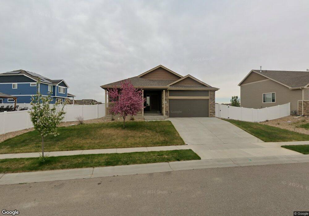
636 Gore Range Dr Severance, CO 80550
Estimated Value: $434,000 - $452,000
3
Beds
2
Baths
2,888
Sq Ft
$153/Sq Ft
Est. Value
About This Home
This home is located at 636 Gore Range Dr, Severance, CO 80550 and is currently estimated at $441,764, approximately $152 per square foot. 636 Gore Range Dr is a home located in Weld County with nearby schools including Range View Elementary School, Severance Middle School, and Windsor High School.
Ownership History
Date
Name
Owned For
Owner Type
Purchase Details
Closed on
Dec 10, 2020
Sold by
Md Holdins Llc
Bought by
Demaske Jeff L and Demaske Madeline M
Current Estimated Value
Home Financials for this Owner
Home Financials are based on the most recent Mortgage that was taken out on this home.
Original Mortgage
$195,000
Outstanding Balance
$141,550
Interest Rate
2.7%
Mortgage Type
New Conventional
Estimated Equity
$300,214
Purchase Details
Closed on
Nov 30, 2018
Sold by
Journey Homes Llc
Bought by
Demaske Jeff L and Demaske Madeline M
Home Financials for this Owner
Home Financials are based on the most recent Mortgage that was taken out on this home.
Original Mortgage
$201,934
Interest Rate
4.8%
Mortgage Type
Commercial
Create a Home Valuation Report for This Property
The Home Valuation Report is an in-depth analysis detailing your home's value as well as a comparison with similar homes in the area
Home Values in the Area
Average Home Value in this Area
Purchase History
We collect this data history from publicly available records. To have your information removed, we recommend requesting removal directly through your county’s website.
| Date | Buyer | Sale Price | Title Company |
|---|---|---|---|
| Demaske Jeff L | -- | Heritage Title Company | |
| Demaske Jeff L | $266,782 | Heritage Title Co |
Source: Public Records
Mortgage History
We collect this data history from publicly available records. To have your information removed, we recommend requesting removal directly through your county’s website.
| Date | Status | Borrower | Loan Amount |
|---|---|---|---|
| Open | Demaske Jeff L | $195,000 | |
| Previous Owner | Demaske Jeff L | $201,934 |
Source: Public Records
Tax History
| Year | Tax Paid | Tax Assessment Tax Assessment Total Assessment is a certain percentage of the fair market value that is determined by local assessors to be the total taxable value of land and additions on the property. | Land | Improvement |
|---|---|---|---|---|
| 2025 | $4,762 | $26,960 | $6,380 | $20,580 |
| 2024 | $4,762 | $26,960 | $6,380 | $20,580 |
| 2023 | $4,545 | $31,670 | $7,100 | $24,570 |
| 2022 | $3,718 | $22,290 | $5,700 | $16,590 |
| 2021 | $3,563 | $22,930 | $5,860 | $17,070 |
| 2020 | $3,332 | $21,680 | $5,010 | $16,670 |
| 2019 | $3,316 | $21,680 | $5,010 | $16,670 |
| 2018 | $258 | $1,640 | $1,640 | $0 |
| 2017 | $14 | $0 | $0 | $0 |
Source: Public Records
Map
Nearby Homes
- 821 Mt Sneffels Ave
- 627 Gore Range Dr
- 1057 Mt Oxford Ave
- 479 Mount Belford Ave
- 965 Mount Andrew Dr
- 548 El Diente Ave
- 1070 Mt Oxford Ave
- 611 Gore Range Dr
- 431 Ptarmigan St
- 259 Castle Dr
- 864 Forest Canyon Rd
- 844 Forest Canyon Rd
- 244 Mt Harvard Ave
- 270 Mt Harvard Ave
- 962 Ouzel Falls Rd
- 929 Milner Pass Rd
- 960 Cascade Falls St
- 511 Prairie Clover Way
- 962 Cascade Falls St
- 961 Cascade Falls St
- 712 Mt Evans Ave
- 639 Gore Range Dr
- 710 Mt Evans Ave
- 715 Mt Evans Ave
- 719 Mt Evans Ave
- 713 Mt Evans Ave
- 717 Mt Evans Ave
- 637 Gore Range Dr
- 634 Gore Range Dr
- 709 Mt Evans Ave
- 742 Elk Mountain Dr
- 635 Gore Range Dr
- 721 Mt Evans Ave
- 707 Mt Evans Ave
- 820 Mt Sneffels Ave
- 824 Mt Sneffels Ave
- 818 Mt Sneffels Ave
- 738 Elk Mountain Dr
- 822 Mt Sneffels Ave
- 633 Gore Range Dr
Your Personal Tour Guide
Ask me questions while you tour the home.