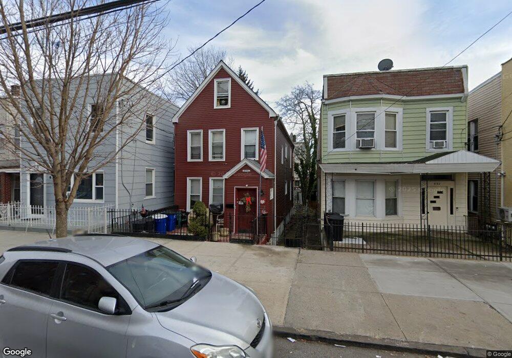
636 van Nest Ave Unit 2 Bronx, NY 10460
Van Nest NeighborhoodEstimated Value: $587,000 - $838,000
4
Beds
1
Bath
1,683
Sq Ft
$423/Sq Ft
Est. Value
About This Home
This home is located at 636 van Nest Ave Unit 2, Bronx, NY 10460 and is currently estimated at $712,545, approximately $423 per square foot. 636 van Nest Ave Unit 2 is a home located in Bronx County with nearby schools including P.S. 083 The Donald Hertz School, Bronx Excellence 2, and Bronx Charter School For Excellence 2.
Ownership History
Date
Name
Owned For
Owner Type
Purchase Details
Closed on
Apr 9, 2016
Sold by
Moore Bruce
Bought by
Ferrara Bernadette
Current Estimated Value
Purchase Details
Closed on
Mar 3, 2007
Sold by
636 Van Nest Ave Llc
Bought by
Moore Bruce
Purchase Details
Closed on
May 29, 2006
Sold by
Ferrara Bernadette M
Bought by
636 Van Nest Ave Llc
Create a Home Valuation Report for This Property
The Home Valuation Report is an in-depth analysis detailing your home's value as well as a comparison with similar homes in the area
Home Values in the Area
Average Home Value in this Area
Purchase History
| Date | Buyer | Sale Price | Title Company |
|---|---|---|---|
| Ferrara Bernadette | -- | -- | |
| Ferrara Bernadette | -- | -- | |
| Moore Bruce | -- | -- | |
| Moore Bruce | -- | -- | |
| 636 Van Nest Ave Llc | -- | -- | |
| 636 Van Nest Ave Llc | -- | -- |
Source: Public Records
Tax History Compared to Growth
Tax History
| Year | Tax Paid | Tax Assessment Tax Assessment Total Assessment is a certain percentage of the fair market value that is determined by local assessors to be the total taxable value of land and additions on the property. | Land | Improvement |
|---|---|---|---|---|
| 2025 | $5,511 | $27,648 | $5,112 | $22,536 |
| 2024 | $5,511 | $27,440 | $6,047 | $21,393 |
| 2023 | $2,600 | $25,887 | $6,198 | $19,689 |
| 2022 | $2,151 | $37,440 | $8,820 | $28,620 |
| 2021 | $4,546 | $33,240 | $8,820 | $24,420 |
| 2020 | $4,581 | $37,260 | $8,820 | $28,440 |
| 2019 | $4,491 | $37,260 | $8,820 | $28,440 |
| 2018 | $4,100 | $21,573 | $5,995 | $15,578 |
| 2017 | $3,849 | $20,352 | $6,925 | $13,427 |
| 2016 | $3,528 | $19,200 | $8,820 | $10,380 |
| 2015 | $2,406 | $20,460 | $9,780 | $10,680 |
| 2014 | $2,406 | $19,407 | $8,259 | $11,148 |
Source: Public Records
Map
Nearby Homes
- 633 Mead St
- 677 van Nest Ave
- 679 van Nest Ave
- 591 van Nest Ave
- 1721 White Plains Rd
- 1667 Hunt Ave
- 1731 White Plains Rd
- 1713 Taylor Ave
- 1738 Melville St
- 1622 Van Buren St
- 1827 Amethyst St
- 506 van Nest Ave
- 508 van Nest Ave
- 504 van Nest Ave
- 500 van Nest Ave
- 1936 E Tremont Ave Unit 5H
- 1760 E Tremont Ave
- 518 Morris Park Ave
- 1938 E Tremont Ave Unit 5C
- 1865 Hunt Ave
- 636 van Nest Ave
- 638 van Nest Ave
- 632 van Nest Ave
- 632 van Nest Ave Unit 1
- 640 van Nest Ave
- 630 van Nest Ave
- 628 van Nest Ave
- 642 van Nest Ave
- 637 Mead St
- 626 van Nest Ave
- 639 Mead St
- 631 Mead St
- 641 Mead St
- 1683 Unionport Rd
- 1679 Unionport Rd
- 629 Mead St
- 622 van Nest Ave
- 644 van Nest Ave
- 643 Mead St Unit 2
- 643 Mead St Unit 1