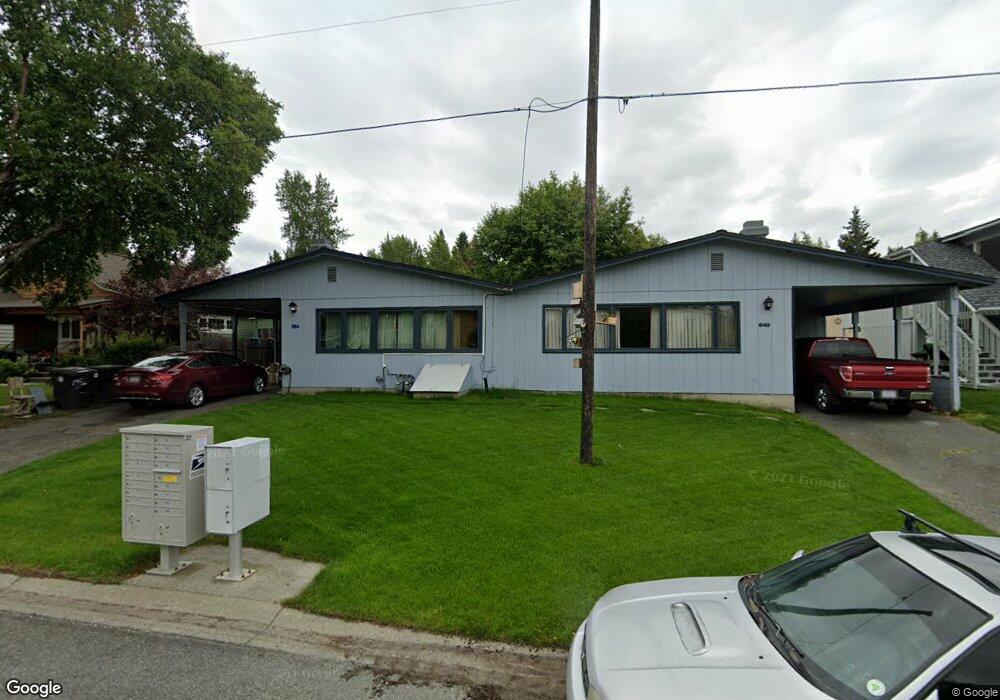
636 W 20th Ave Anchorage, AK 99503
North Star NeighborhoodEstimated Value: $286,000 - $530,000
6
Beds
2
Baths
2,304
Sq Ft
$184/Sq Ft
Est. Value
About This Home
This home is located at 636 W 20th Ave, Anchorage, AK 99503 and is currently estimated at $424,083, approximately $184 per square foot. 636 W 20th Ave is a home located in Anchorage Municipality with nearby schools including North Star Elementary School, Central Middle School of Science, and West High School.
Create a Home Valuation Report for This Property
The Home Valuation Report is an in-depth analysis detailing your home's value as well as a comparison with similar homes in the area
Home Values in the Area
Average Home Value in this Area
Tax History Compared to Growth
Tax History
| Year | Tax Paid | Tax Assessment Tax Assessment Total Assessment is a certain percentage of the fair market value that is determined by local assessors to be the total taxable value of land and additions on the property. | Land | Improvement |
|---|---|---|---|---|
| 2025 | $6,452 | $408,600 | $111,900 | $296,700 |
| 2024 | $6,267 | $388,200 | $111,900 | $276,300 |
| 2023 | $6,219 | $365,200 | $111,900 | $253,300 |
| 2022 | $6,140 | $364,600 | $111,900 | $252,700 |
| 2021 | $6,264 | $347,600 | $111,900 | $235,700 |
| 2020 | $5,984 | $352,000 | $111,900 | $240,100 |
| 2019 | $5,896 | $360,400 | $111,900 | $248,500 |
| 2018 | $5,853 | $356,900 | $116,700 | $240,200 |
| 2017 | $5,753 | $367,400 | $110,700 | $256,700 |
| 2016 | $4,631 | $379,400 | $110,700 | $268,700 |
| 2015 | $4,631 | $348,900 | $101,100 | $247,800 |
| 2014 | $4,631 | $341,400 | $99,400 | $242,000 |
Source: Public Records
Map
Nearby Homes
- 800 W 21st Ave
- 827 W 20th Ave
- 2140 Dawson St
- 207 W 22nd Ave Unit 304
- 1016 W 25th Ave
- 1113 W Fireweed Ln Unit 505
- 1113 W Fireweed Ln Unit 204
- 1945 Spenard Rd
- 2607 Arctic Blvd
- 1434 I St
- 2205 Barrow St
- 409 W Northern Lights Blvd
- 000 Dawson St
- 2201 Romig Place Unit 105
- 1327 W 25th Ave Unit 218
- 100 W 15th Ave Unit A
- 1430 Bridgeway St Unit 7
- 1430 Bridgeway St Unit 3
- 1430 Bridgeway St Unit 9
- 1200 I St Unit 503
- L1 B2 W 20th Ave
- 635 W 21st Ave
- 626 W 20th Ave
- 650 W 20th Ave
- 651 W 21st Ave
- 649 W 21st Ave
- 618 W 20th Ave
- 637 W 20th Ave
- 627 W 20th Ave
- 702 W 20th Ave
- 612 W 20th Ave
- 647 W 20th Ave
- 703 W 21st Ave
- 617 W 20th Ave
- 2000 Blueberry St
- 701 W 20th Ave
- 626 W 21st Ave
- 718 W 20th Ave
- 601 W 20th Ave
- 624 W 21st Ave