6360 Barfield Rd Macon, GA 31216
Macon AreaEstimated Value: $89,000 - $261,000
About This Home
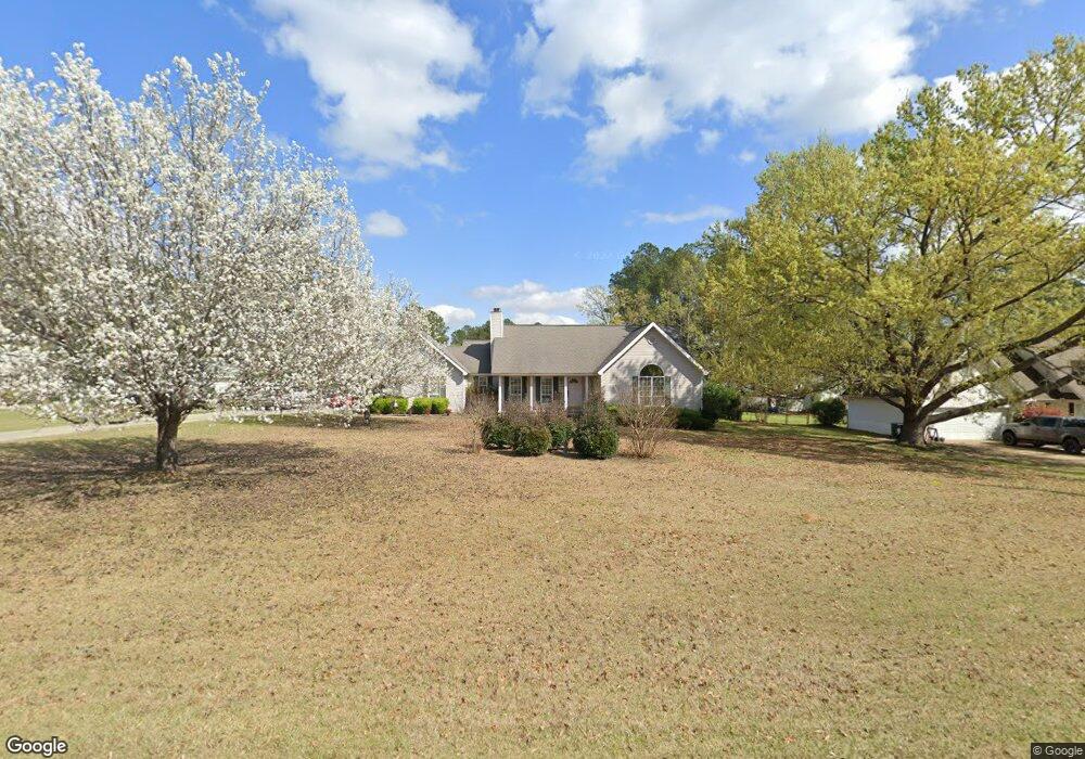
This home is located at 6360 Barfield Rd, Macon, GA 31216 and is currently estimated at $197,173, approximately $125 per square foot. 6360 Barfield Rd is a home located in Bibb County with nearby schools including Heard Elementary School, Rutland Middle School, and Rutland High School.
Ownership History
We collect this data history from publicly available records. To have your information removed, we recommend requesting removal directly through your county’s website.
Purchase Details
Purchase Details
Purchase History
We collect this data history from publicly available records. To have your information removed, we recommend requesting removal directly through your county’s website.
| Date | Buyer | Sale Price | Title Company |
|---|---|---|---|
| $90,000 | None Listed On Document | ||
| $90,000 | None Listed On Document | ||
| $143,000 | -- |
Mortgage History
We collect this data history from publicly available records. To have your information removed, we recommend requesting removal directly through your county’s website.
| Date | Status | Borrower | Loan Amount |
|---|---|---|---|
| Previous Owner | $90,471 |
Tax History
We collect this data history from publicly available records. To have your information removed, we recommend requesting removal directly through your county’s website.
| Year | Tax Paid | Tax Assessment Tax Assessment Total Assessment is a certain percentage of the fair market value that is determined by local assessors to be the total taxable value of land and additions on the property. | Land | Improvement |
|---|---|---|---|---|
| 2025 | $1,573 | $71,022 | $12,000 | $59,022 |
| 2024 | $1,626 | $71,022 | $12,000 | $59,022 |
| 2023 | $1,169 | $71,022 | $12,000 | $59,022 |
| 2022 | $2,022 | $65,416 | $10,607 | $54,809 |
| 2021 | $1,922 | $57,585 | $9,223 | $48,362 |
| 2020 | $1,964 | $57,585 | $9,223 | $48,362 |
| 2019 | $1,980 | $57,585 | $9,223 | $48,362 |
| 2018 | $3,171 | $56,894 | $9,223 | $47,671 |
| 2017 | $1,869 | $56,894 | $9,223 | $47,671 |
| 2016 | $1,726 | $56,894 | $9,223 | $47,671 |
| 2015 | $2,440 | $56,894 | $9,223 | $47,671 |
| 2014 | $2,380 | $55,684 | $9,223 | $46,461 |
Map
- 114 Marcar Rd
- 220 Welsh Trail Unit LOT 3
- 220 Welsh Trail
- 227 Welsh Trail
- 155 Shetland Pines Dr
- 7212 Winterberry Cir
- 5538 Neal Dr
- 4732 Arnold Dr
- 5540 Janeru Cir
- 5540 Janeru Cir
- 6371 Fulton Mill Rd
- 4961 Hartley Bridge Rd
- 5516 Janeru Cir
- 5397 Mount Pleasant Church Rd Unit Parcel 1
- 0 Mount Pleasant Church Rd Unit 10731191
- 5397 Mount Pleasant Church Rd
- 0 Mount Pleasant Church Rd Unit 183961
- 5385 Mount Pleasant Church Rd Unit Parcel 3
- 5385 Mount Pleasant Church Rd
- 1017 Homestead Dr Unit HI201
Ask me questions while you tour the home.