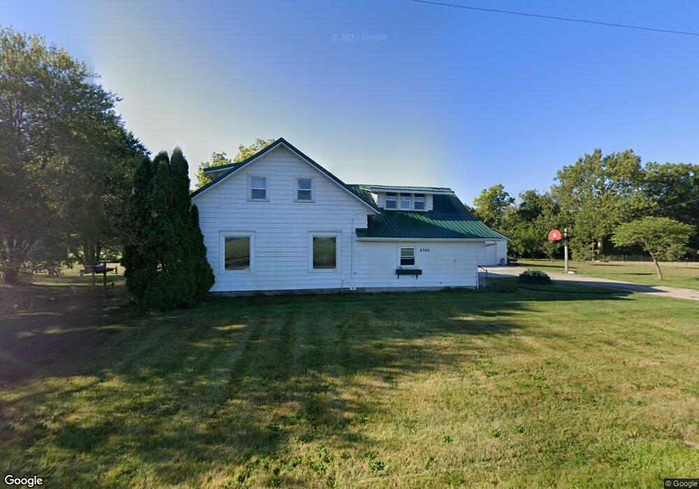
6360 Road 192 Antwerp, OH 45813
Estimated Value: $178,000 - $213,000
3
Beds
1
Bath
1,728
Sq Ft
$113/Sq Ft
Est. Value
About This Home
This home is located at 6360 Road 192, Antwerp, OH 45813 and is currently estimated at $195,366, approximately $113 per square foot. 6360 Road 192 is a home located in Paulding County with nearby schools including Antwerp Local Elementary School and Antwerp Local High School.
Ownership History
Date
Name
Owned For
Owner Type
Purchase Details
Closed on
Jul 16, 2020
Sold by
Walk Mary Ellen and Chamberlain Robin R
Bought by
Taylor Brock M
Current Estimated Value
Home Financials for this Owner
Home Financials are based on the most recent Mortgage that was taken out on this home.
Original Mortgage
$100,000
Outstanding Balance
$88,673
Interest Rate
3.1%
Mortgage Type
New Conventional
Estimated Equity
$106,693
Purchase Details
Closed on
Nov 12, 2019
Sold by
Walk Jerome William
Bought by
Walk Mary Ellen
Purchase Details
Closed on
Apr 14, 1998
Sold by
Walk Jerome W
Bought by
Walk Jerome W Walk Mary Ellen
Purchase Details
Closed on
Jan 1, 1990
Bought by
Walk Jerome W Walk Mary Ellen
Create a Home Valuation Report for This Property
The Home Valuation Report is an in-depth analysis detailing your home's value as well as a comparison with similar homes in the area
Home Values in the Area
Average Home Value in this Area
Purchase History
| Date | Buyer | Sale Price | Title Company |
|---|---|---|---|
| Taylor Brock M | $120,000 | Ceadr Title & Escrow | |
| Walk Mary Ellen | -- | None Available | |
| Walk Jerome W Walk Mary Ellen | -- | -- | |
| Walk Jerome W Walk Mary Ellen | -- | -- |
Source: Public Records
Mortgage History
| Date | Status | Borrower | Loan Amount |
|---|---|---|---|
| Open | Taylor Brock M | $100,000 |
Source: Public Records
Tax History Compared to Growth
Tax History
| Year | Tax Paid | Tax Assessment Tax Assessment Total Assessment is a certain percentage of the fair market value that is determined by local assessors to be the total taxable value of land and additions on the property. | Land | Improvement |
|---|---|---|---|---|
| 2024 | $1,417 | $41,800 | $9,560 | $32,240 |
| 2023 | $1,417 | $41,800 | $9,560 | $32,240 |
| 2022 | $1,395 | $41,800 | $9,560 | $32,240 |
| 2021 | $1,371 | $37,320 | $8,580 | $28,740 |
| 2020 | $1,079 | $37,320 | $8,580 | $28,740 |
| 2019 | $1,094 | $33,570 | $8,580 | $24,990 |
| 2018 | $935 | $33,570 | $8,580 | $24,990 |
| 2017 | $936 | $33,570 | $8,580 | $24,990 |
| 2016 | $936 | $33,570 | $8,580 | $24,990 |
| 2015 | $849 | $31,990 | $6,650 | $25,340 |
| 2014 | $841 | $31,990 | $6,650 | $25,340 |
| 2013 | $998 | $33,320 | $6,650 | $26,670 |
Source: Public Records
Map
Nearby Homes
- 16453 Road 63
- 5092 Road 176
- 208 W River St
- 136 Maumee Ln
- 309 N Madison St
- 3190 Road 204
- 13149 Road 27b
- 1258 Road 192
- 11309 State Route 49
- 11234 State Route 49
- 15010 U S 127
- 11051 Road 93
- 516 Ogen St
- 217 W Edgerton St
- 9316 Anderson St
- 319 W High St
- 10690 Fountain Street Rd
- 110 Sholl Terrace
- 307 Spencerville St
- 338 Chicago Ave